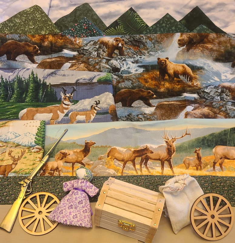
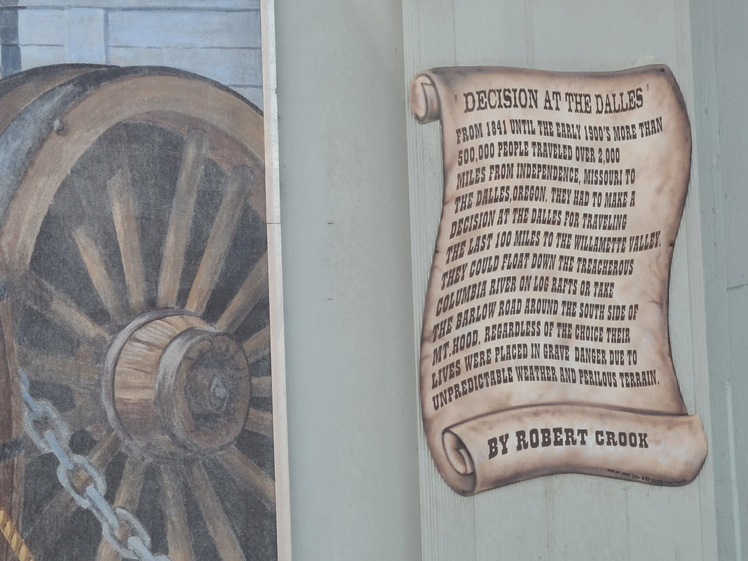
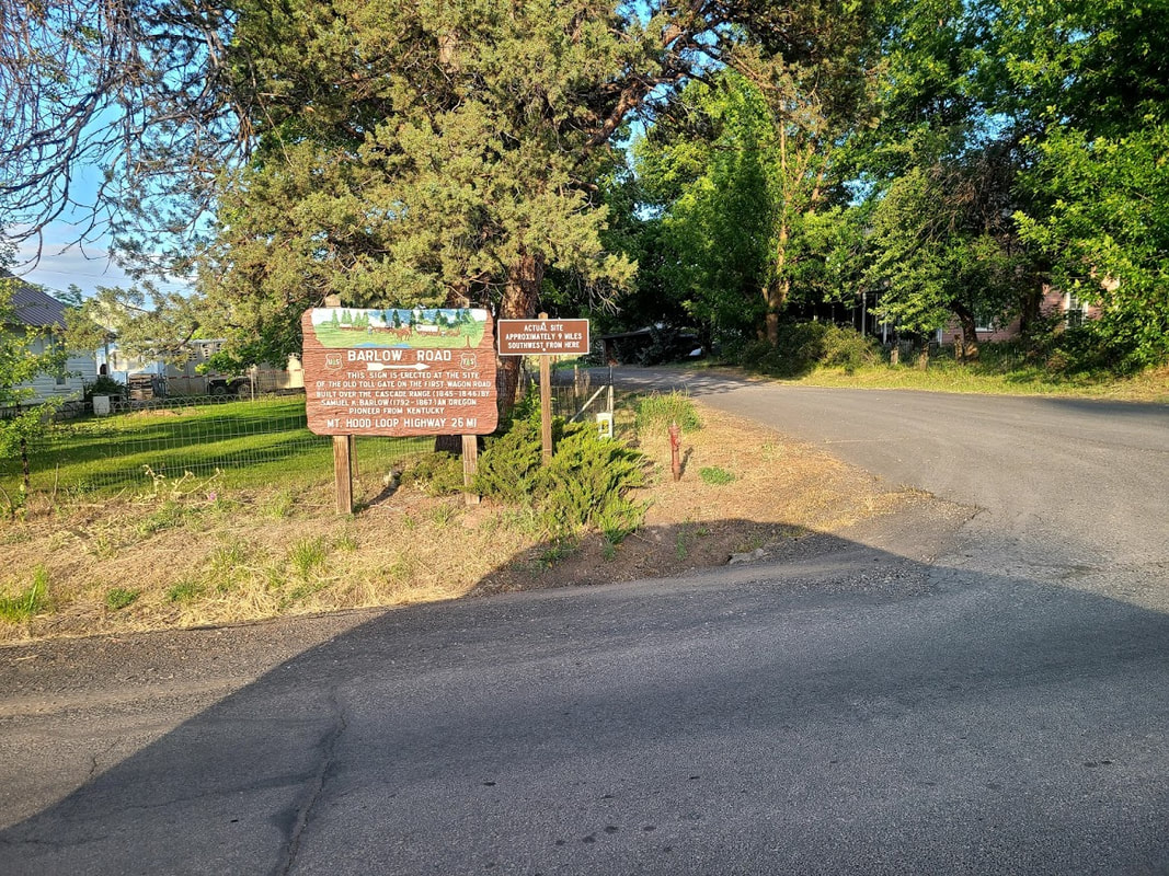
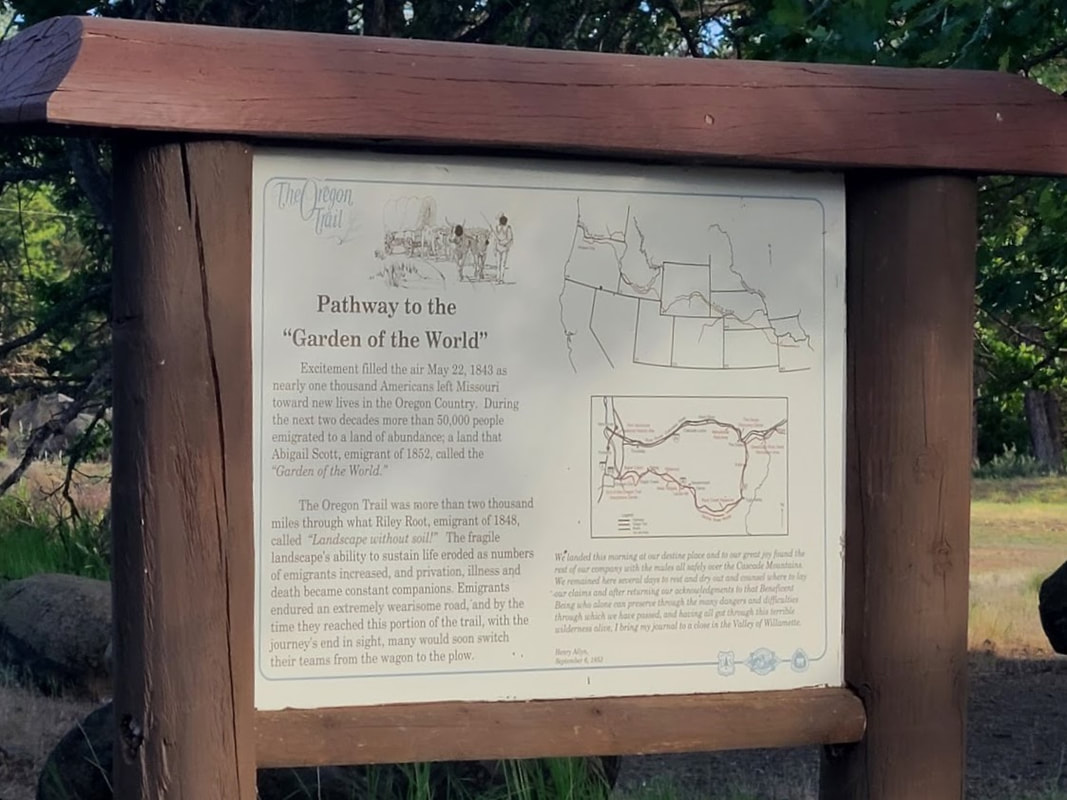
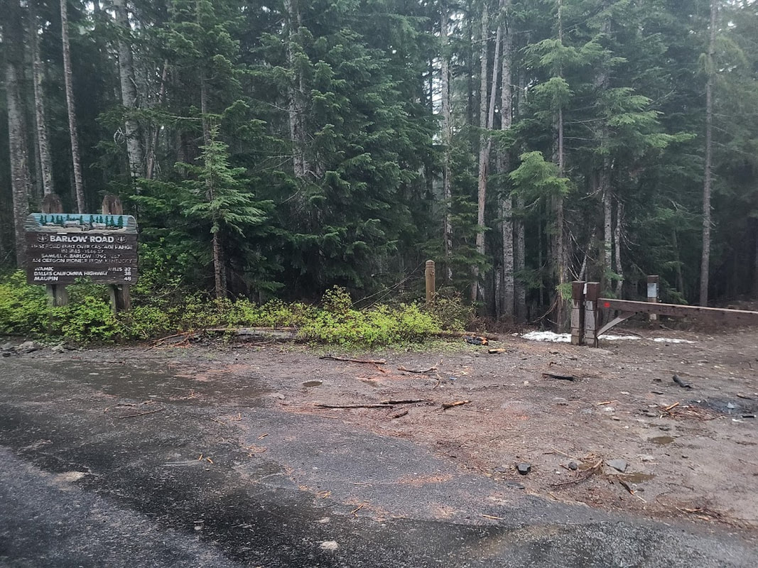
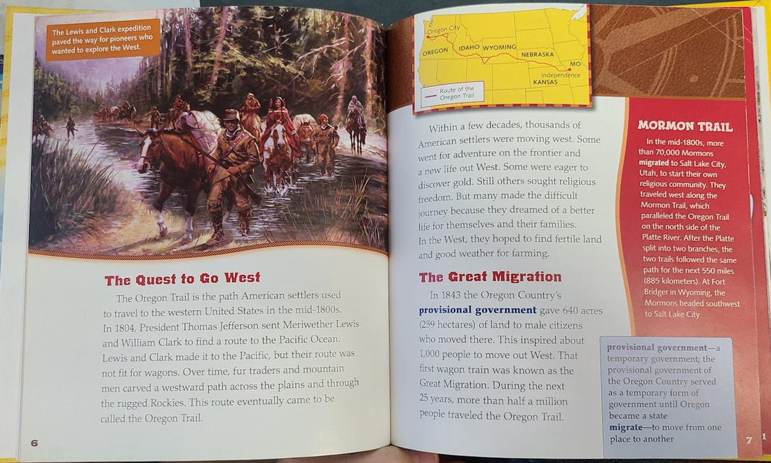
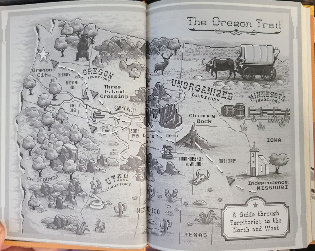
 Traveling the Oregon Trail overland routes, fabric collage by ST Folks were always looking for ways to make easier traveling to the rich Willamette valley in Oregon country, as well as to California. So the trail changed considerably over the years, and more and more variants became options. Here's a link to a great article: see also At the end of this post you'll find The End of The Oregon Trail. Last Updated 6-6-2024 with visit to Brownsville OR. On my way home from Biggs Junction OR one time (on I-84), on a whim I made my own "Decision at The Dalles" to try to drive the Barlow Road. There's a sign to get you started up the hill from The Dalles for traveling the Barlow: take Hwy 197 south towards Dufur. Up above the gorge of the Columbia River are beautiful orchards and rolling grain fields. Dufur OR
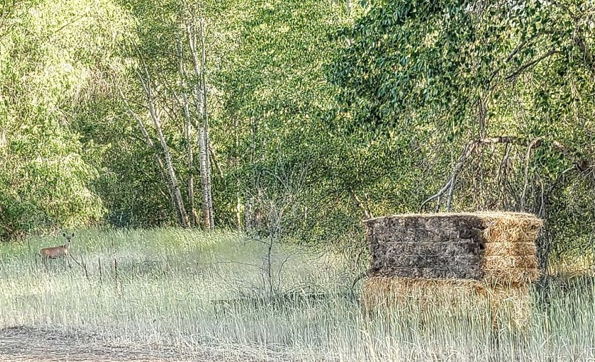
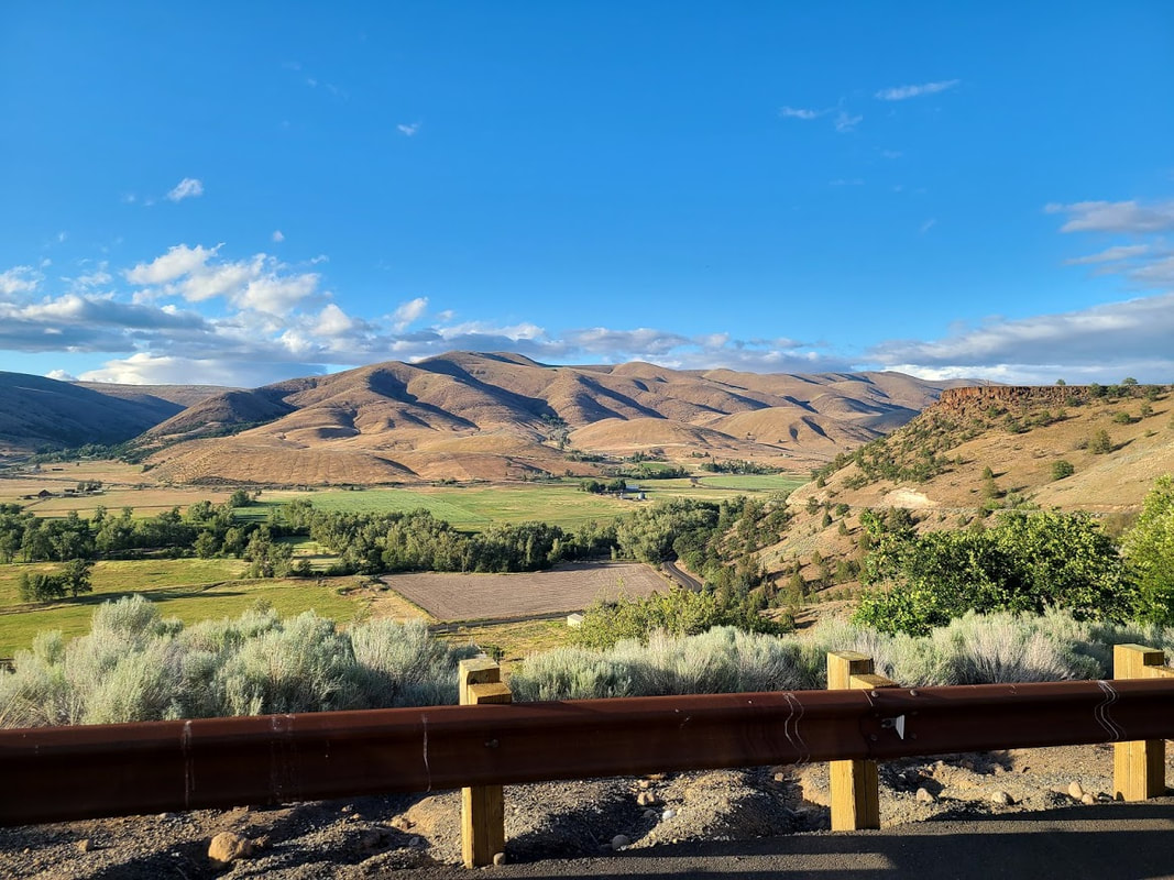
About 15 mi south of Dufur turn right onto Tygh Valley Rd (opposite Hwy 216), unless you want to take a little detour to White River Falls State Park not far east on Hwy 216. I missed my turn, and turned around at a wide spot off the road where stood a stack of hay, interrupting a deer making the most of it. Thus, the photo above right is coming back up from south of the right turn. The little community of Tygh Valley is at the base of the hill that takes in a splendiferous view of the Valley as you drive up Wamic Market Rd. Bend with Wamic Market Rd though town (Wamic) until it straightens itself out to become White River Rd (aka Rock Creek Dam Rd?) to continue traveling the modern equivalent of the Barlow Road. But there are events, places to go/things to do about these tiny towns as well. White River Falls State Park—about 15 mi south of Dufur turn onto Hwy 216, it’s not too far Tygh Valley OR--16 mi South of Dufur OR
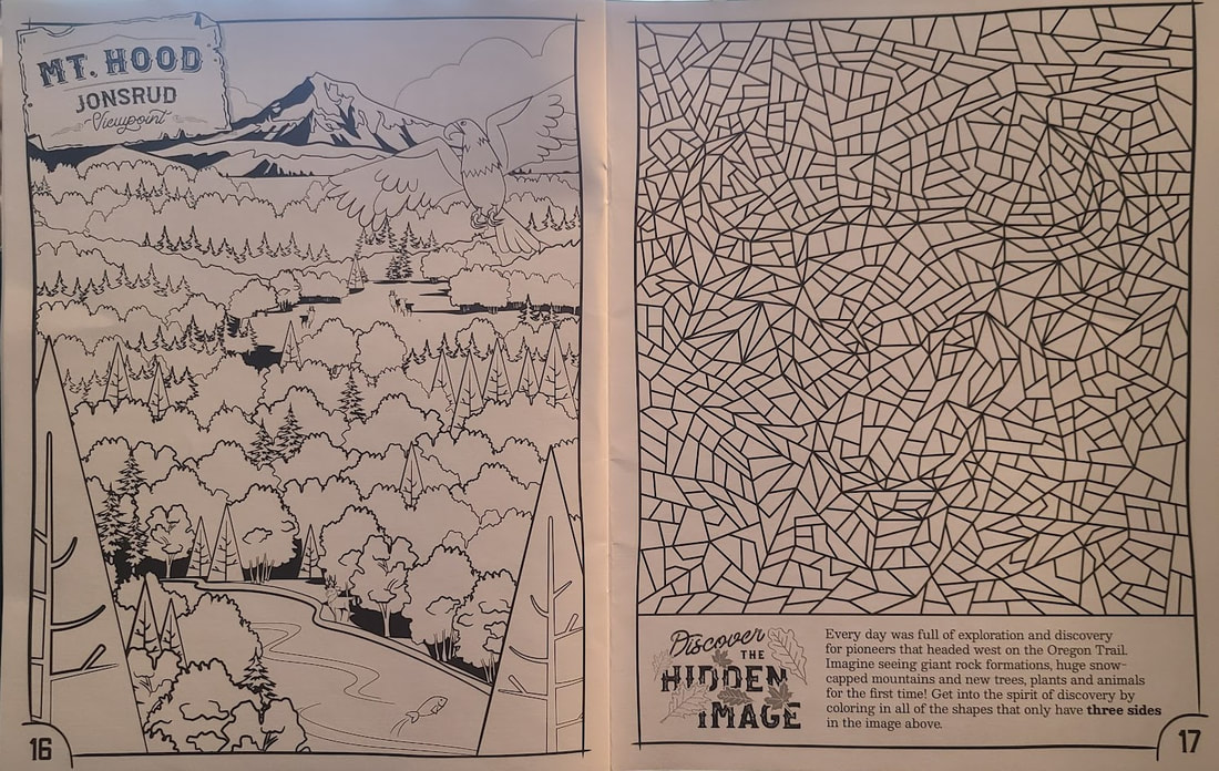
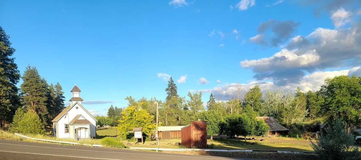
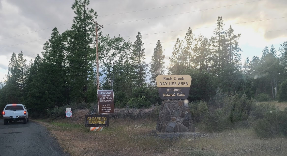
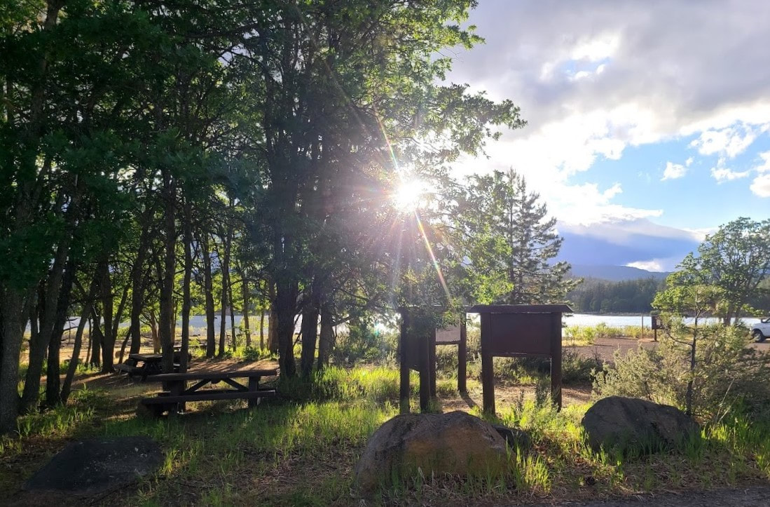
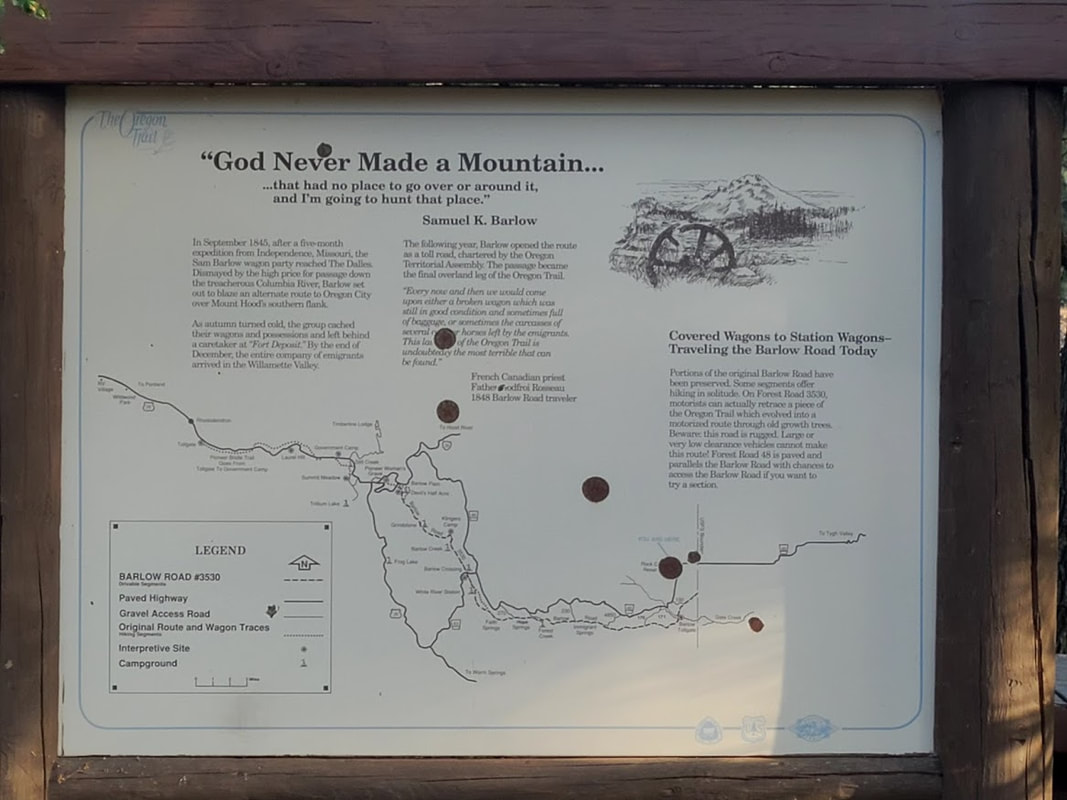
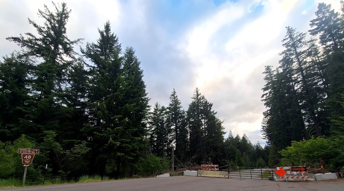
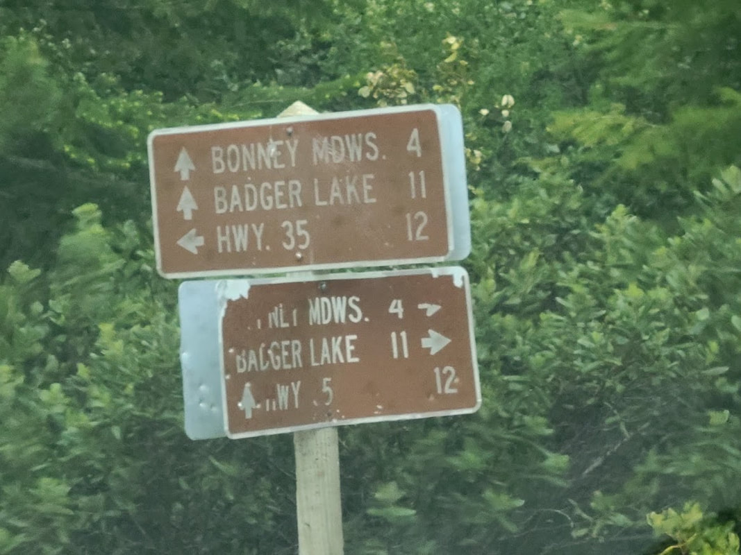
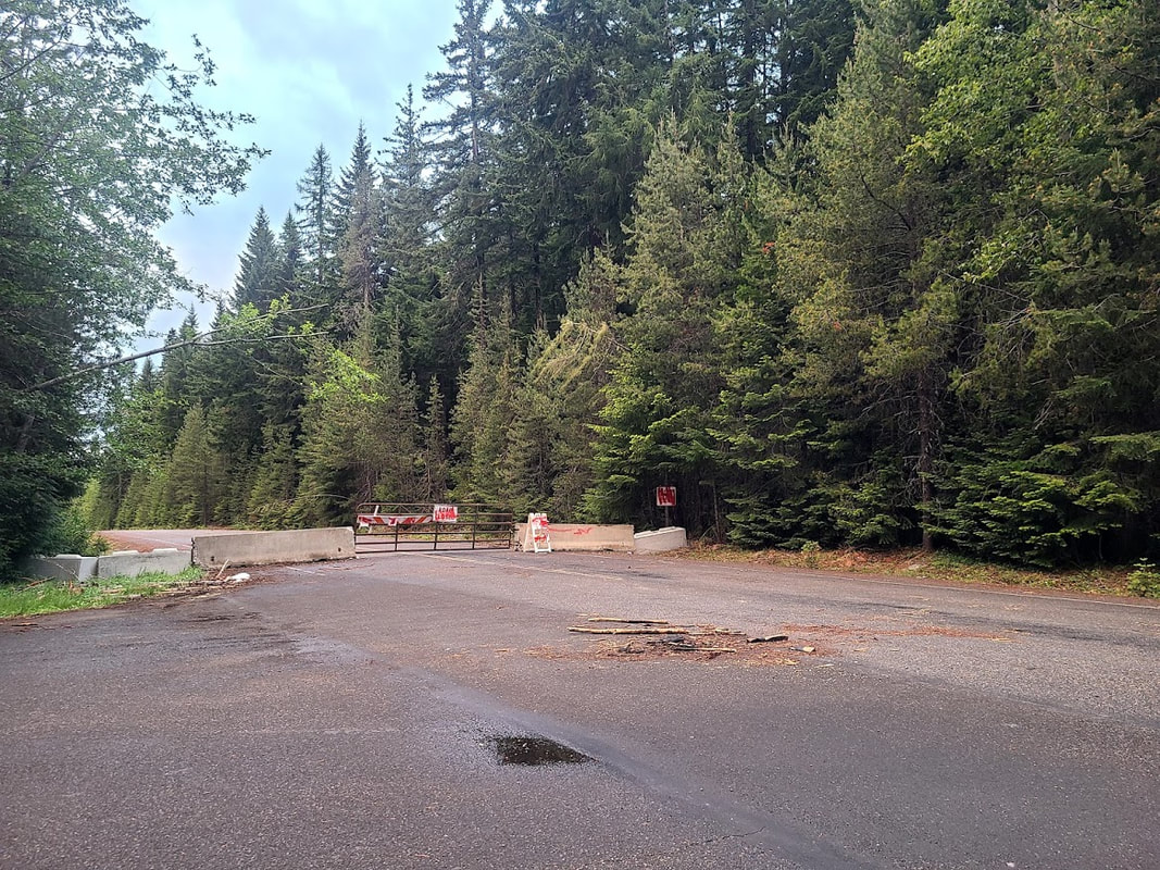
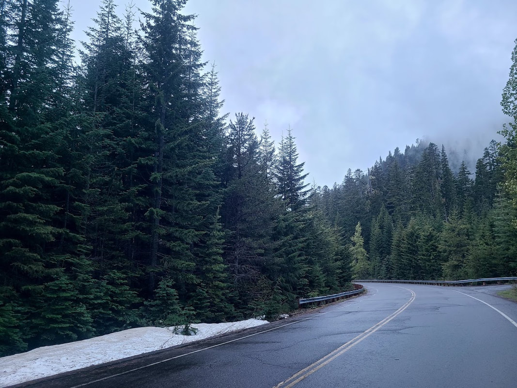
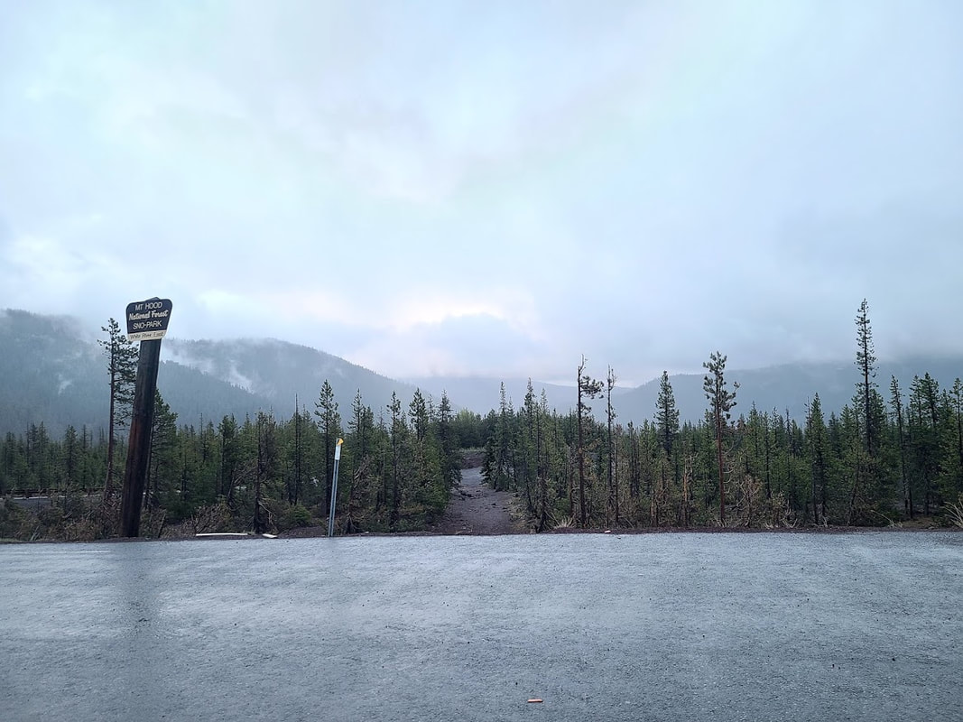
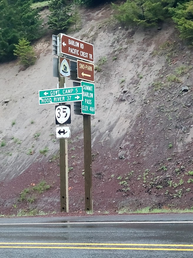
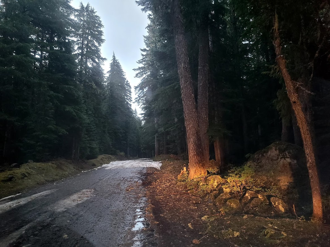
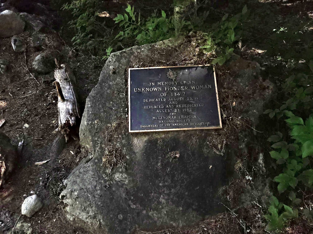
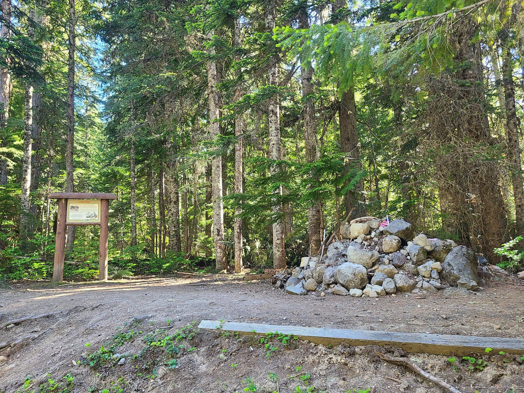
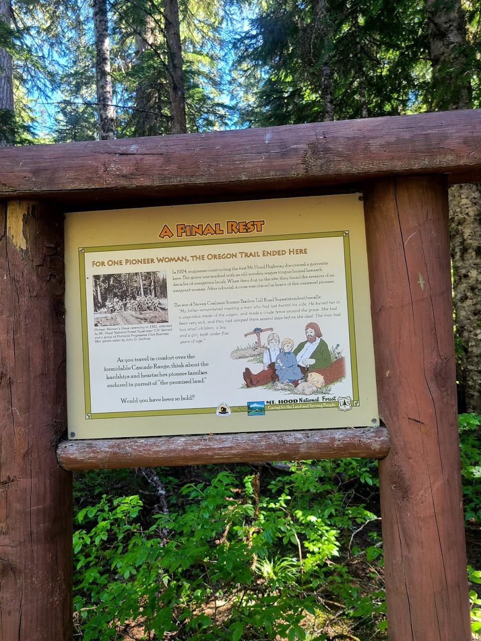
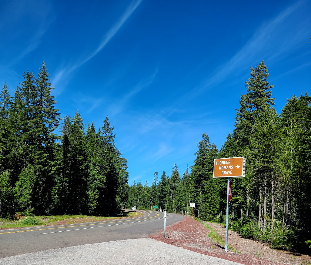
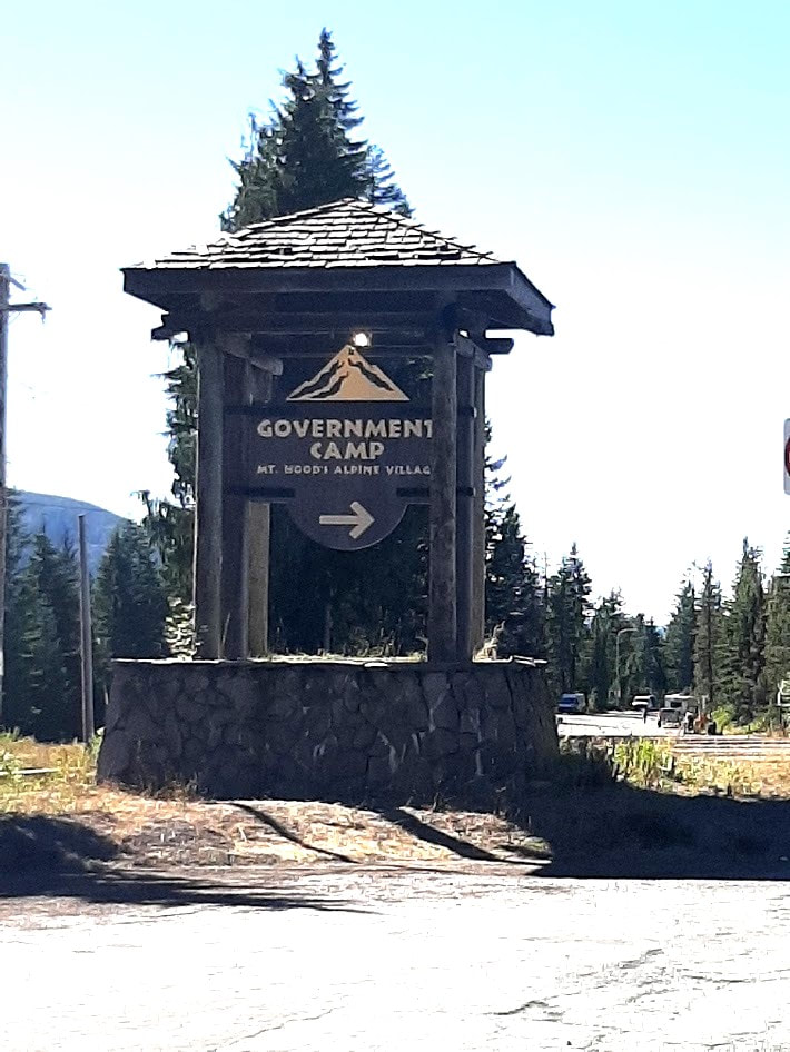
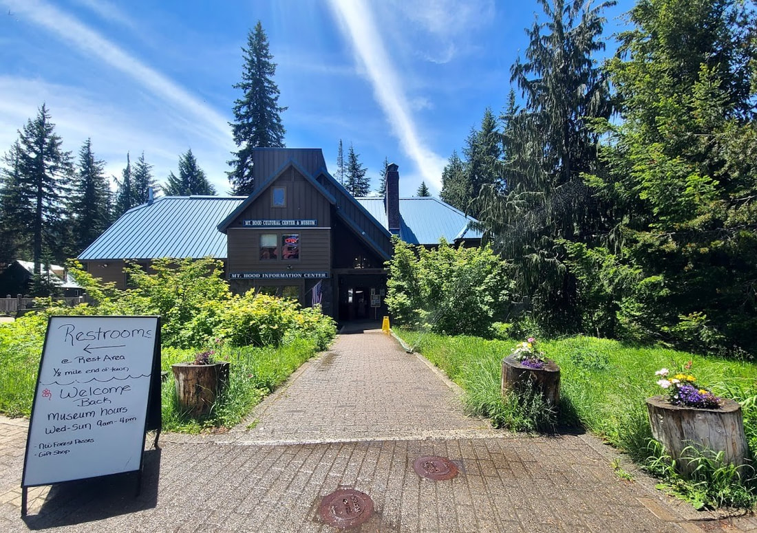
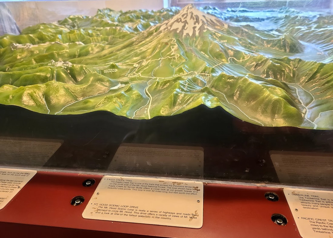
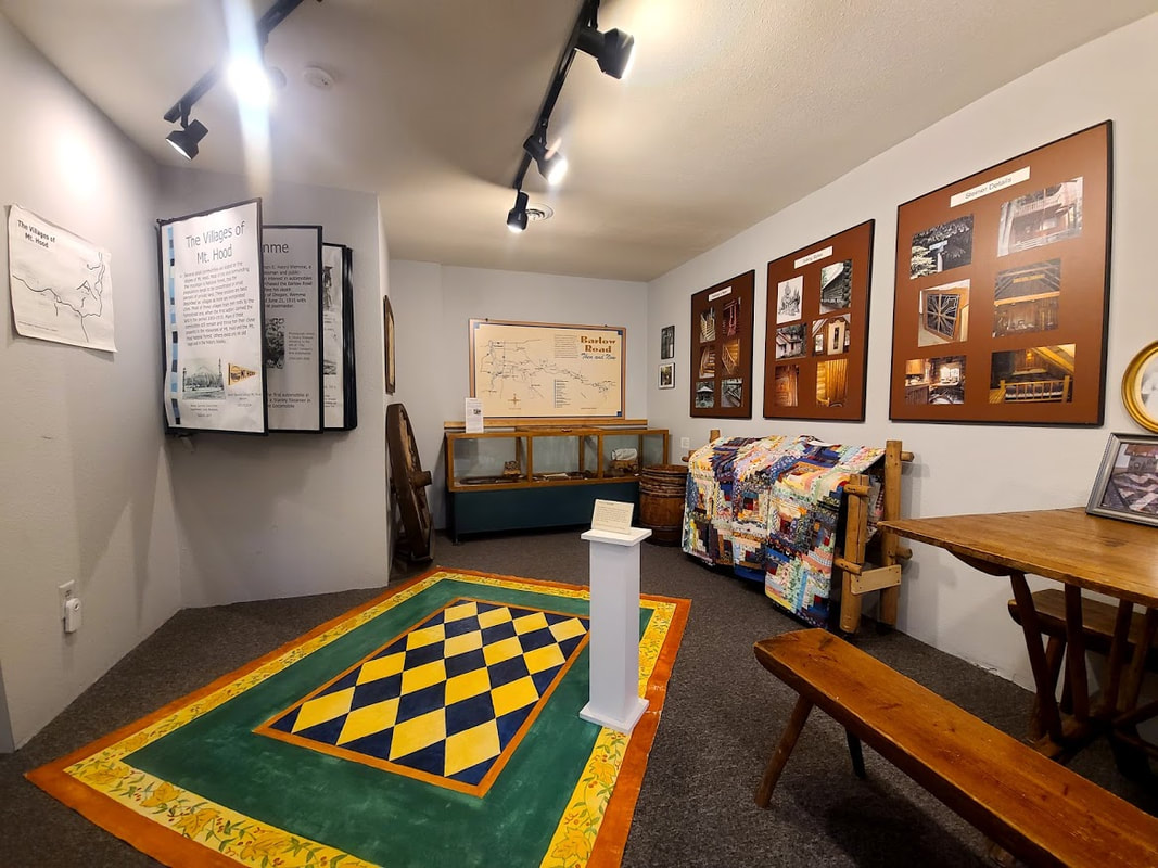
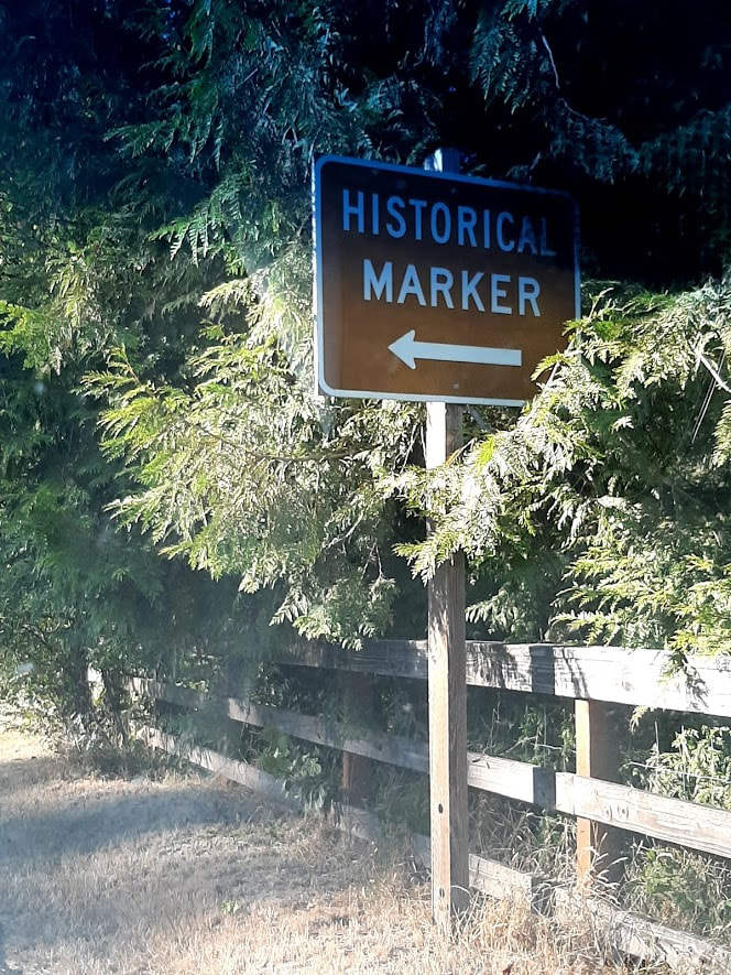
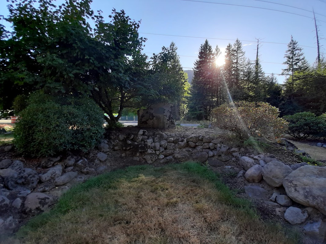
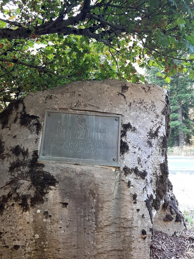
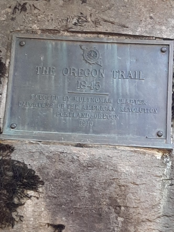
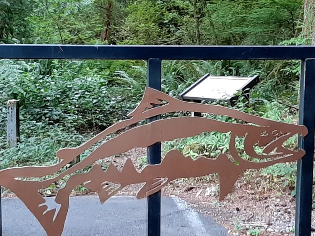
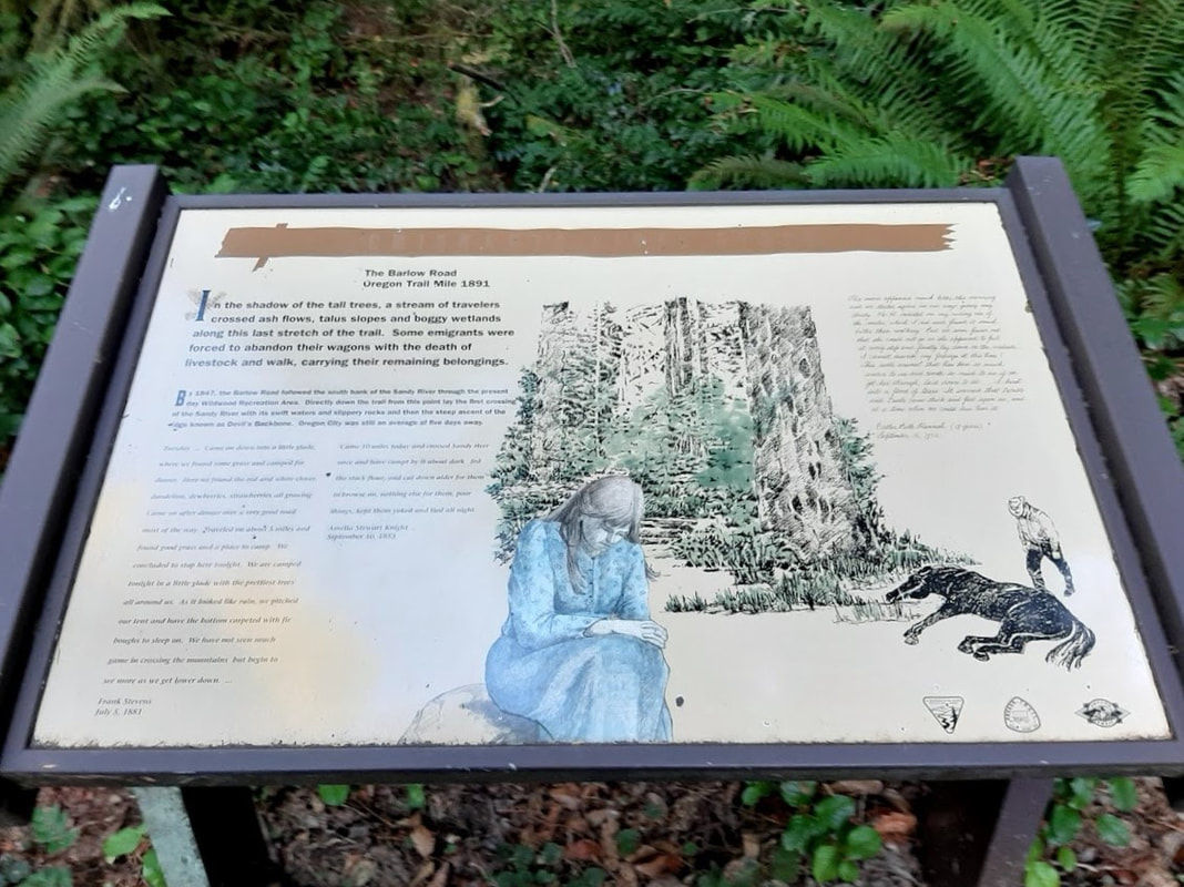
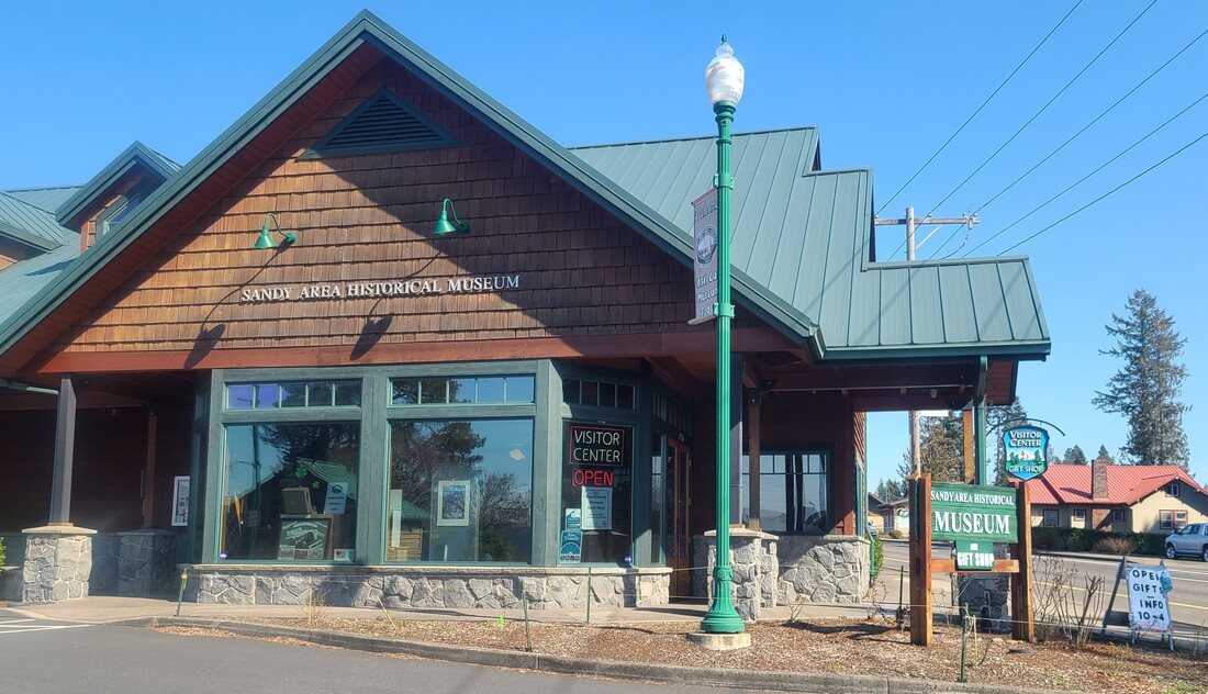
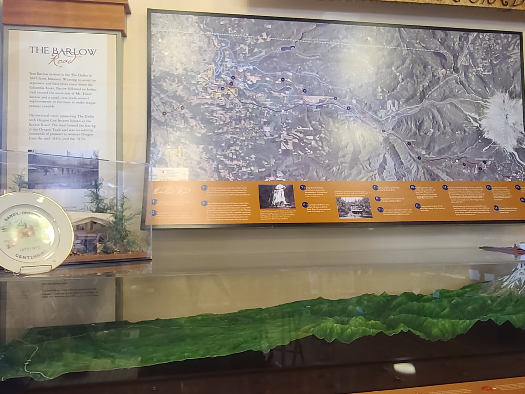
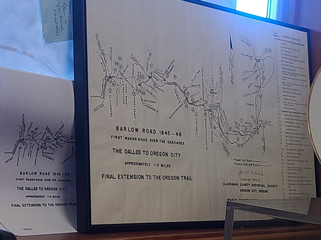
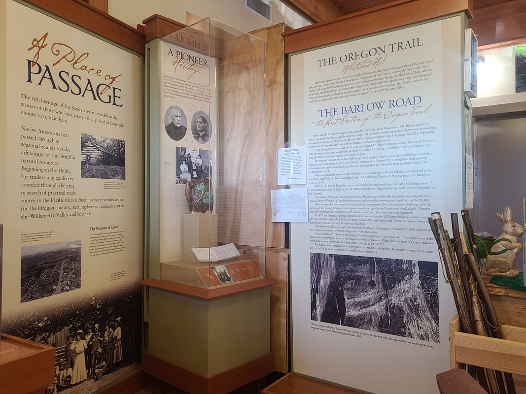
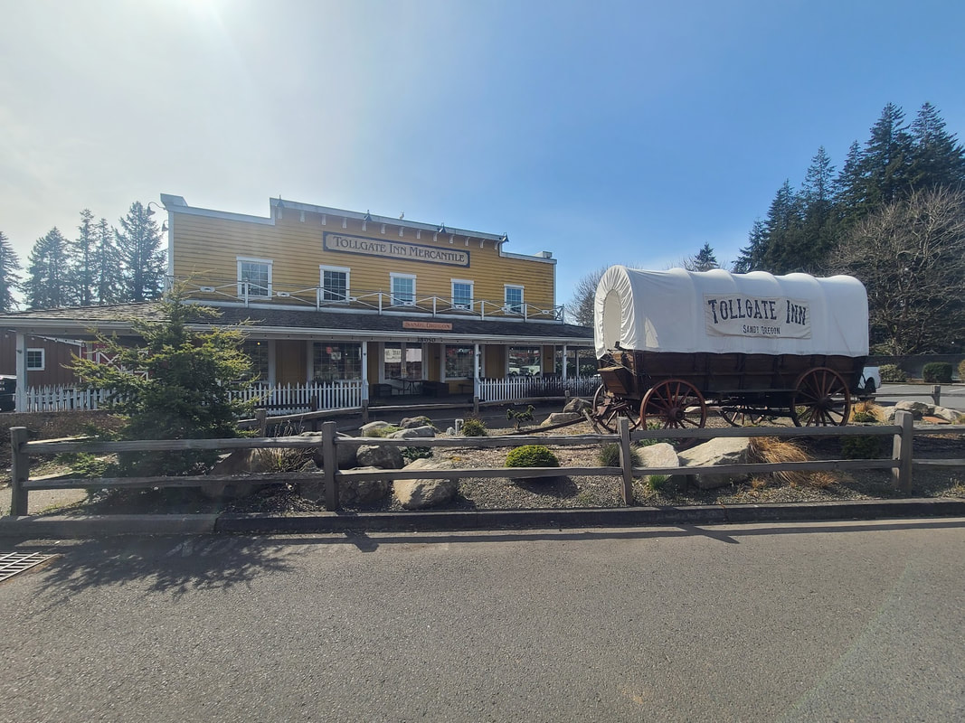
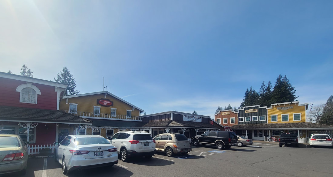
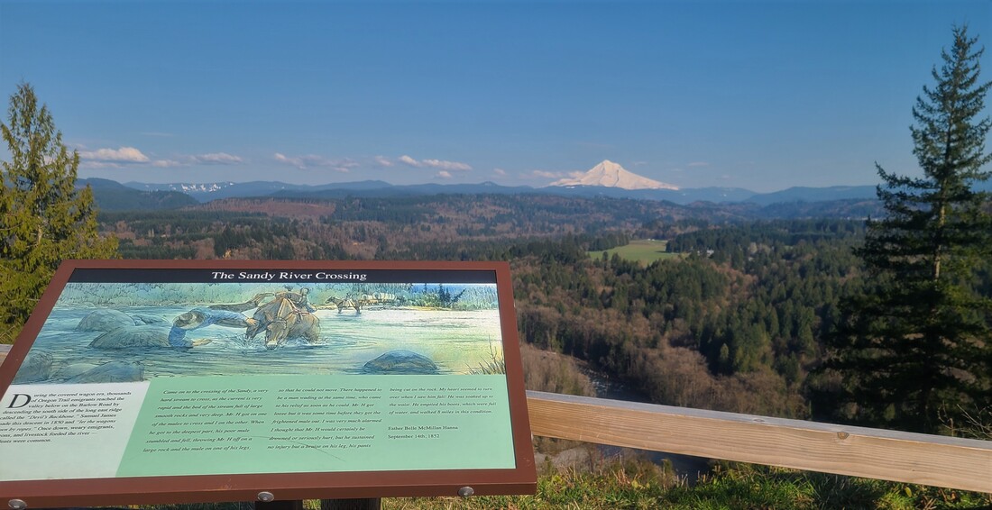
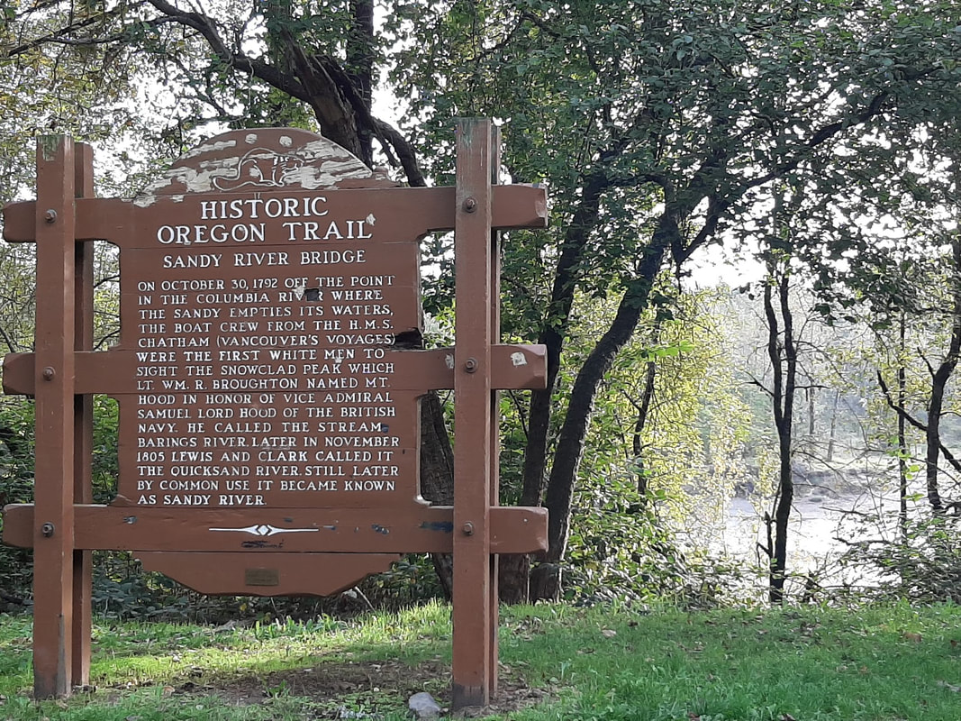
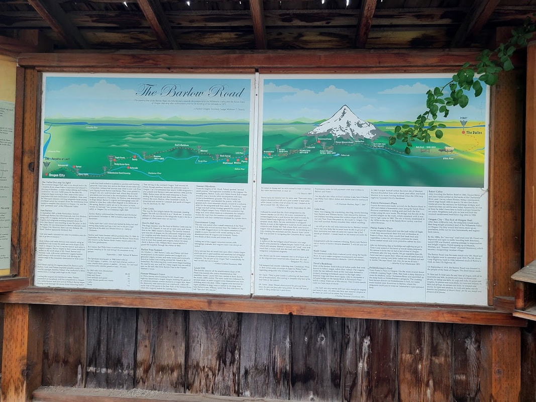
Historical Smock Prairie School, now a museum The Cottage by the Creek-- 57036 Wamic Market Rd, Wamic, OR 97063 Pine Hollow Lakeside Resort—just northwest of Wamic, at Pine Hollow Reservoir I had more than one adventure on this trip into the dark! My tank had plenty of gas, but eventually I was down to 19% phone battery. I had an annotated map, but still came to an unexpected fork in the road and fortunately chose the right one, which was left. I made it to Rock Creek Reservoir. It was wonderful country for a drive, but then winding up into the mountains, I began wondering how far my destination lay ahead, and when it would be too far to turn back. Some rather rugged roads, with signs warning "Not maintained for winter driving", seemed apparently not maintained for spring/nearly summer, either. Beside being rough riders, shrubs were invading the edges. There was no stopping for pictures. Then suddenly I faced a detour. With no familiarity with the roads or terrain, hardly knowing where I was, I was relieved to find reassurance from another traveler (few and fairly far between). Next, a warning, "Single lane ahead". Since I was driving solo, I took photos with my cellphone and sent them home in case I had to be rescued (as it turned out, they didn't get them until I was already home). As I drove I felt some small notion of what it might have been like traveling through the tall trees up the thickly forested mountain in a covered wagon for days and days in the cold and probable snow. Snow still lay along Rd 48 near the intersection (at last!) with Hwy 35. My original intent was to travel south from Hood River to meet Hwy 26 and the Barlow Route. Yet when I reached Hwy 35, I didn’t know which way to turn, so took a guess and watched for mile markers. Once again, I was fortunate to have made a choice choice. South of the intersection of Rd 48 with Hwy 35, turning off to see the Pioneer Woman’s Grave (also near the intersection of 35 and 26), did not turn out to be a good choice—the road much less taken at that time of year was paved, but narrow and shady, the snow wet & slippery. My vehicle (with me in it) nearly got stuck trying to turn around, and it was getting dark. My thoughts were chilled at the possibility/prospect of having to spend the night alone on a cold snowy mountain road off the main highway. I had emergency supplies, but it would mean climbing clear to the back of the car, as I daren’t get out into the snow. I could only hope I had enough battery and coverage to call for help if needed (now I have a car with cellphone charging). Thankfully I did finally get some traction, got turned around, and headed home along Hwy 26. Government Camp OR--50 mi east of the End of the Oregon Trail in Oregon City The map app says that it takes an hour and 20 min to travel those 50 miles: mind-blowing for a pioneer on the Oregon Trail, despite road improvements since then, or should I say beside road improvements! This little jewel community near historic Timberline Lodge features skiing and other tourist activities one would find on a mountain, including a Chalet theme. The small museum at Government Camp has a bit about the Oregon Trail. Government Camp OR Mt Hood Cultural Center & Museum, Government Camp OR More info about Mt Hood, the area around it, and Hwy 26 Laurel Hill--only accessible eastbound, and not that accessible at that 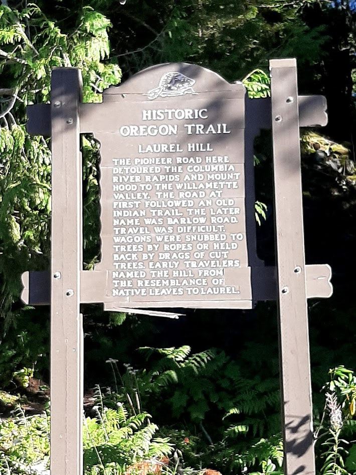 Rhododendron OR To find the little monument for the Oregon Trail, watch for the sign for E. Little Brook Lane, and the Barlow Road marker, west end of town. The little monument is right there off Hwy 26. It’s historic in its own right, erected 1916. Wildwood Recreation Site—39 mi east of Portland OR, near Welches Right at the entrance, behind a fish art gate is where we saw an inconspicuous marker for the Barlow Road. For more photos and info, scroll down to the bottom of the first link below, and check out the others as well. Sandy OR--27 mi east of downtown Portland OR, but it takes about an hour's drive due to traffic (at best) I was attempting to check out places to go up on Mt Hood too early in the year, and ended up with some time to explore Sandy, to my delight. Only the gift shop of the museum was open, due to COVID restrictions, but they had beautiful displays for the Barlow Road of the Oregon Trail, and I got vital info about other places: Jonsrud in particular was an excellent sight site. Second site below shows and tells more.
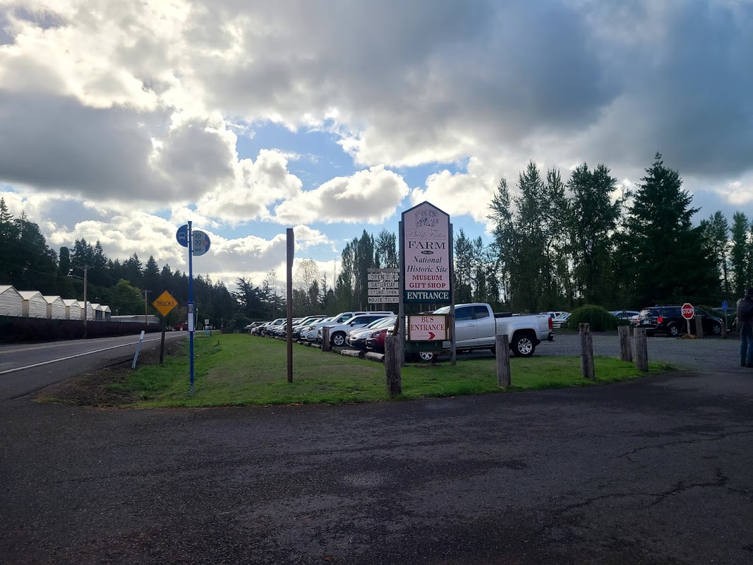
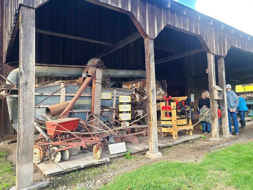
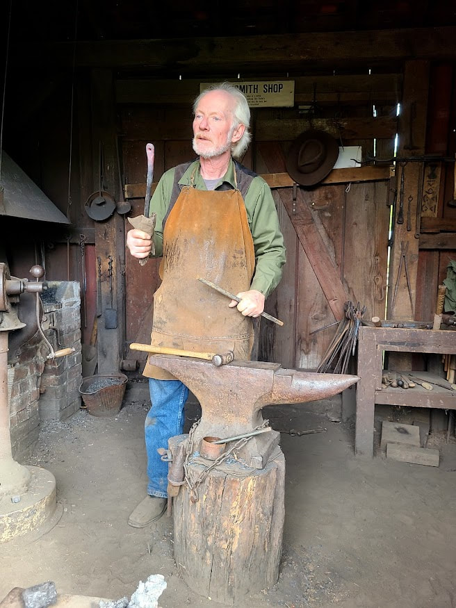
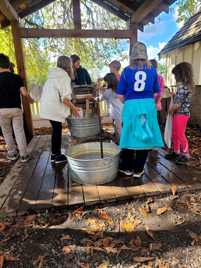
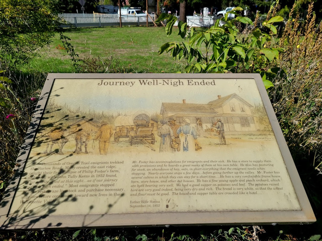
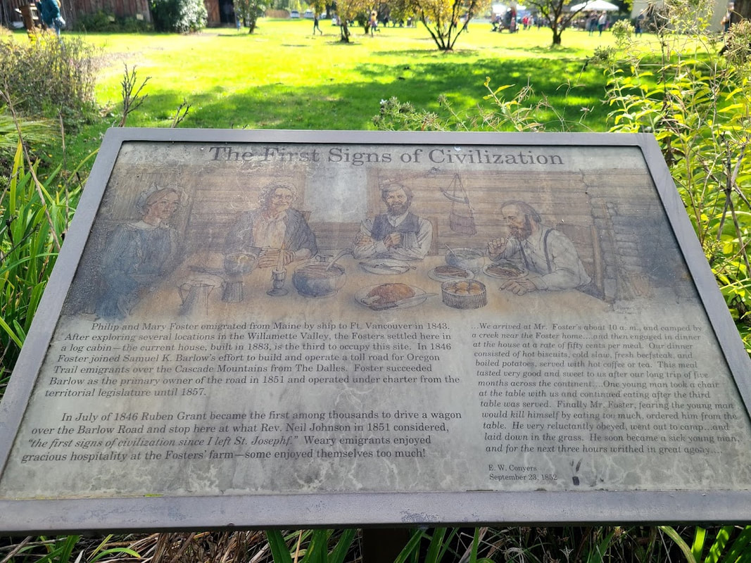
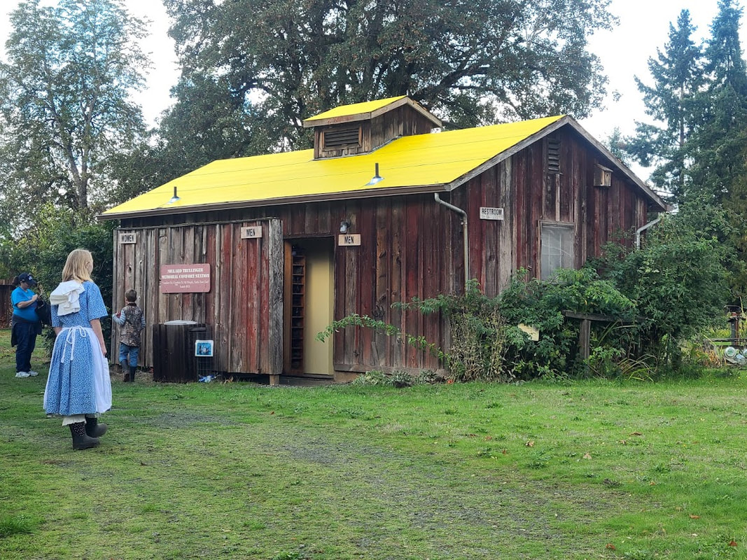
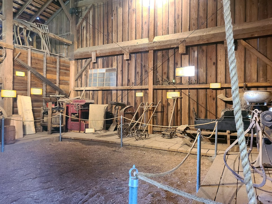
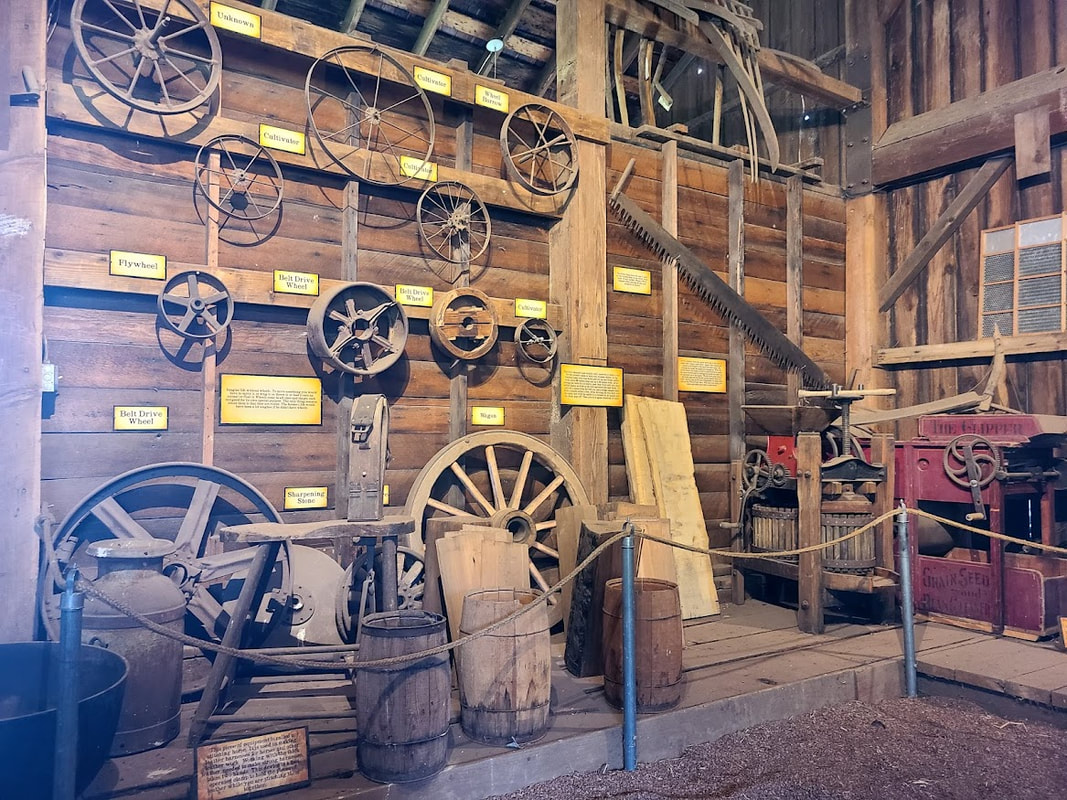
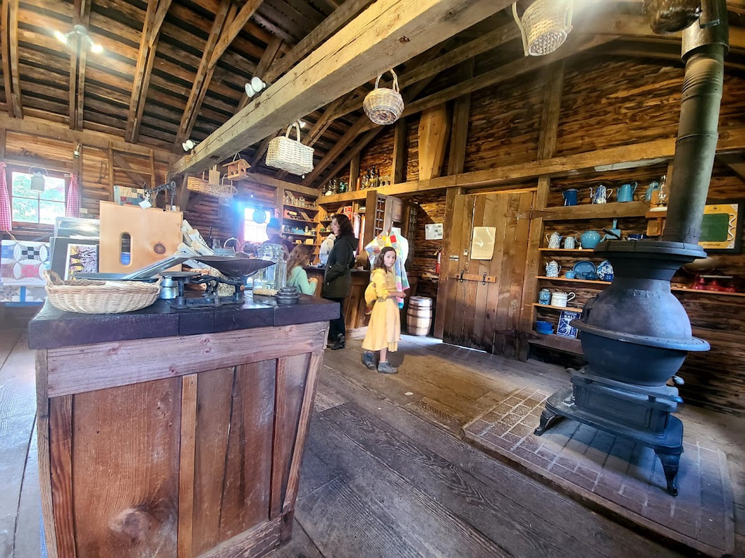
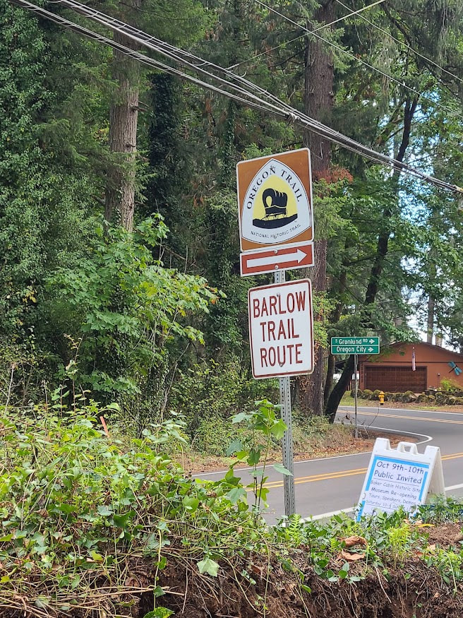
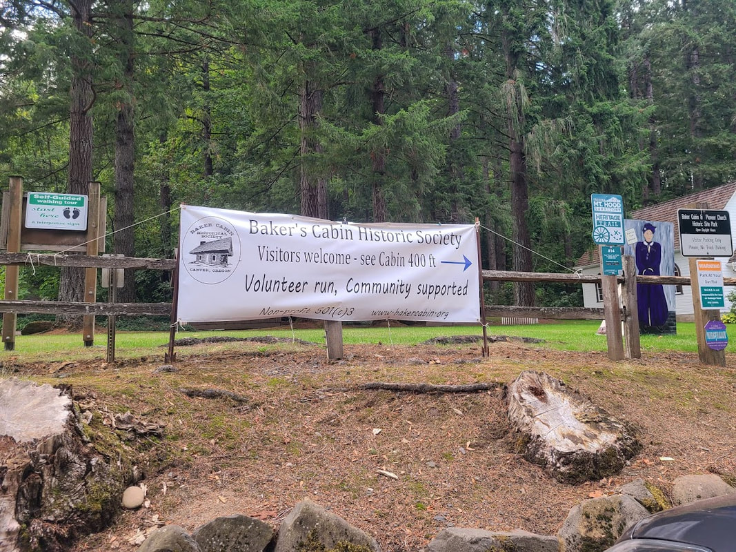
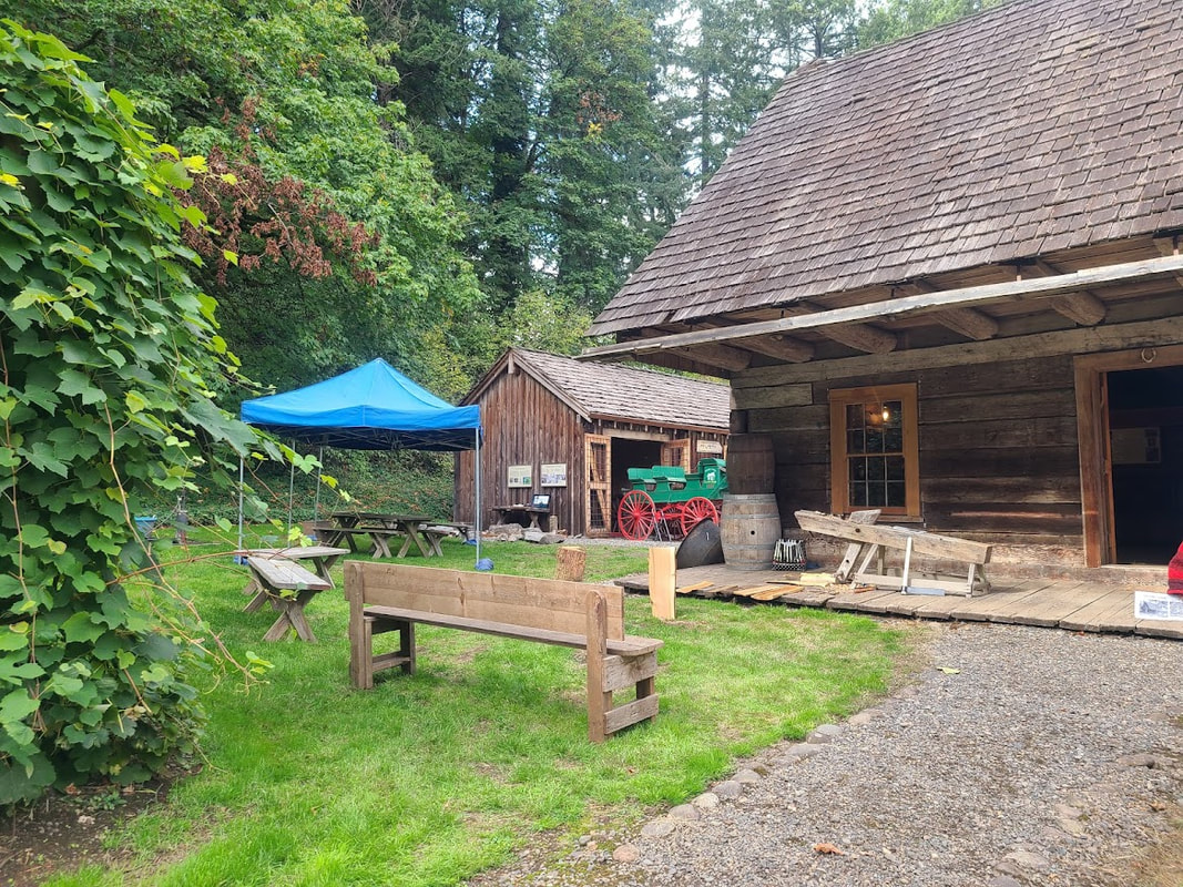
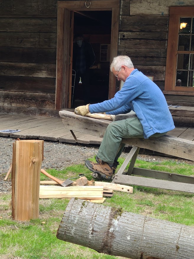
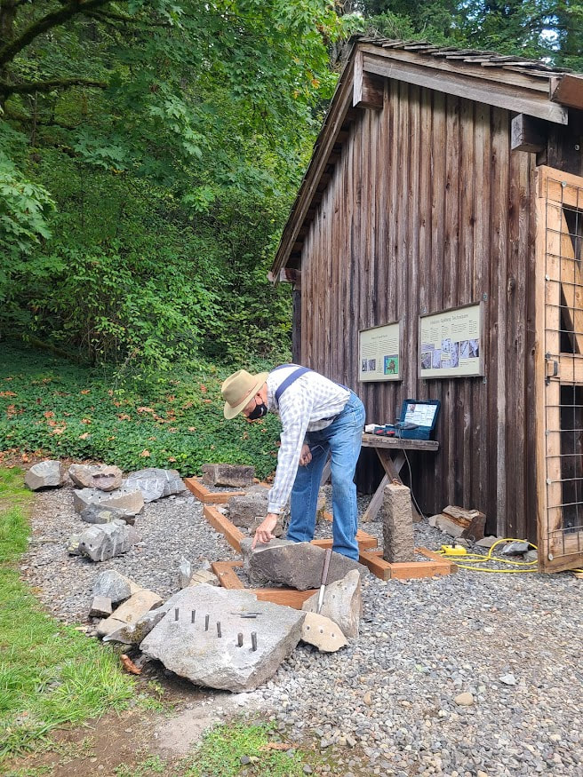
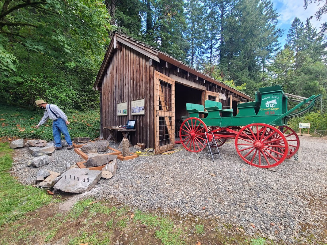
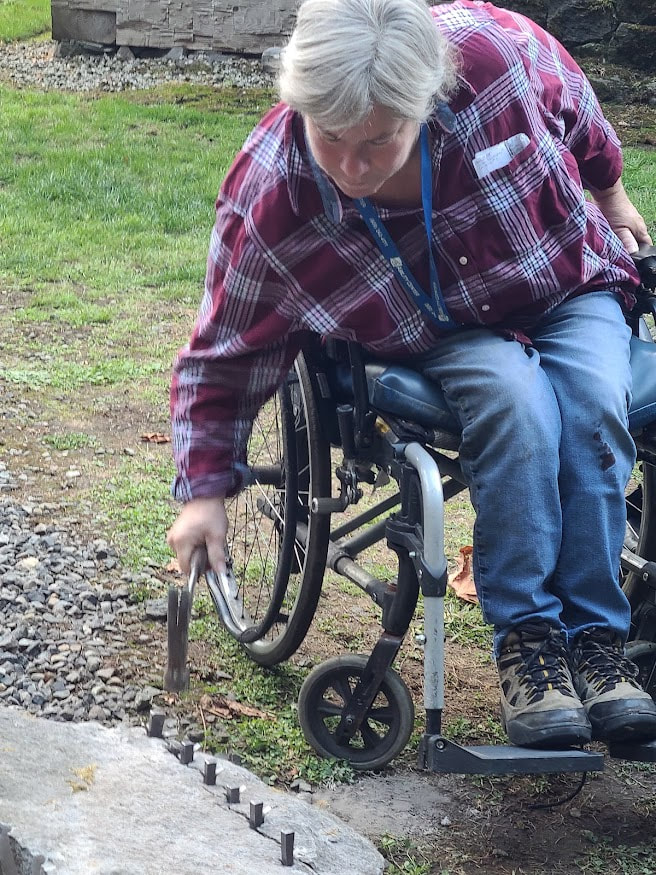
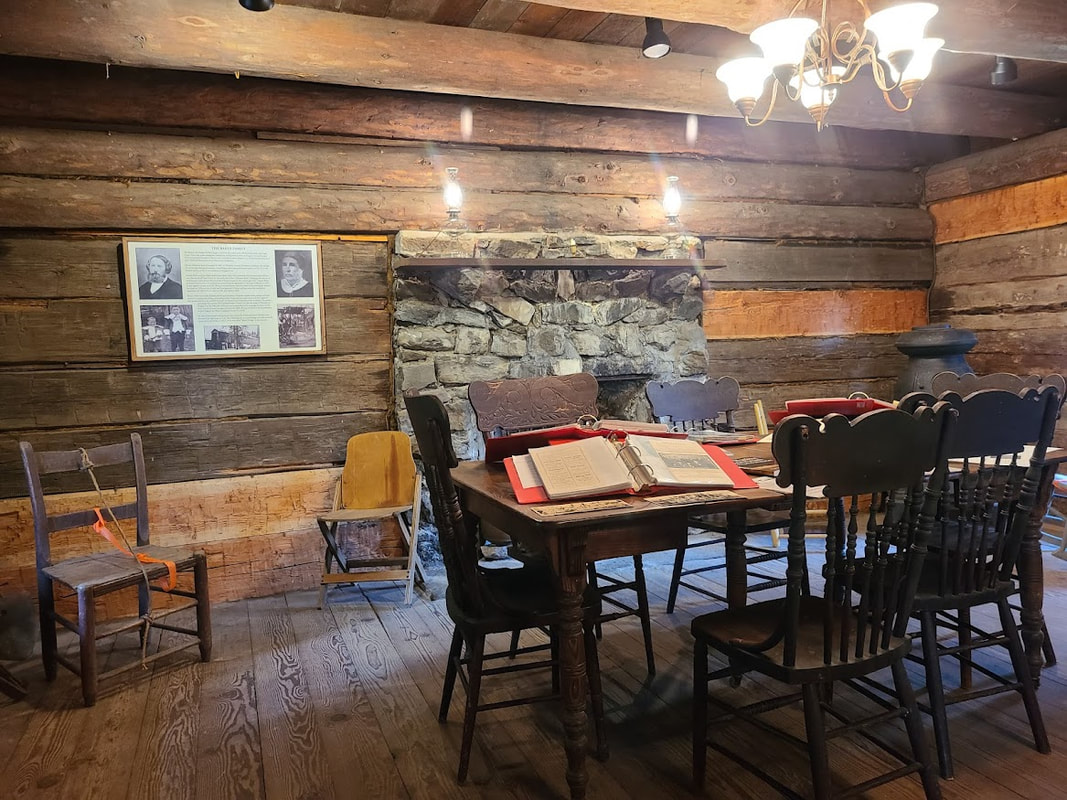
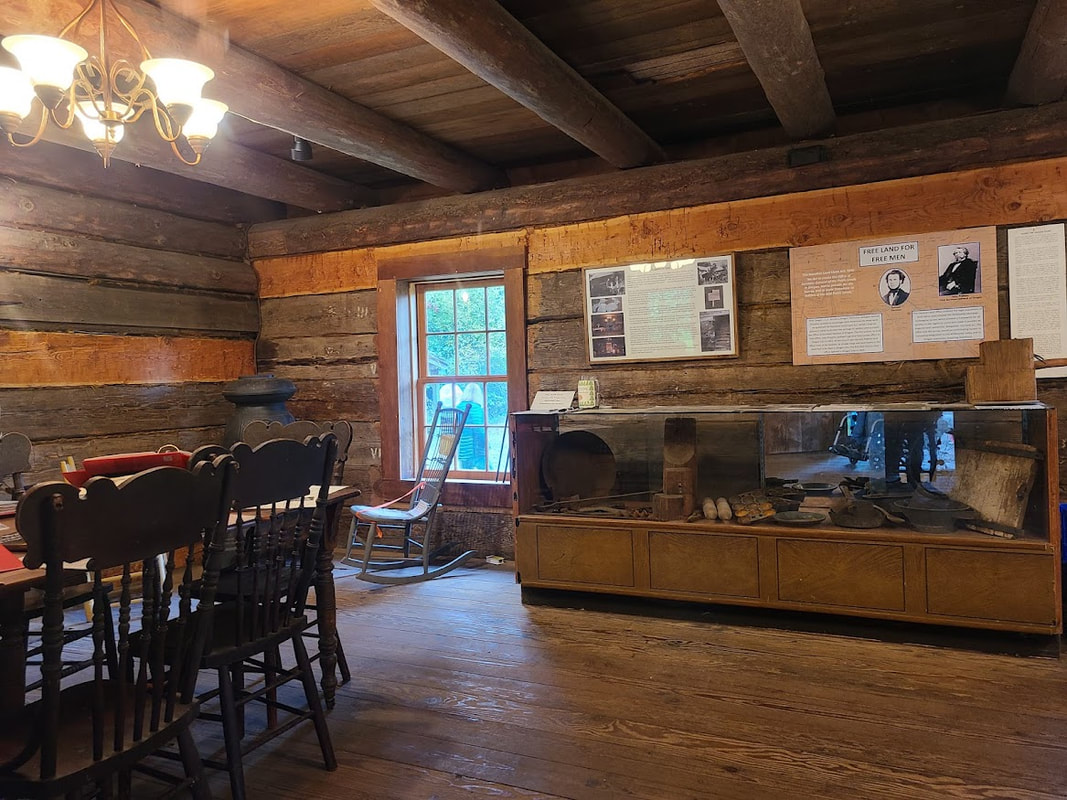
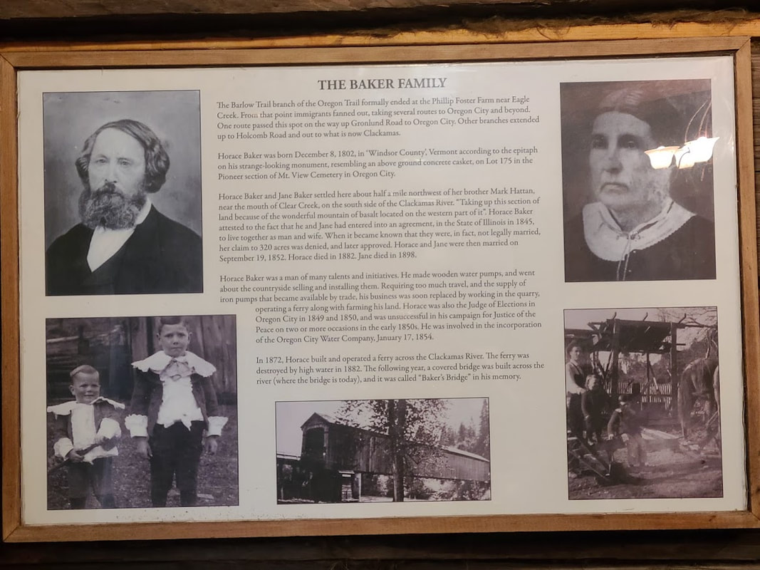
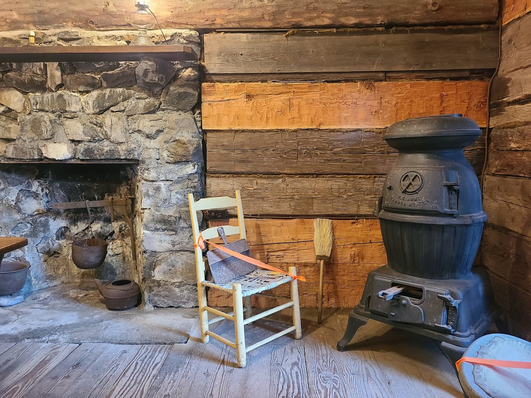
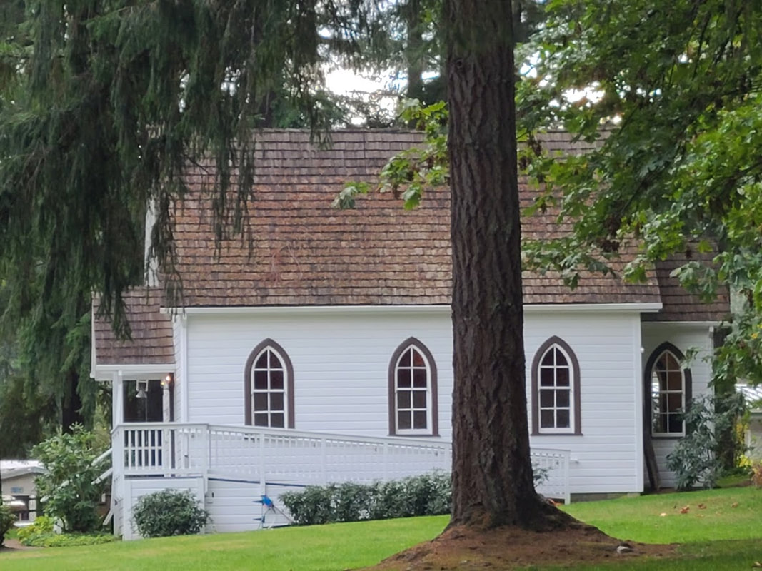
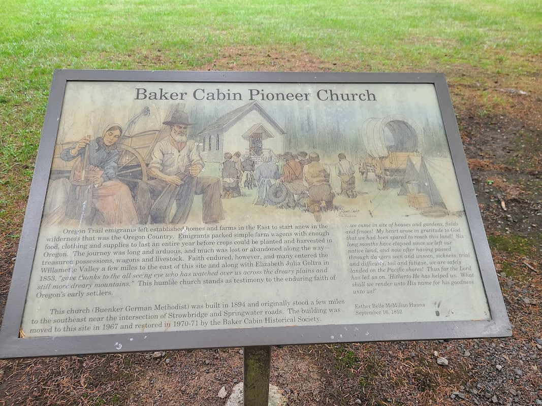
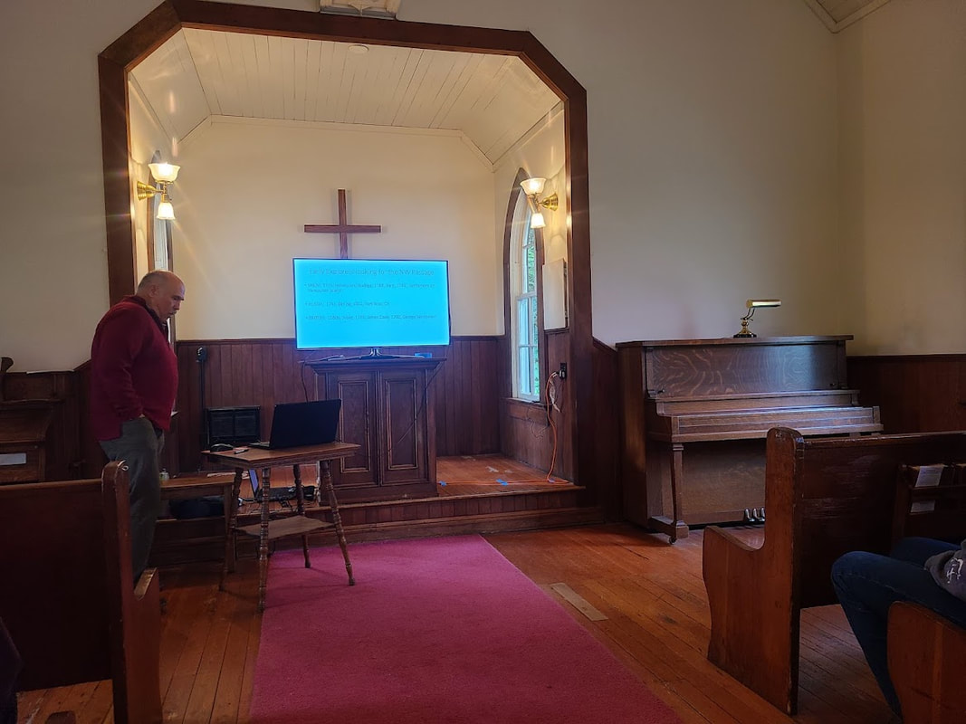
 the Sandy River, across from Lewis & Clark State Rec Site just south of I-84 Phillip Foster Farm--22725 SE Eagle Creek Road, Eagle Creek OR 97022 What a wonderful place to go! They have annual and special events like apple cider pressing and various camps, tours, living history . . . Baker Cabin--corner of South Hattan & South Gronlund Roads, Carve OR (18005 S Gronlund Rd, Oregon City) We went for an event day, and how glad we did! The pioneer, Horace Baker, was a stone mason, and I got a chance to give it a little try 😊! The place is not super accessible for a wheelchair, but we managed most of it. The people/volunteers are very friendly and helpful.
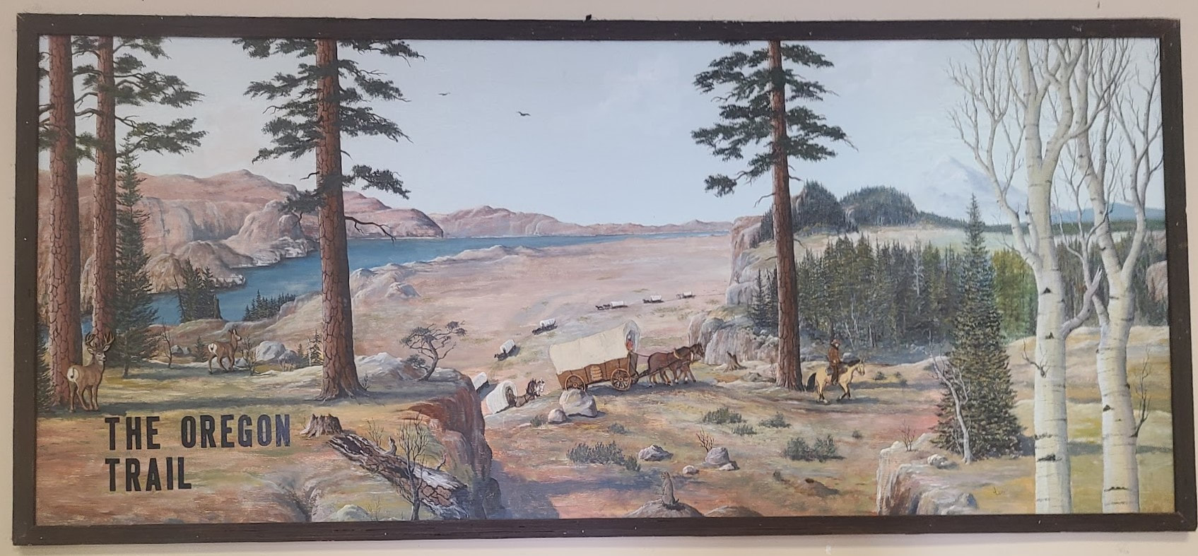
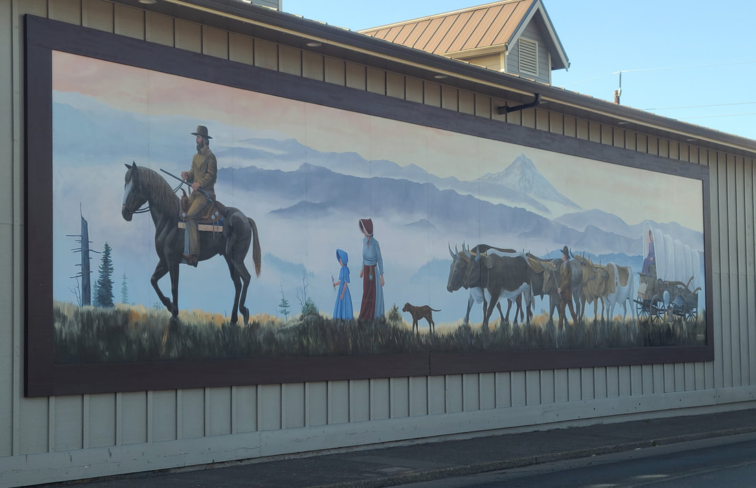
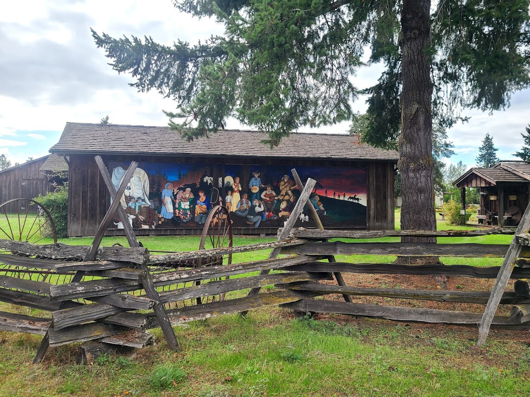
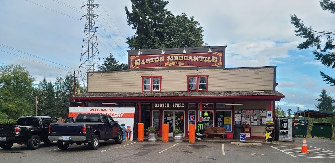
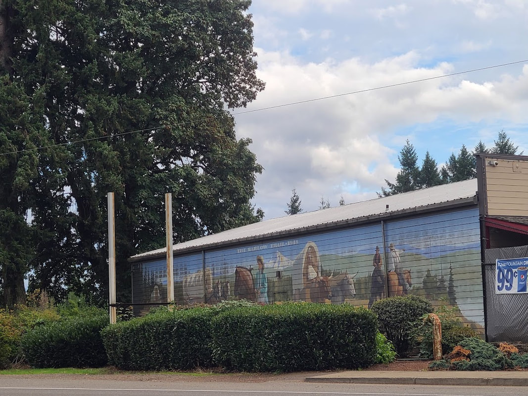
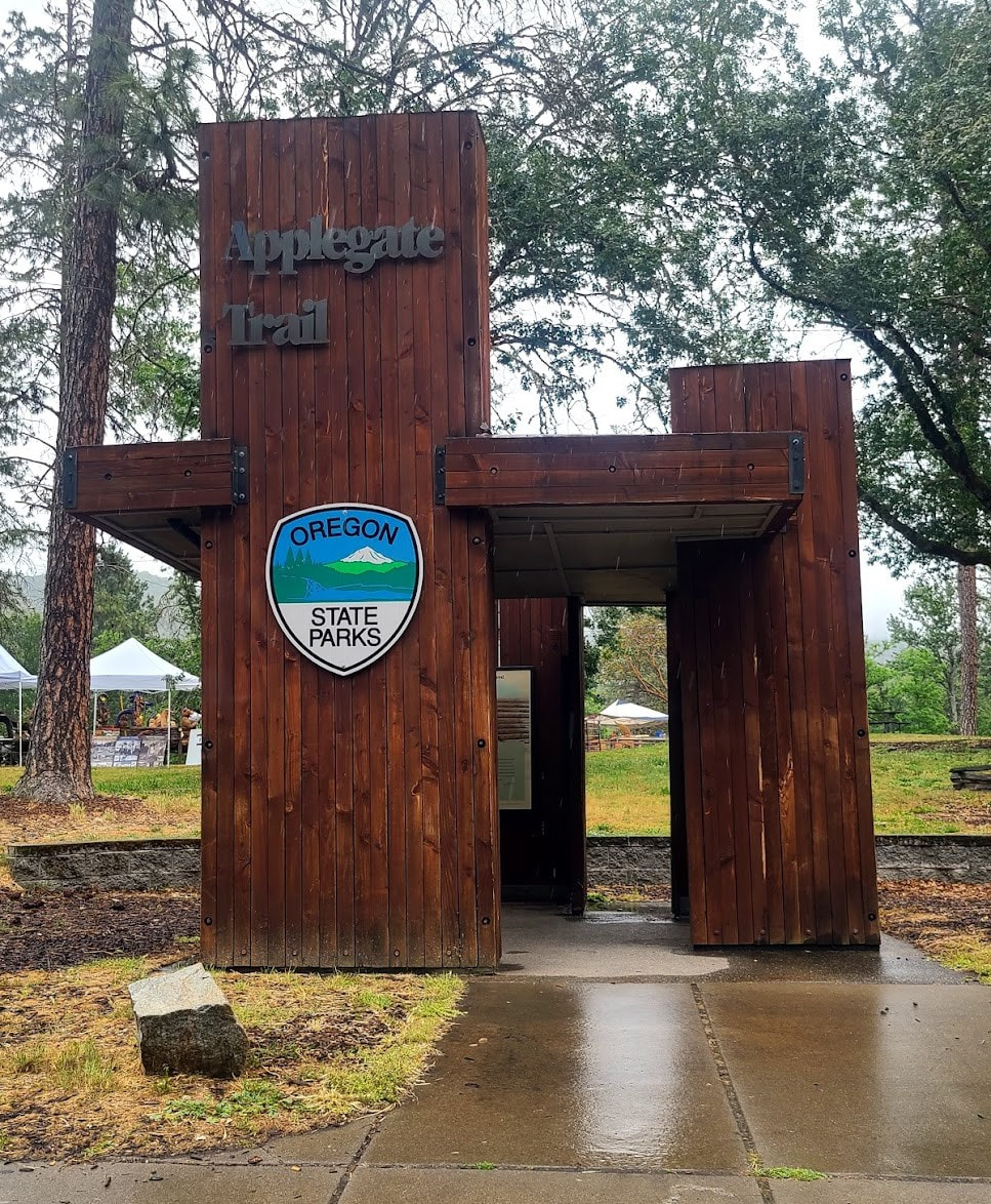
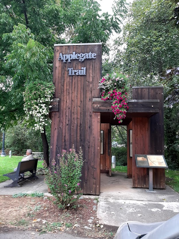
Barton Mercantile (Store) with Oregon Trail mural--19009 SE Barton Park Rd, Boring, OR 97009 aka Clackamas Hwy 224 The Applegate Trail
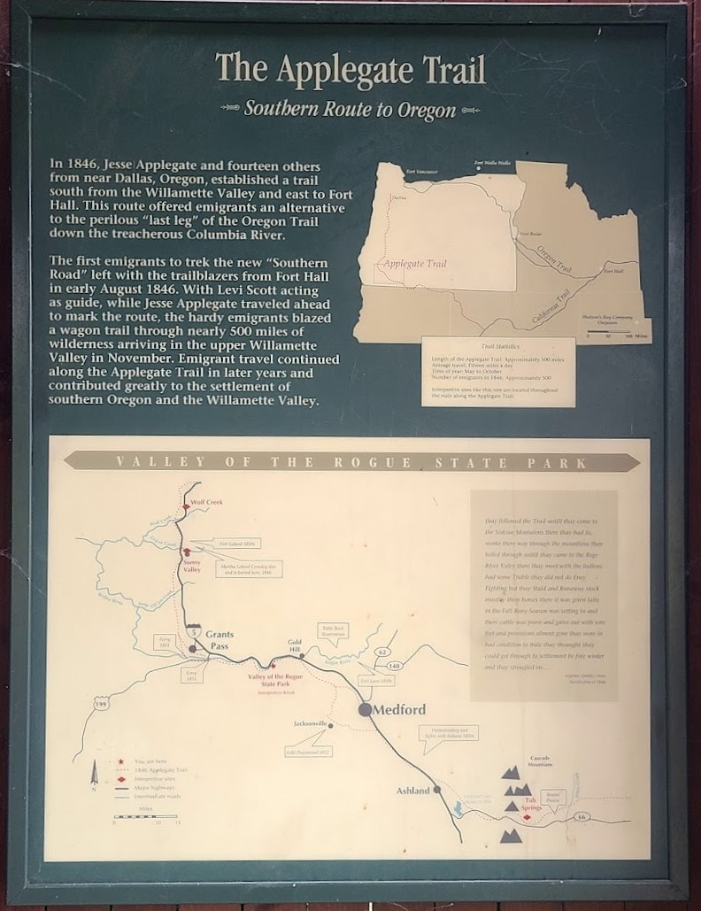
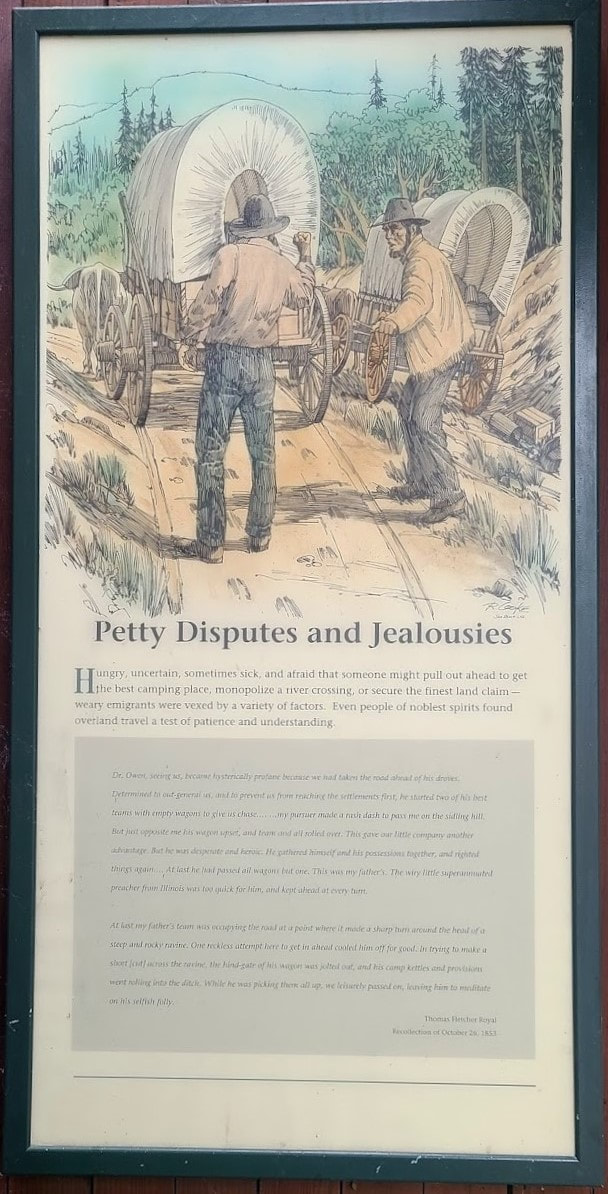
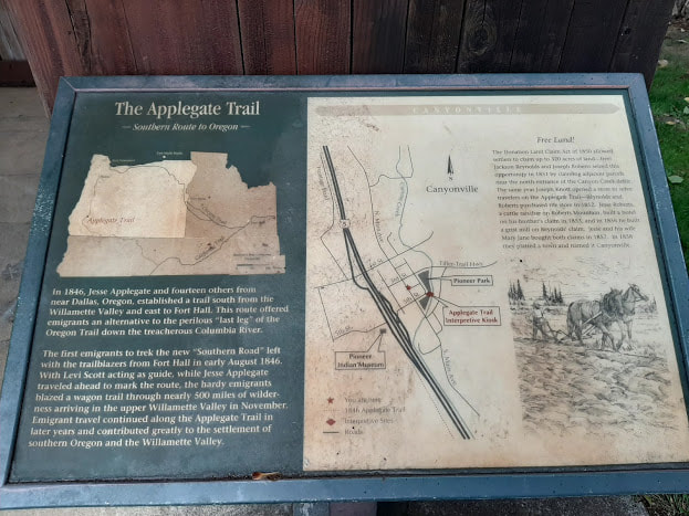
The Applegate Trail cuts off The California Trail and heads northwest from what is now Nevada. I became aware of it while traveling I-5 in southern Oregon, and was intrigued. The furthest south I got was the Valley of the Rogue State Park east of Grant's Pass OR, so that's where I'll start. 
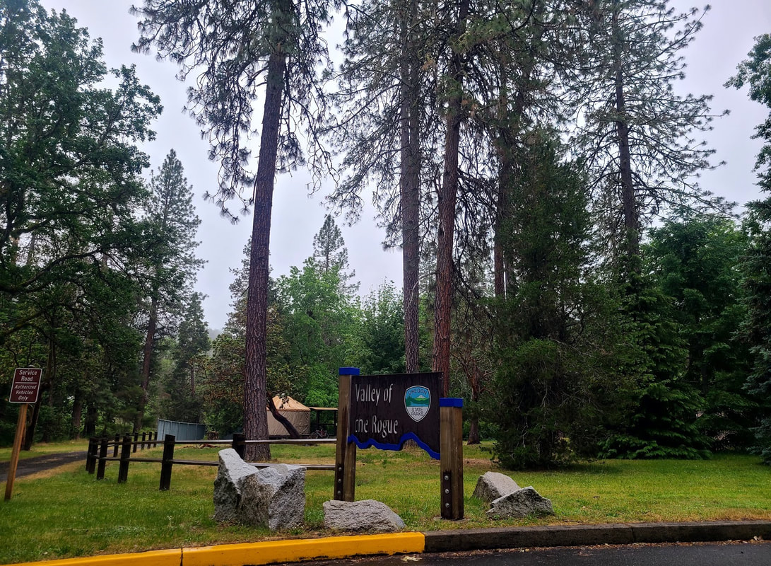
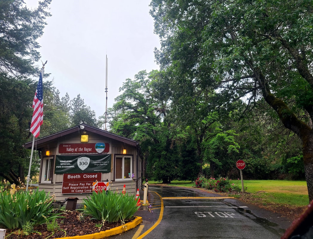
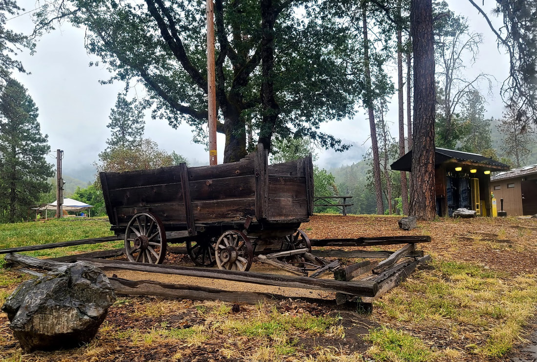
Valley of the Rogue State Park—13 mi east of Grant’s Pass OR on I-5 I stopped here on my way back from Mt Shasta on a rainy day. The park just happened to be hosting a chainsaw carving event in conjunction with Oregon State Parks centennial--all the more delightful for me! Not many had come on such a day, but I was glad I did. Apparently it is a very popular park in the summer. I thought it would make a good place for a reunion gathering, and of several yurts, one is accessible. For more about this park, see links below.
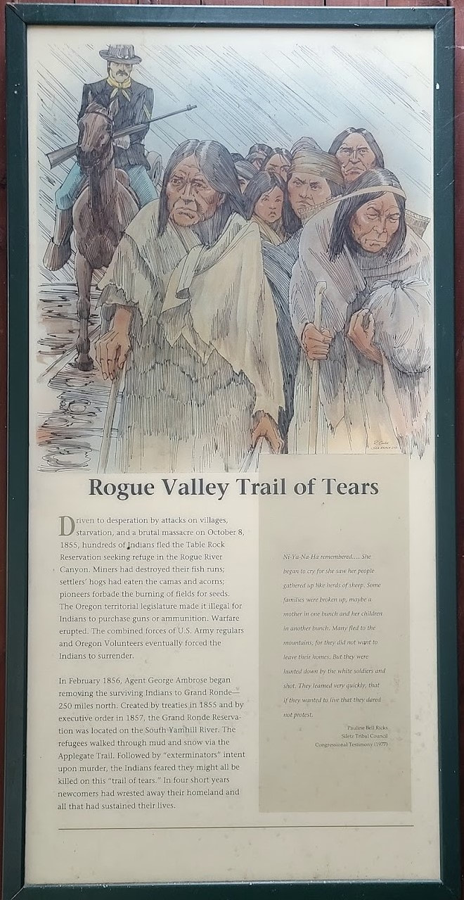
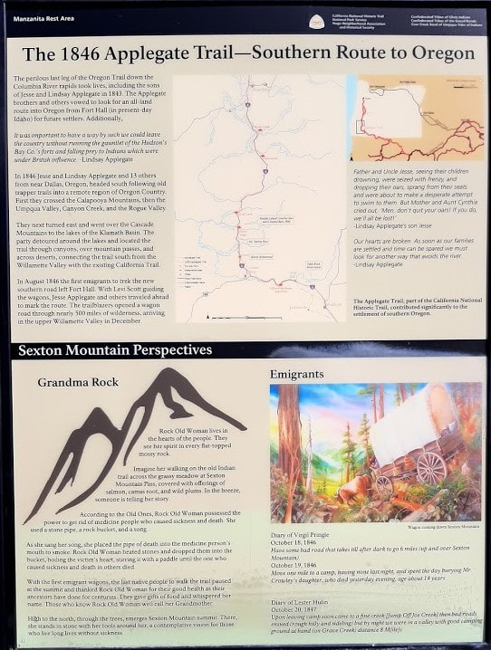
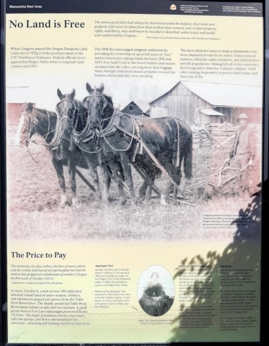
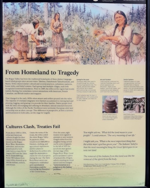
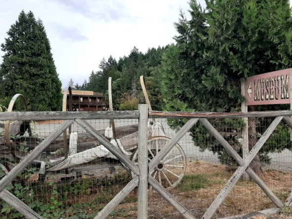
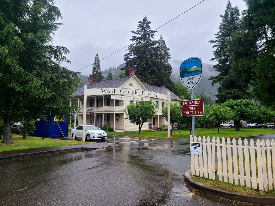
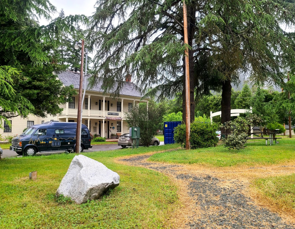
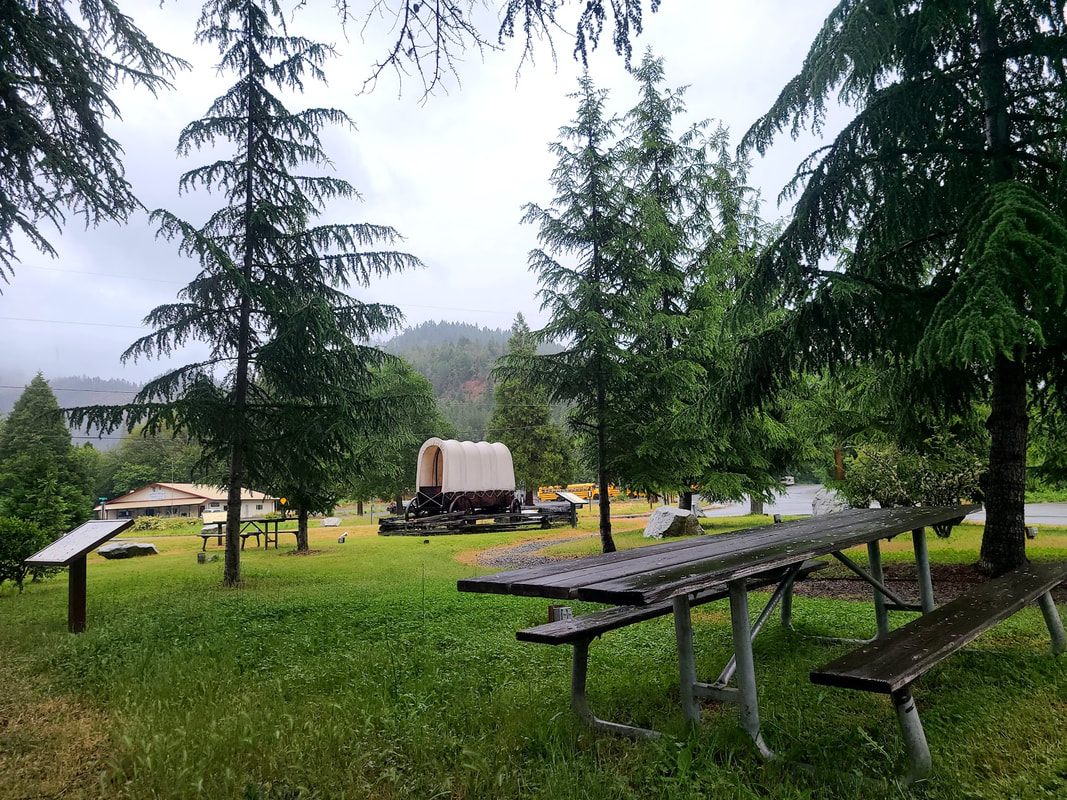
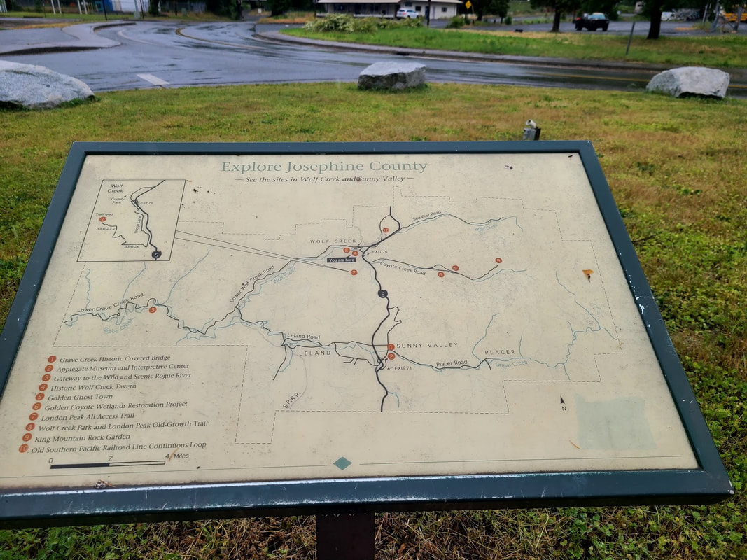
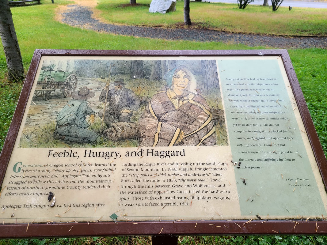
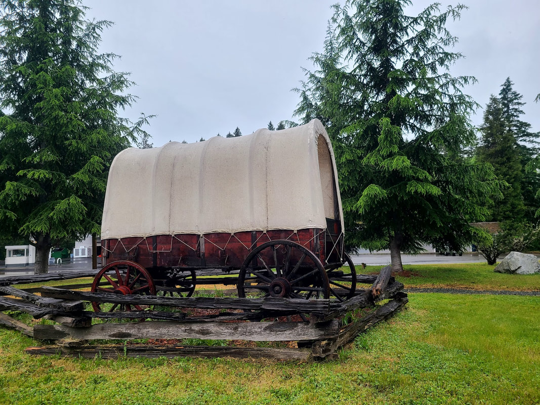
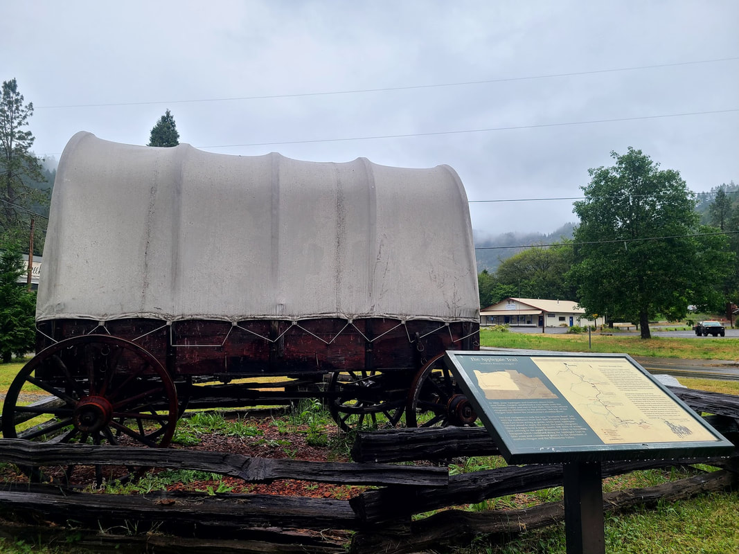
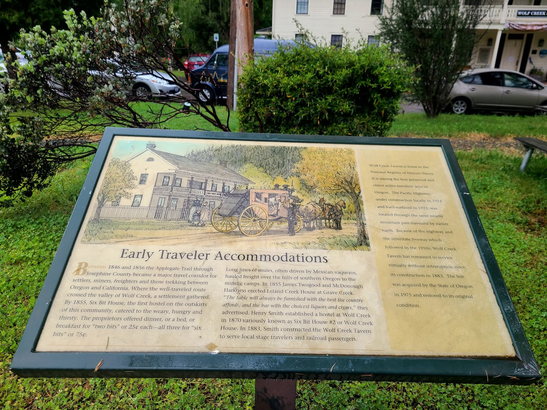
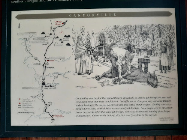
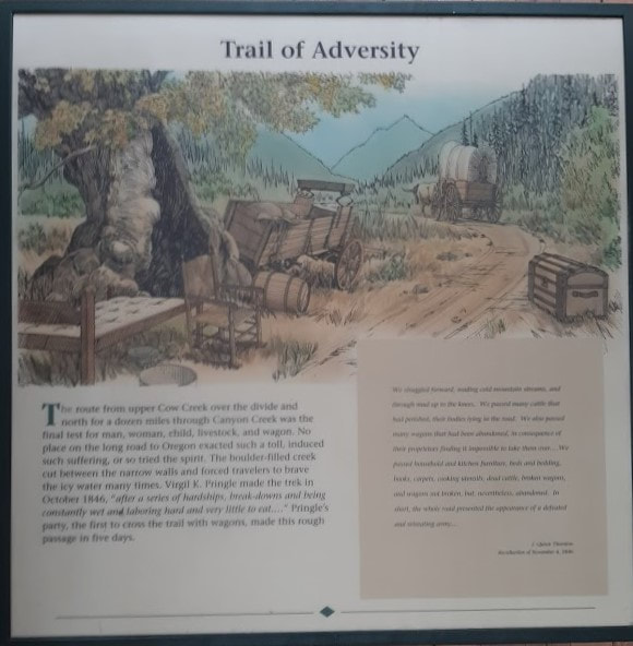
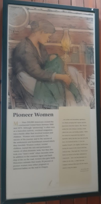
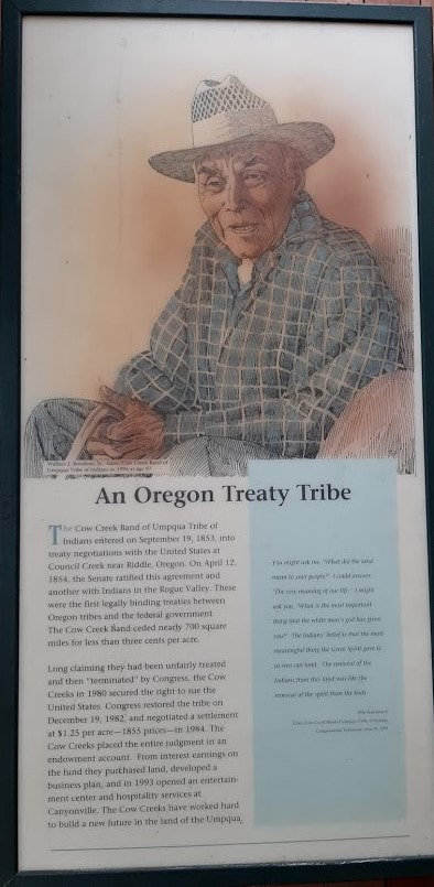
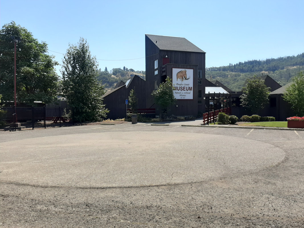
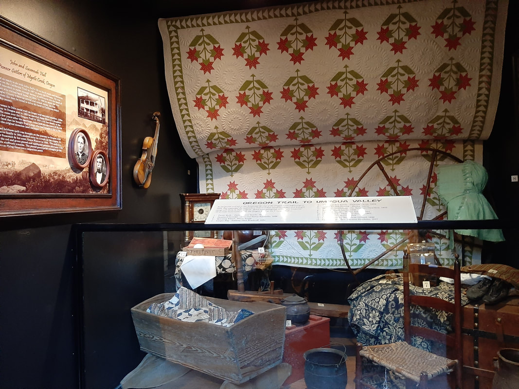
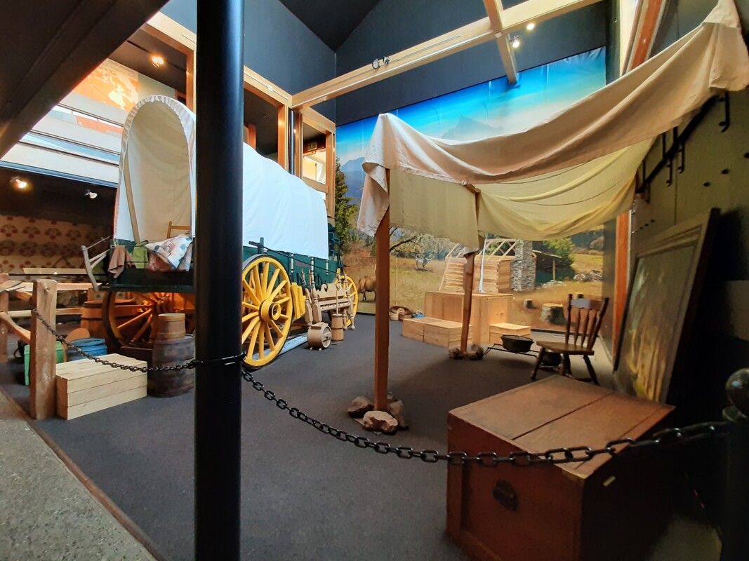
Manzanita rest area, just up the hill north of Grant’s Pass on I-5 This is such a pleasant place to stop, rest, picnic, potty, run off some energy . . . for more about this place: Applegate Trail Interpretive Center—Sunny Valley OR, 14 mi north of Grants Pass Such an intriguing place, but still closed since COVID, “until further notice.” More photos & links at Wolf Creek OR—20 mi north of Grants Pass, off I-5 I finally got to see the Oregon Trail part of this place, on an “island” in front of the Inn. I didn't see a ramp for the curb, or it was blocked, but by parking my vehicle next to the curb where the gravel path was, I could deploy my ramp onto the path. The gravel was angular, so though not easy, I was able to traverse it around the loop of interpretive signs & exhibits in my electric chair it wasn't the death of me. Will be updating link below with more pictures of this little community. Canyonville OR--42 mi north of Grants Pass, 203 mi south of Portland "As I drove south on I-5, on a sudden I saw a sign about Applegate info, and took the exit to Canyonville. A Google search and a call to the local Pioneer & Indian Museum furnished me with directions to Pioneer Park (E 5th St & Canyon Ave), where the highway department has built an attractive open structure to house excellent information about the Applegate arm of the Oregon Trail." I wrote in my post, which see for more pics and info about the park, the museum, and the community (will be updating with more about Stanton Park): More links Roseburg OR—26 mi north of Canyonville, 178 mi south of Portland on I-5 I loved the Douglas County Museum of History and Natural History! Only a part of it is dedicated to the Oregon Trail--it has lots of other great exhibits--but here I'll just focus on the Oregon Trail. For more about Roseburg:
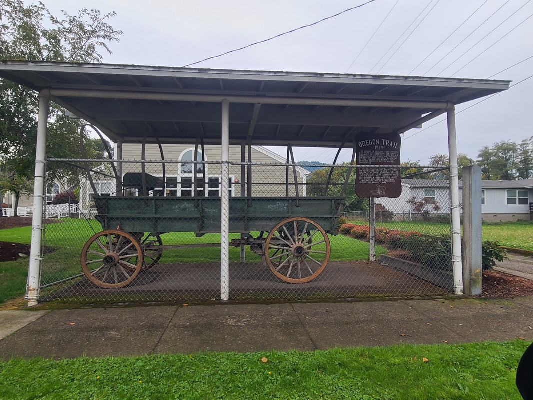
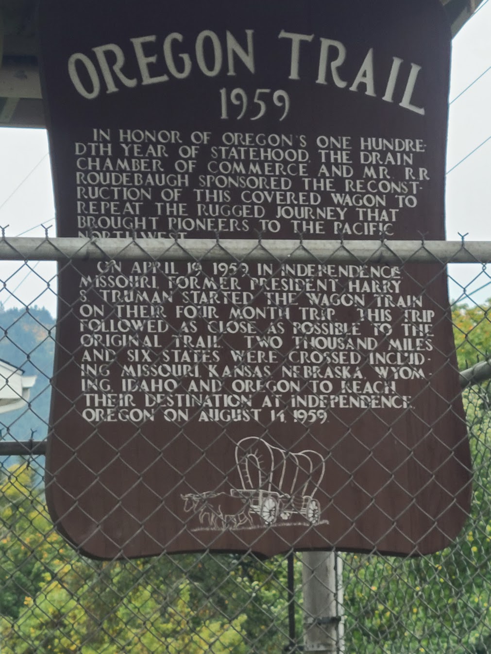
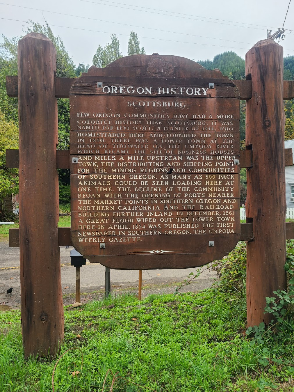
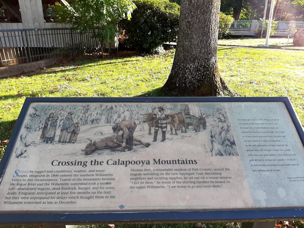
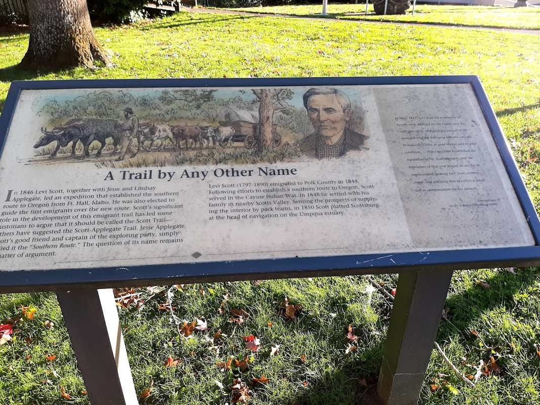
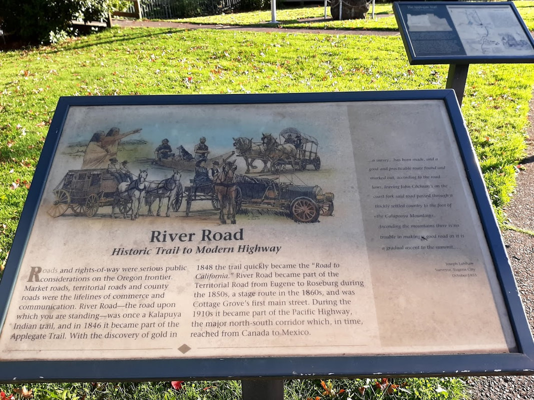
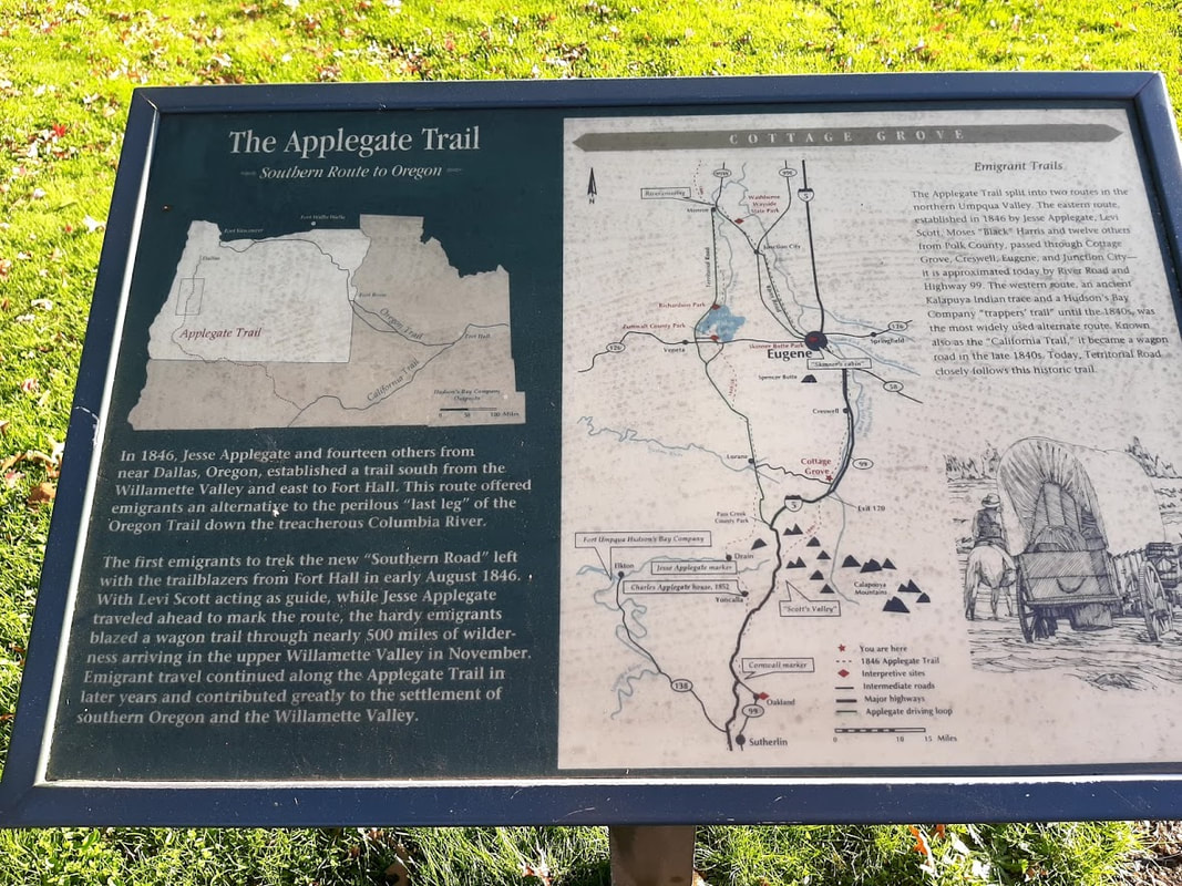
Drain (& Scottsburg) OR--a few miles west of I-5, on the Umpqua Hwy (Hwy 38) On my way back from the coast on Hwy 38 (from Reedsport) I unexpectedly came across a little history connected with the Oregon Trail, in the tiny hamlet of Scottsburg & the village of Drain. A railroad was built through Drain OR, and an overland stage route between Drain & Scottsburg. The stage route linked the RR in Drain to the paddlewheel river boats in Scottsburg (shipping things to and from the coast). The OR History sign in Scottsburg says, "Few Oregon communities have had a more colorful history than Scottsburg. It was named for Levi Scott, a pioneer of 1844, who homesteaded here and founded the town in 1850. There was a tower down at the head of tidewater on the Umpqua River which became the site of business houses and mills. A mile upstream was the upper town, the distributing and shipping point for the mining regions and communities of southern Oregon. As many as 500 pack animals could be seen loading here at one time. The decline of the community began with the opening of ports nearer the market points in southern Oregon and northern California, and the railroad building further inland. In December, 1861 a great flood wiped out the lower town. Here in April, 1854 was published the first newspaper in southern Oregon, the Umpqua Weekly Gazette.” Cottage Grove OR—51 mi north of Roseburg OR, 128 mi south of Portland on I-5 "Several times I’ve seen a sign about Applegate (one branch of the Oregon Trail) information at a Cottage Grove exit. I had a chance to take that exit on my trip to visit the Redwoods and Crescent City. Unfortunately, it was the back way in, and 6 miles from the city itself. I suggest taking exit 174 straight on to Gateway Blvd and follow it until it meets Main St, then turn right onto Main Street. The Veterans Park has the interpretive signs about the Applegate (Oregon) Trail. It’s on W Main St and River Road." I wrote in my post. More about Cottage Grove at the links below.
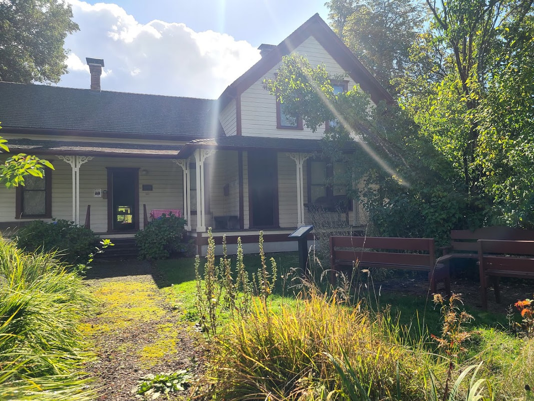
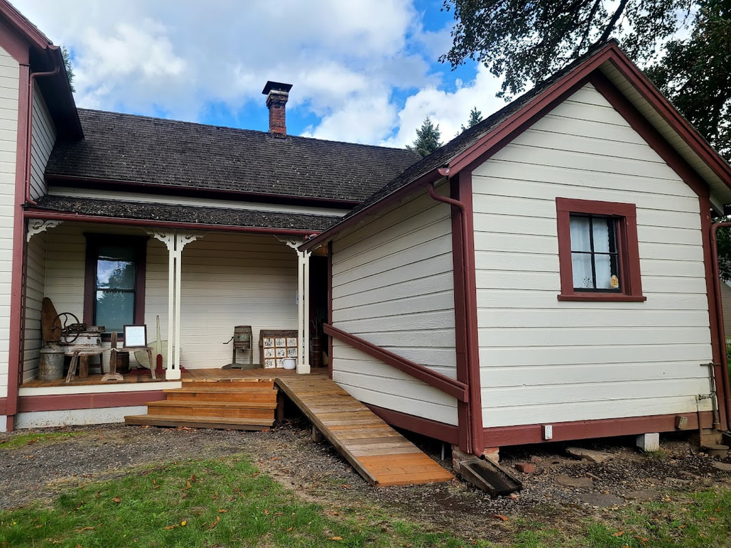
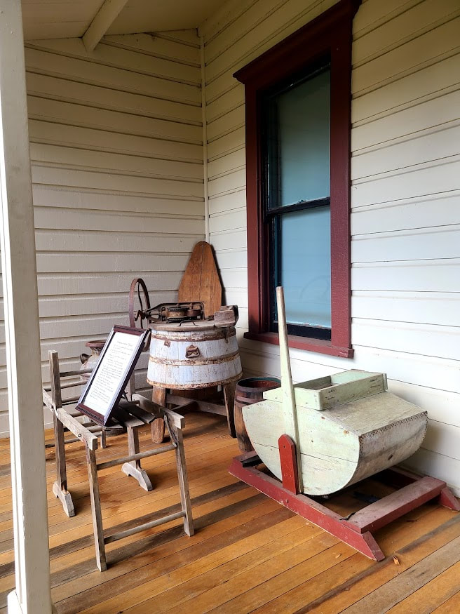
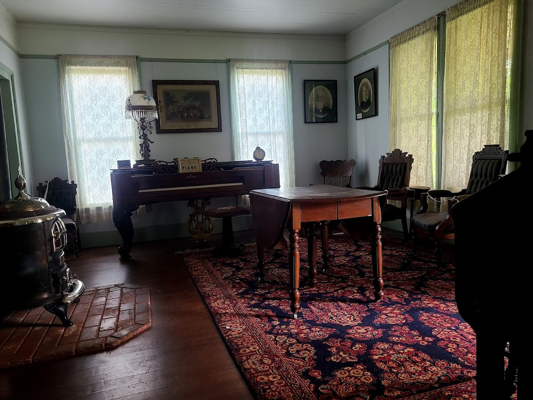
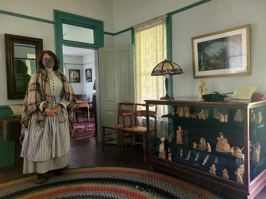
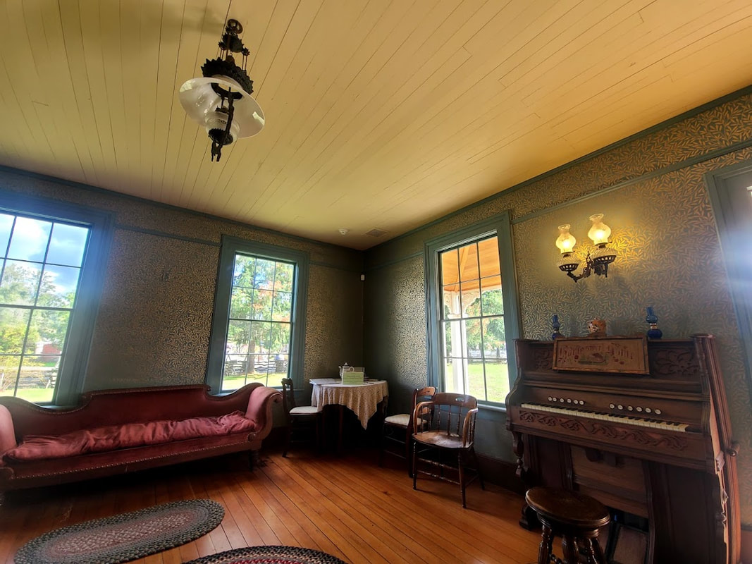
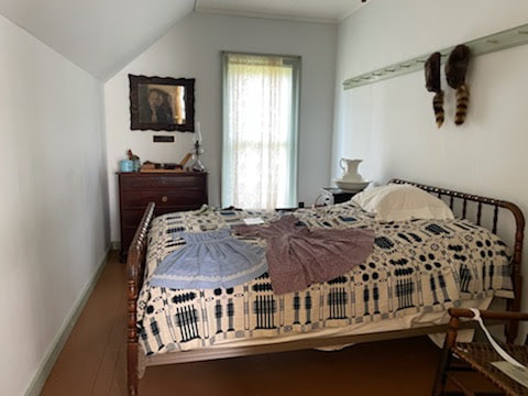
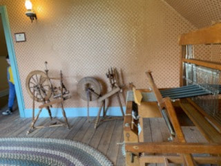
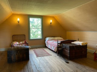
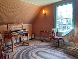
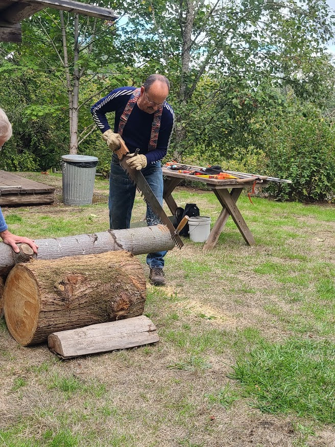
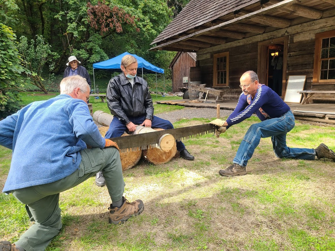
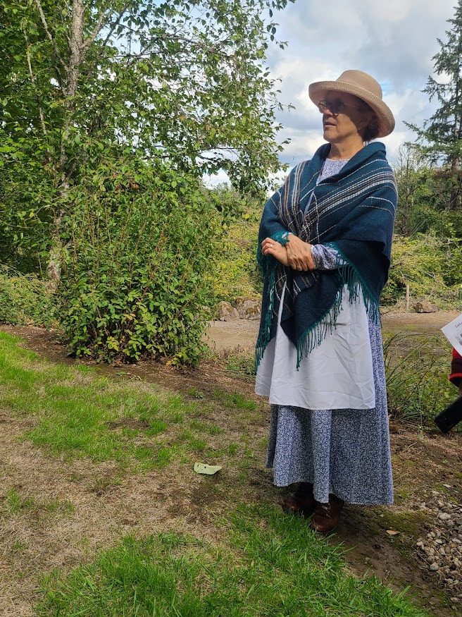
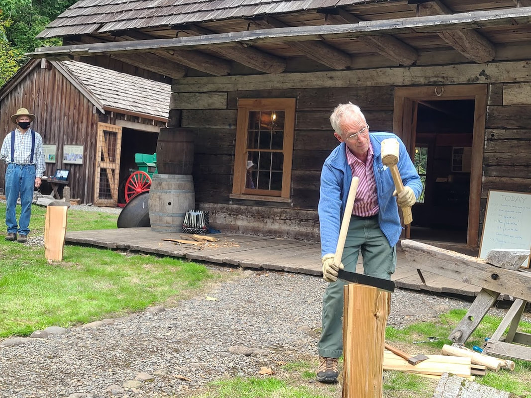
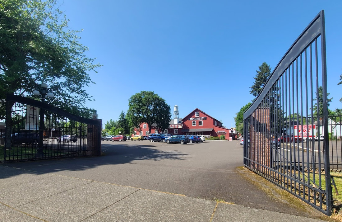
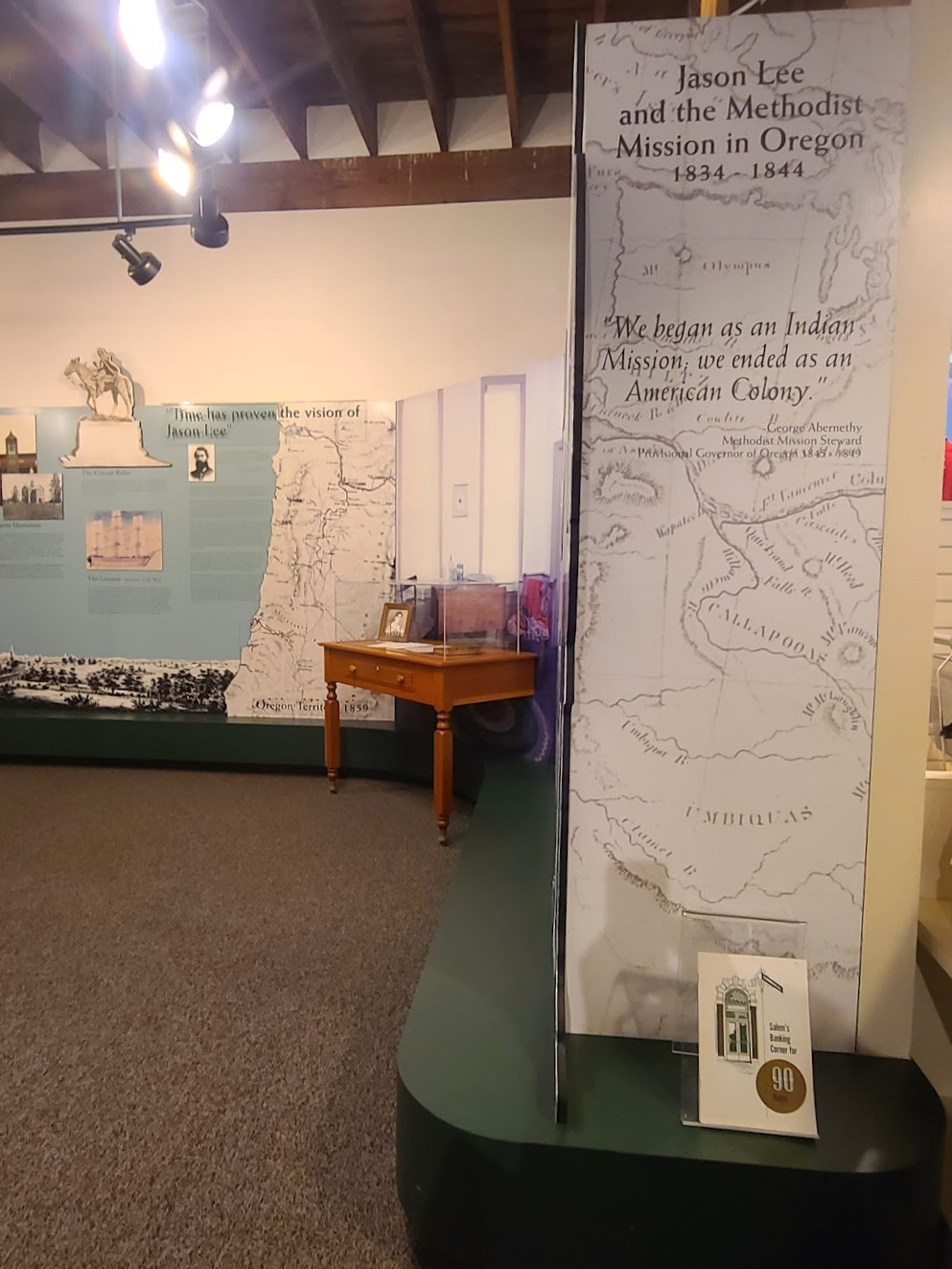
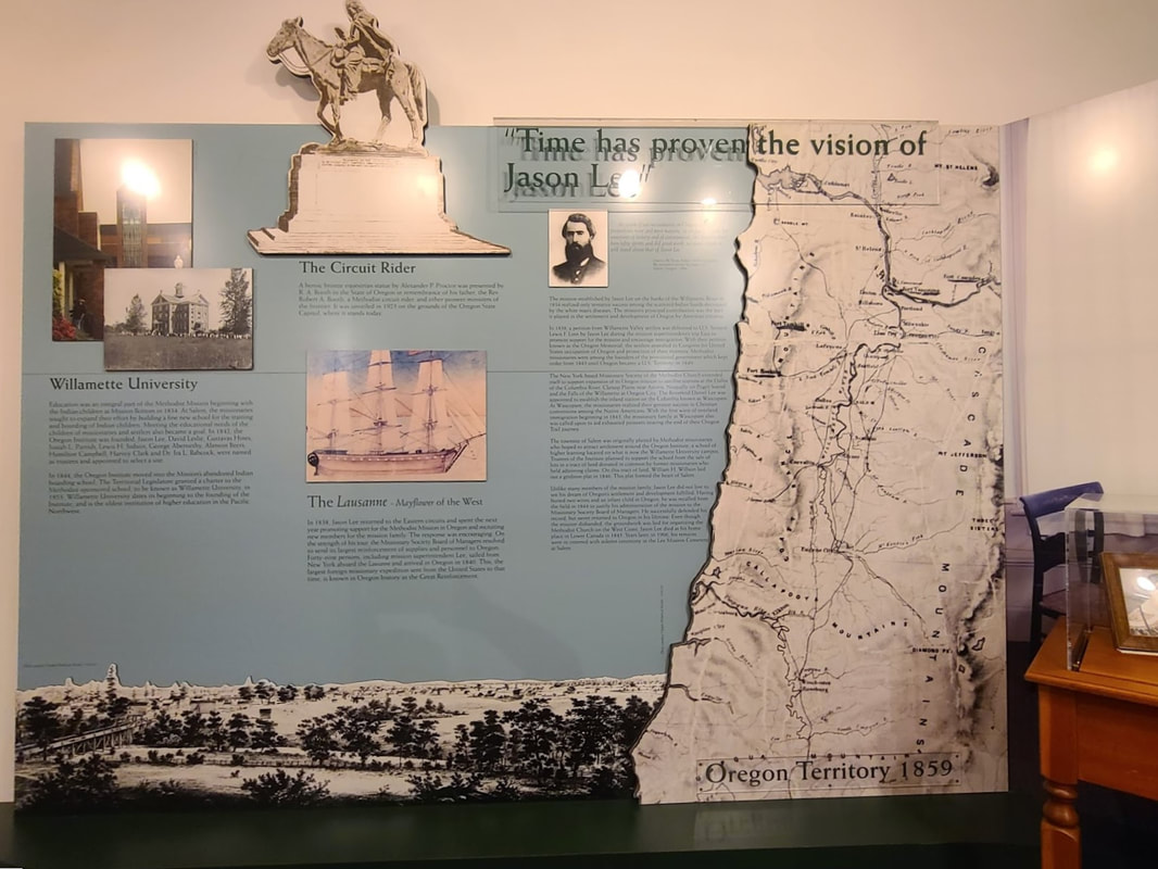
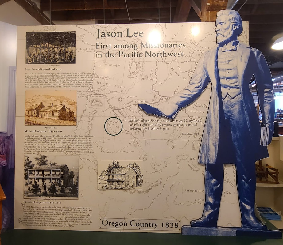
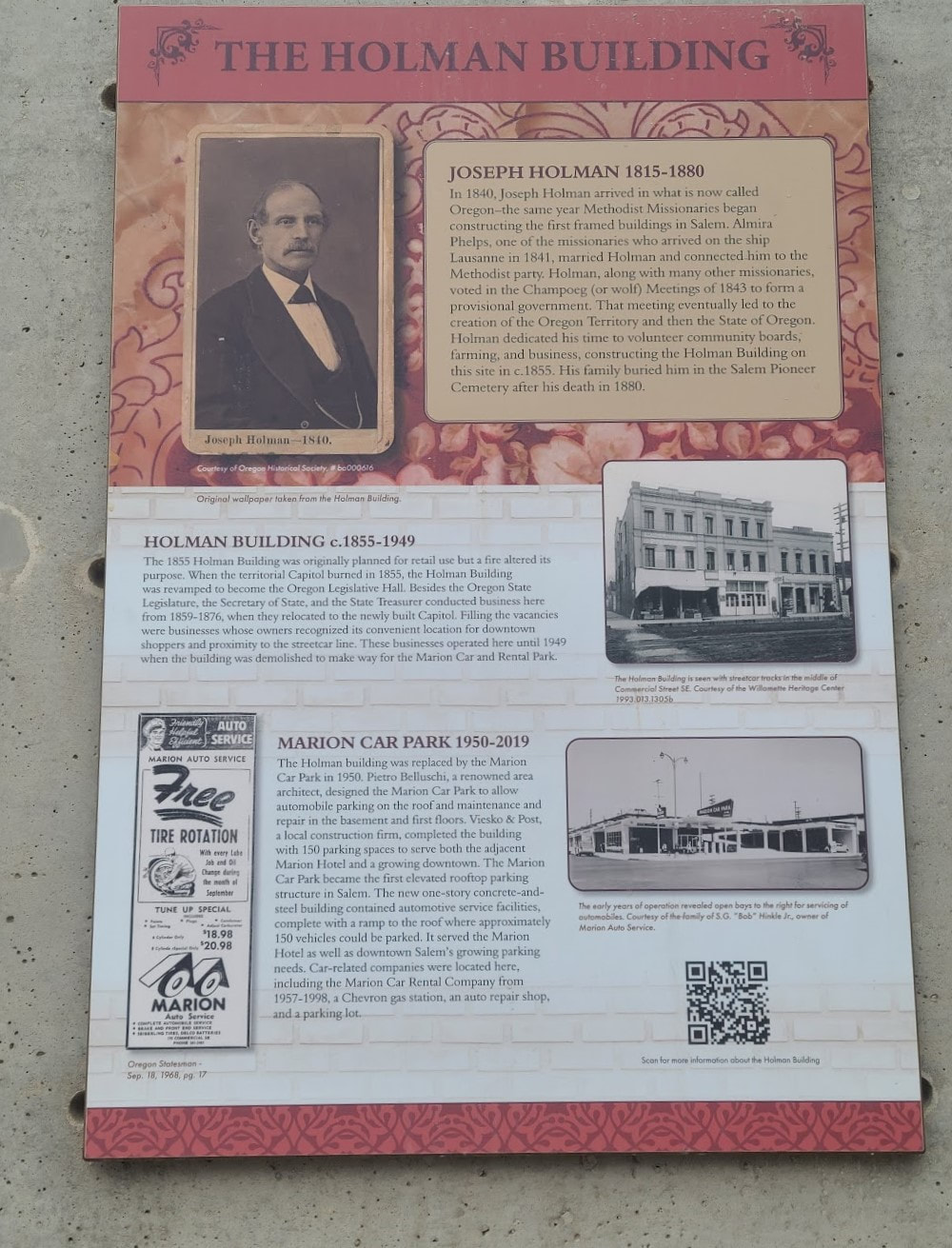
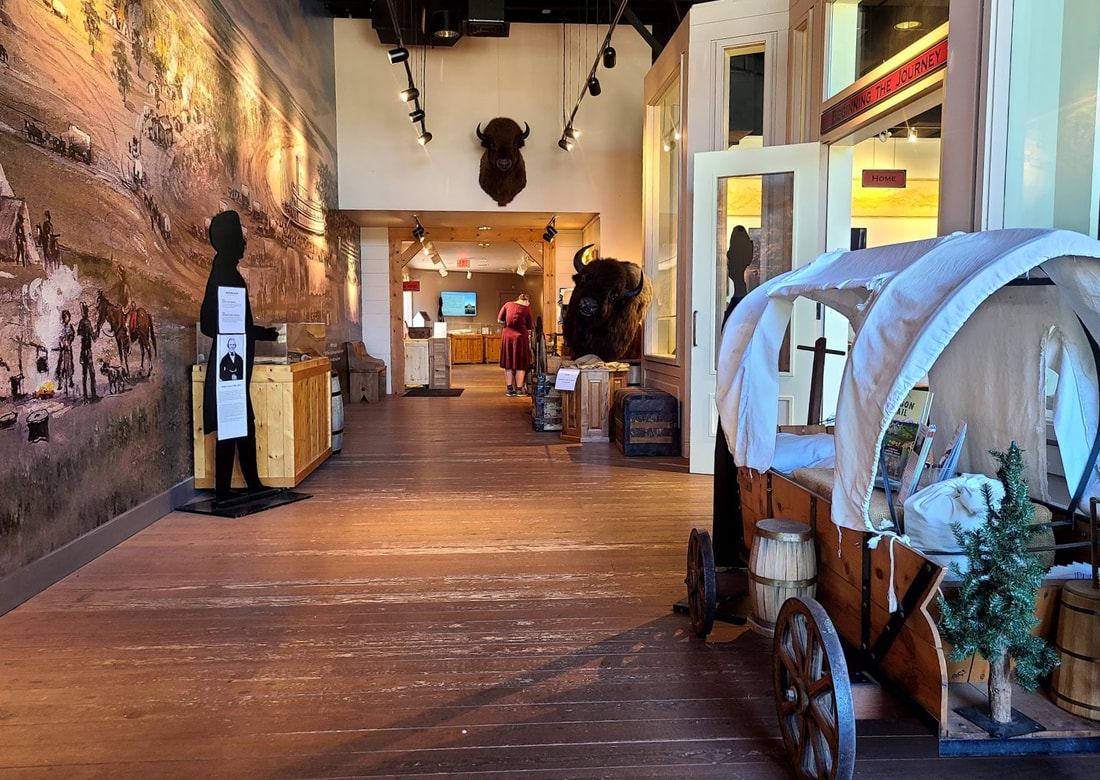
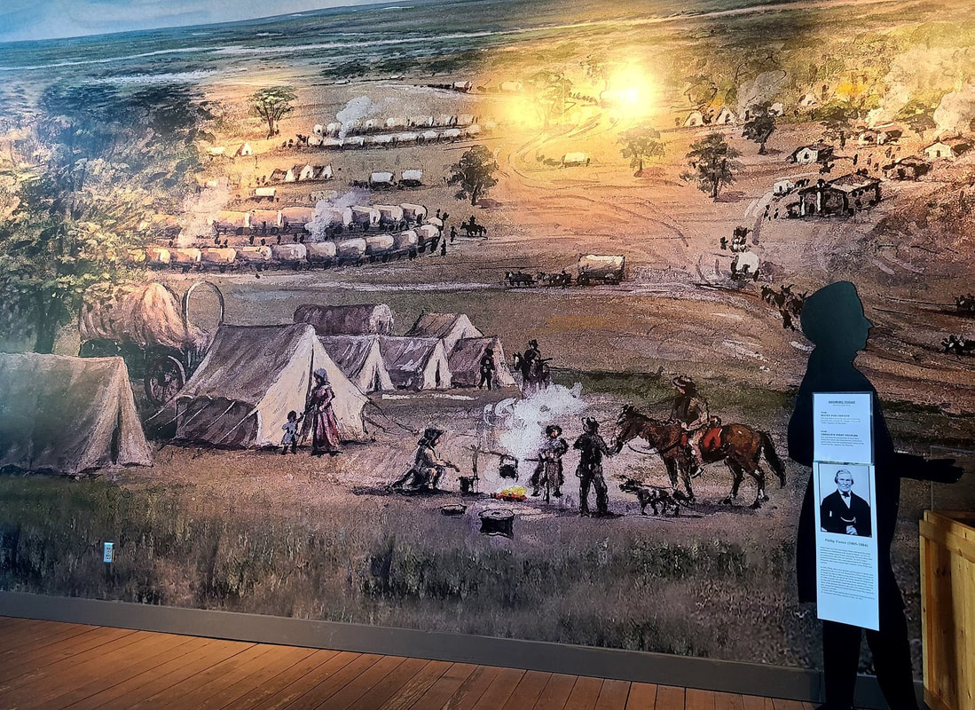
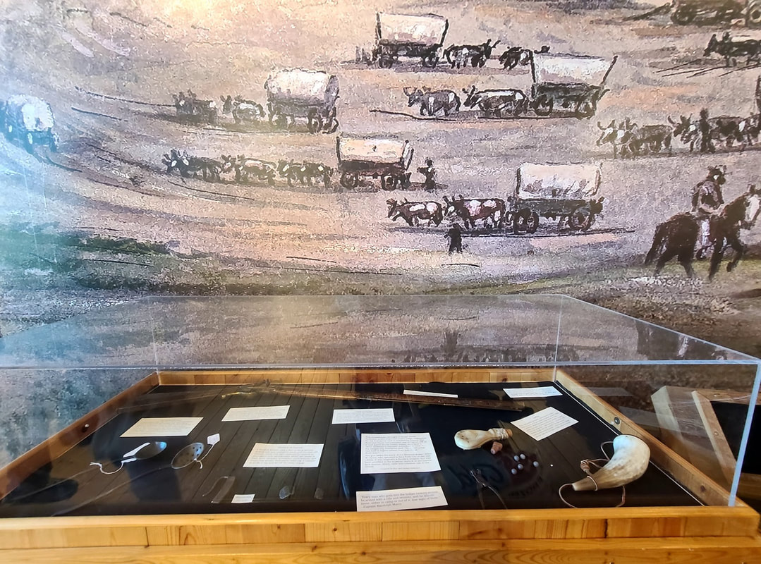
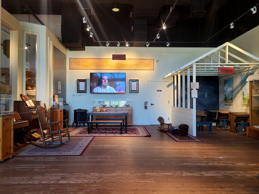
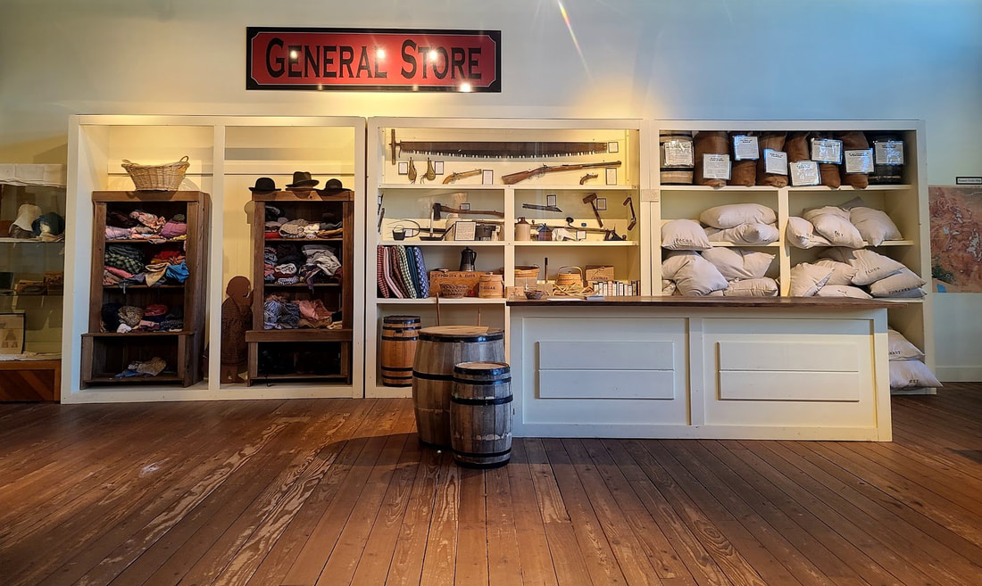
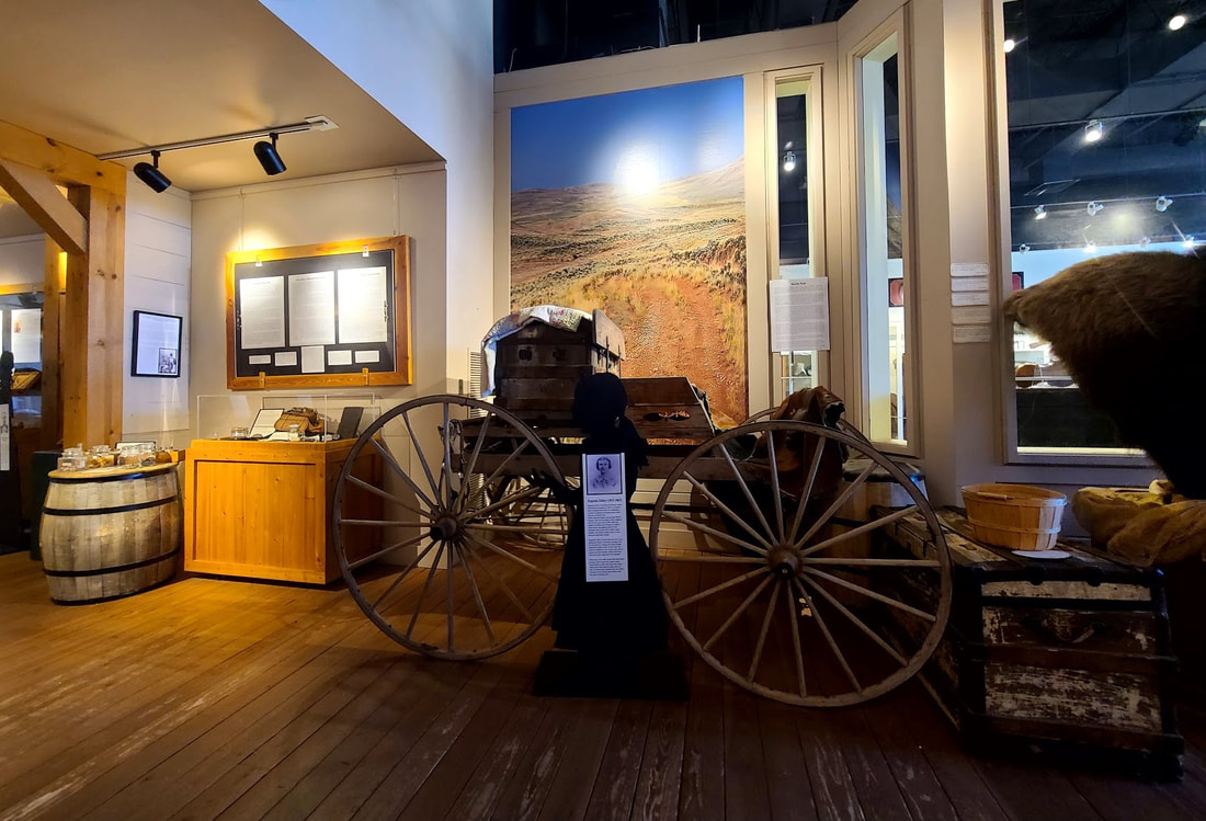
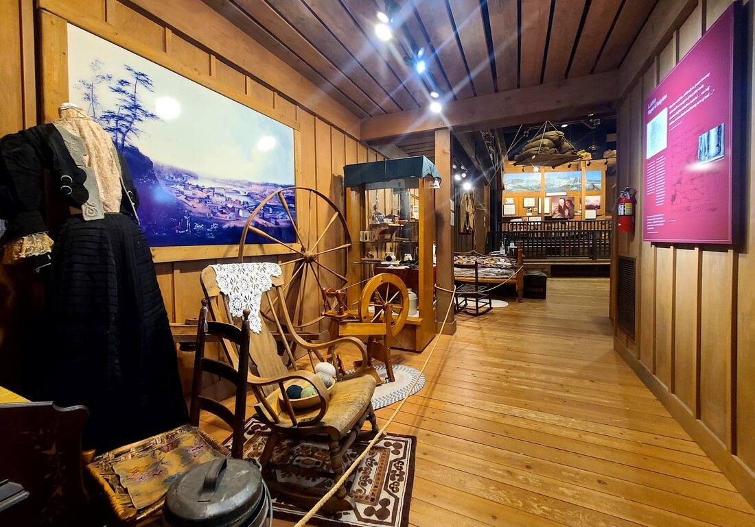
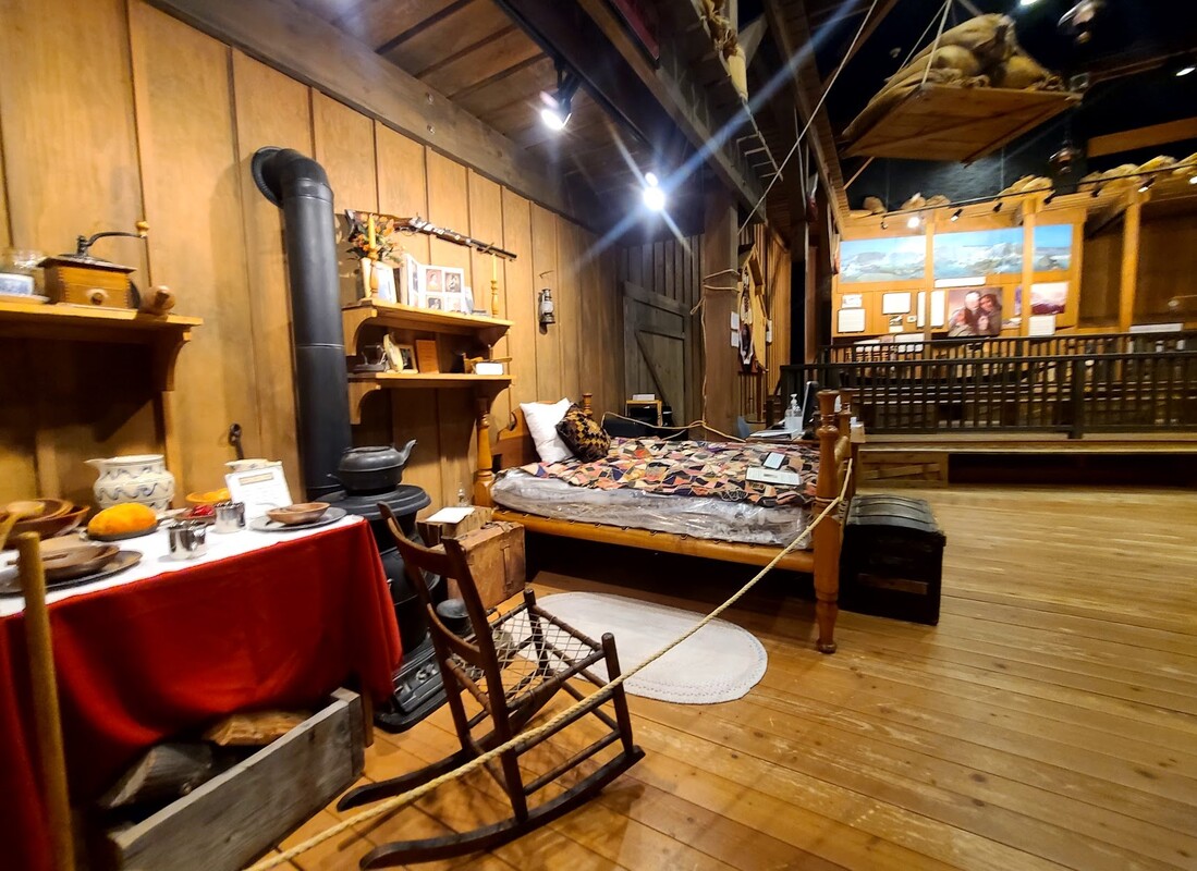
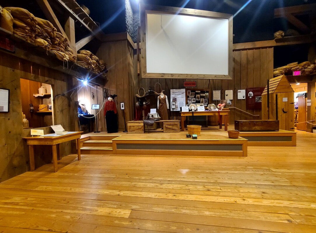
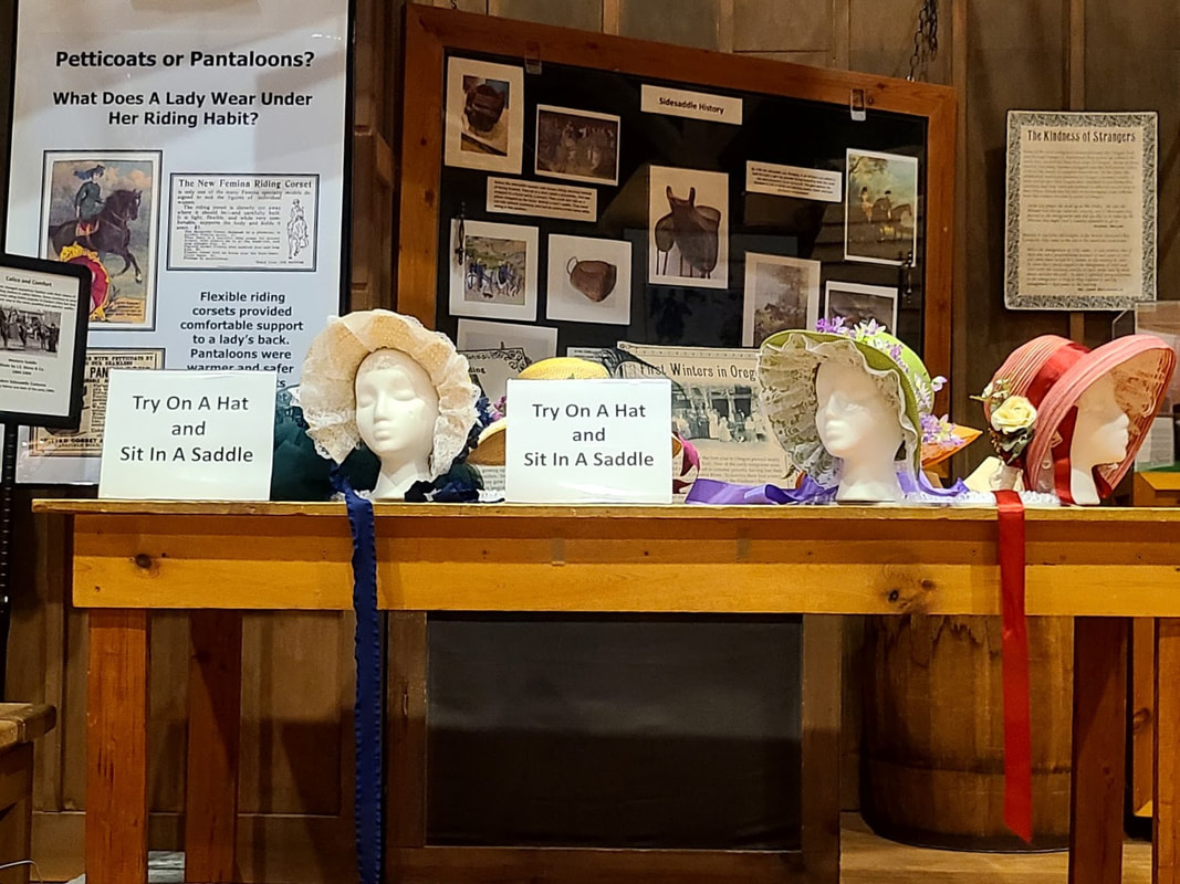
 The Oregon Trail painting at Irving Grange, Eugene OR Brownsville OR—between Albany & Eugene; 81 mi south of Portland, 24 mi north of Eugene Having passed the signs about the Pioneer Museum in Brownsville many times, it finally occurred to me that it might have something about the Oregon Trail, beside later local lore. Oh yes, it does! It is crammed with all kinds of interesting history, but I'll try to mostly include things having to do with the Oregon Trail here, and count on including more about the quaint, historic town of Brownsville in a future post.
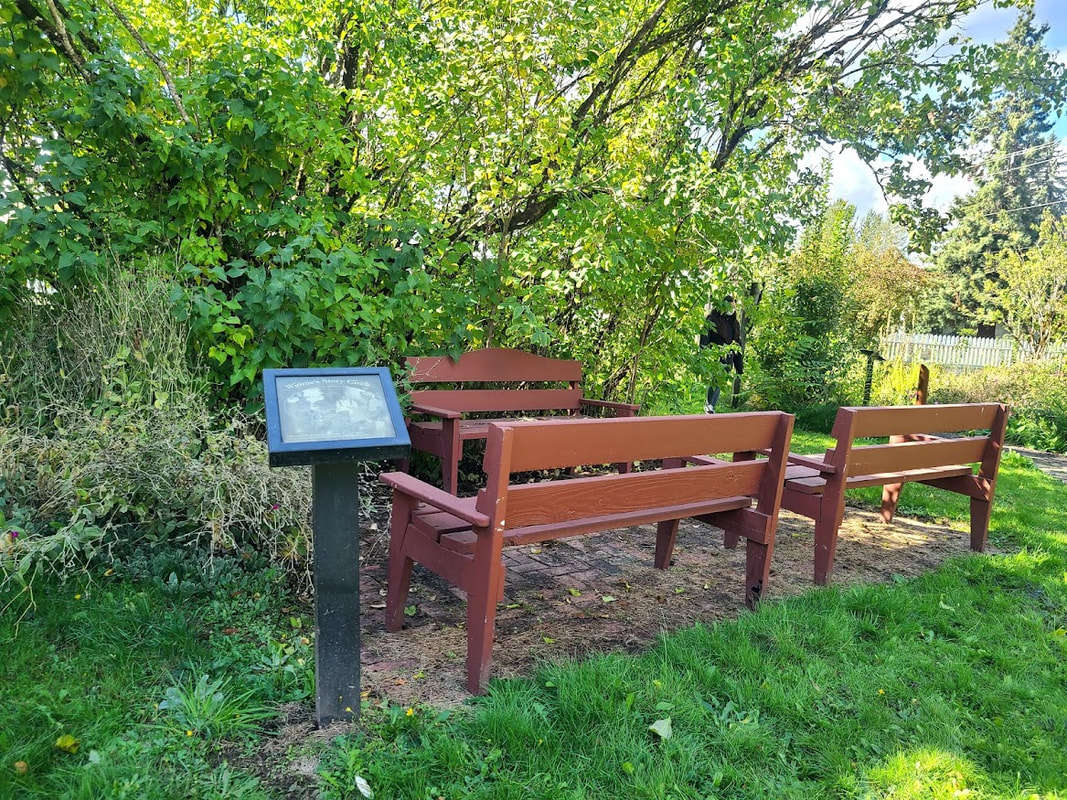
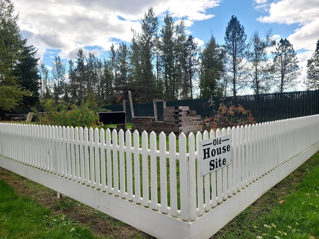
Pioneer Villa Truck/Travel Plaza—33180 Hwy 228, Halsey OR; exit 216 east off I-5 Brownsville is 4 mi east of I-5, the sign says, but just off the freeway is Pioneer Villa travel complex, with restaurant, accommodations, gas, EV charging, and vehicle repair. Coming into Brownsville OR from the west, 4 mi off I-5 Historic Downtown Brownsville OR--easy and fun to stroll or roll around  Historic Brownsville OR across the Calapooia River Linn County Historical Museum, aka Brownsville Historic Pioneer Museum--101 Park Ave, Brownsville, OR 97327 I parked at the little park just east of the main museum (housed in the old Depot building and train cars. It has a Civil War memorial and an interpretive sign about the local mills; the building behind is the behind of the Public Library.
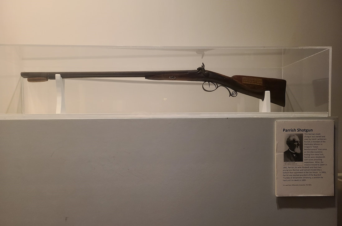
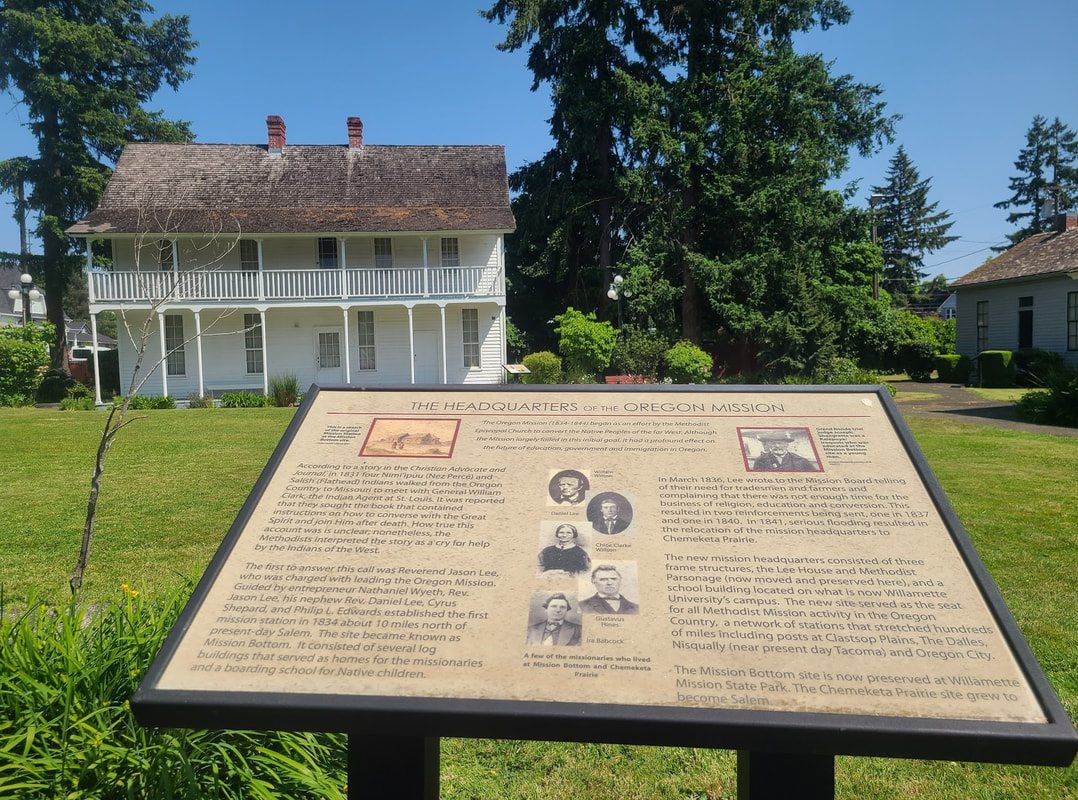
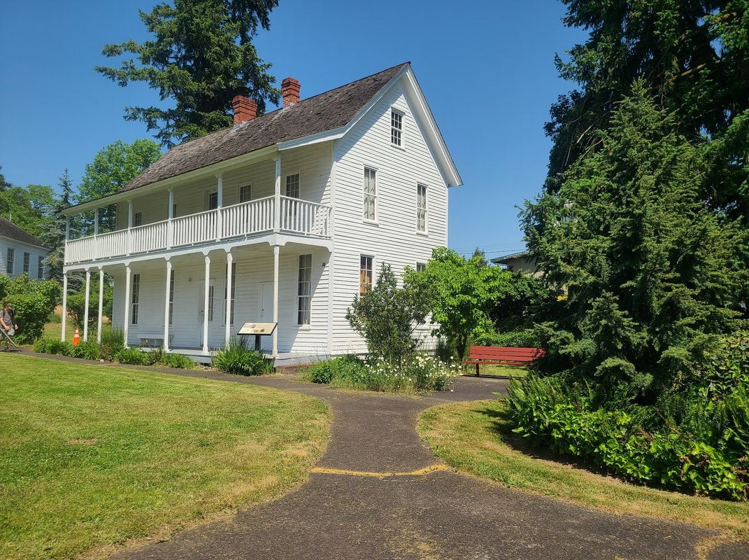
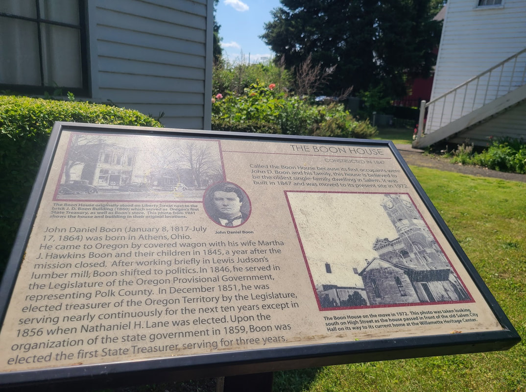
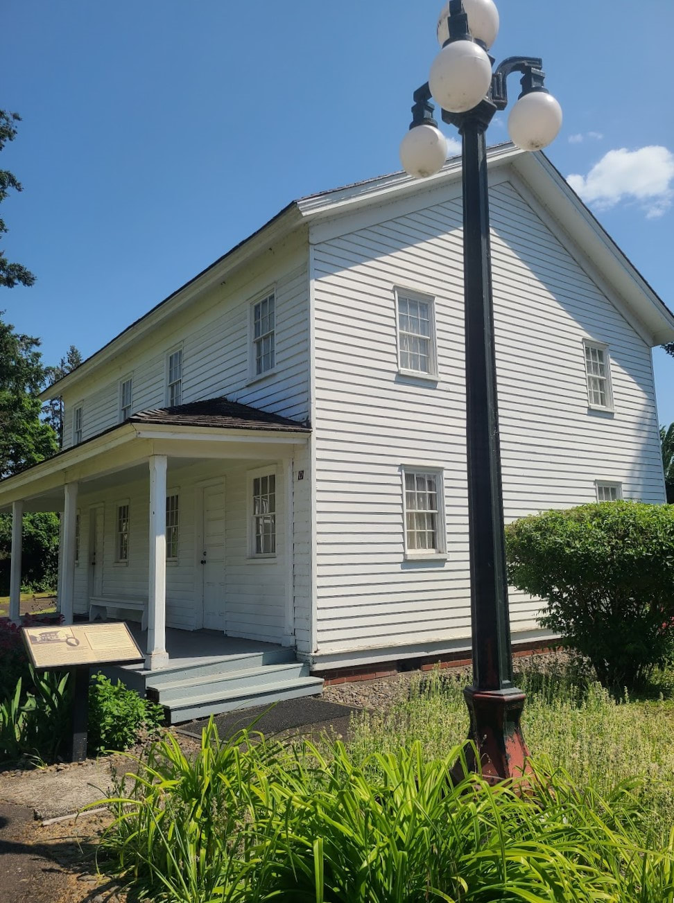
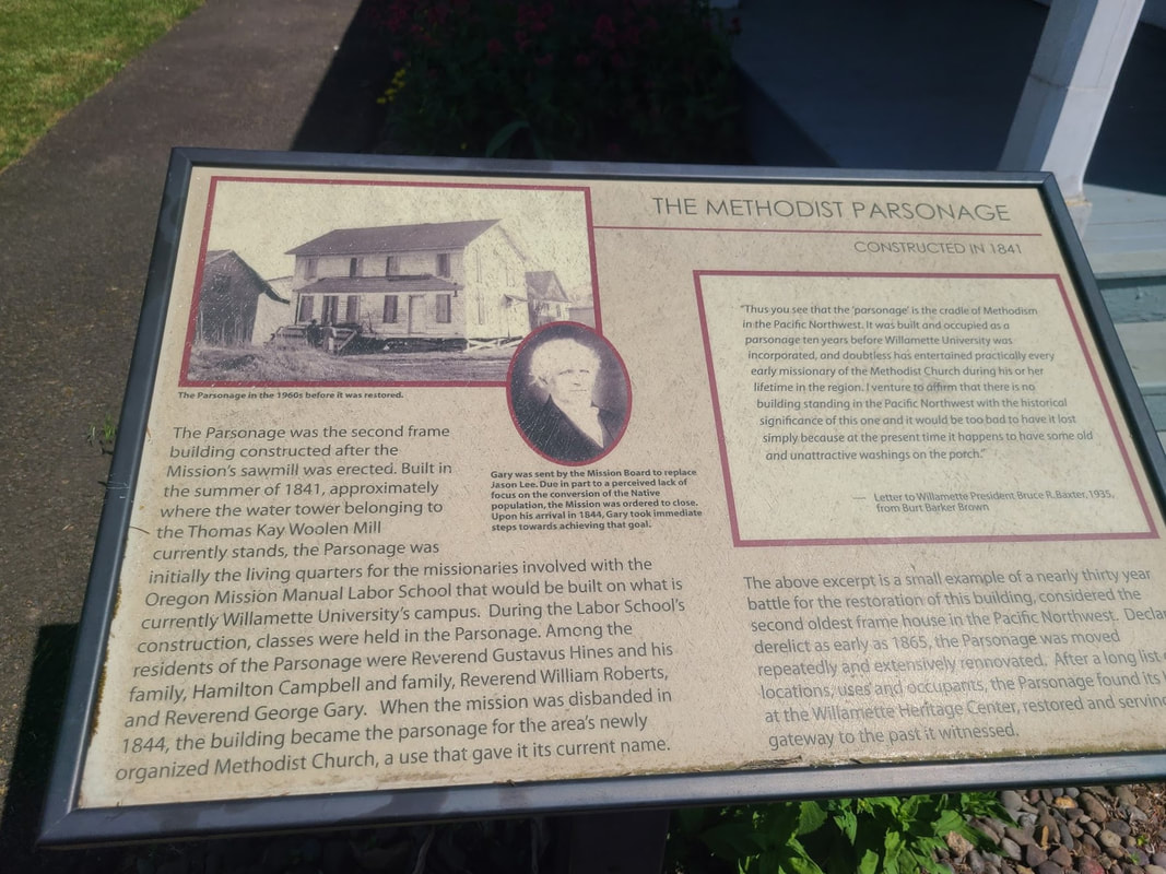
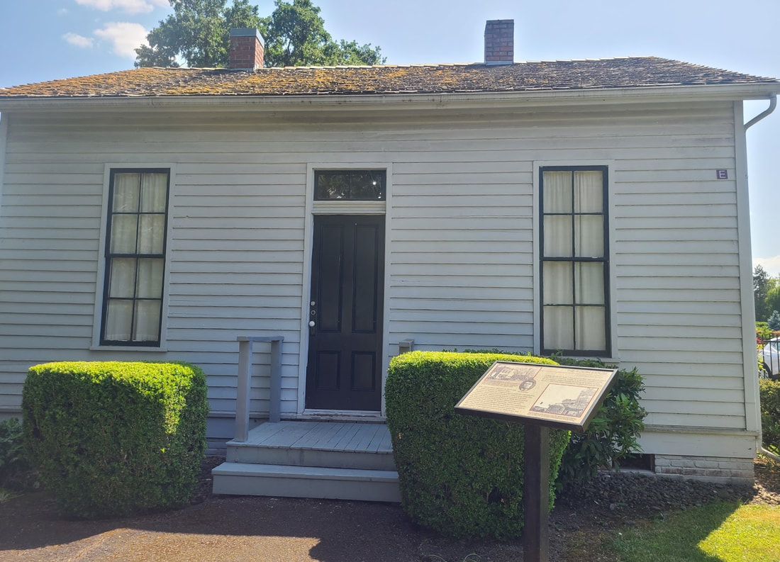
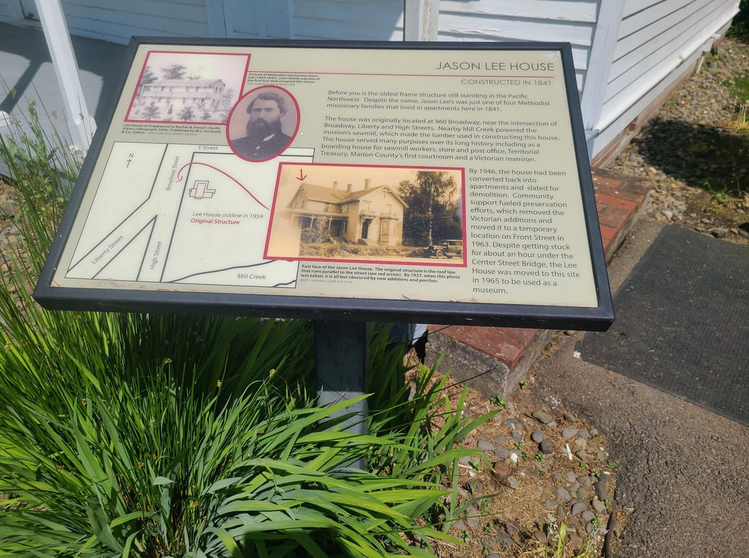
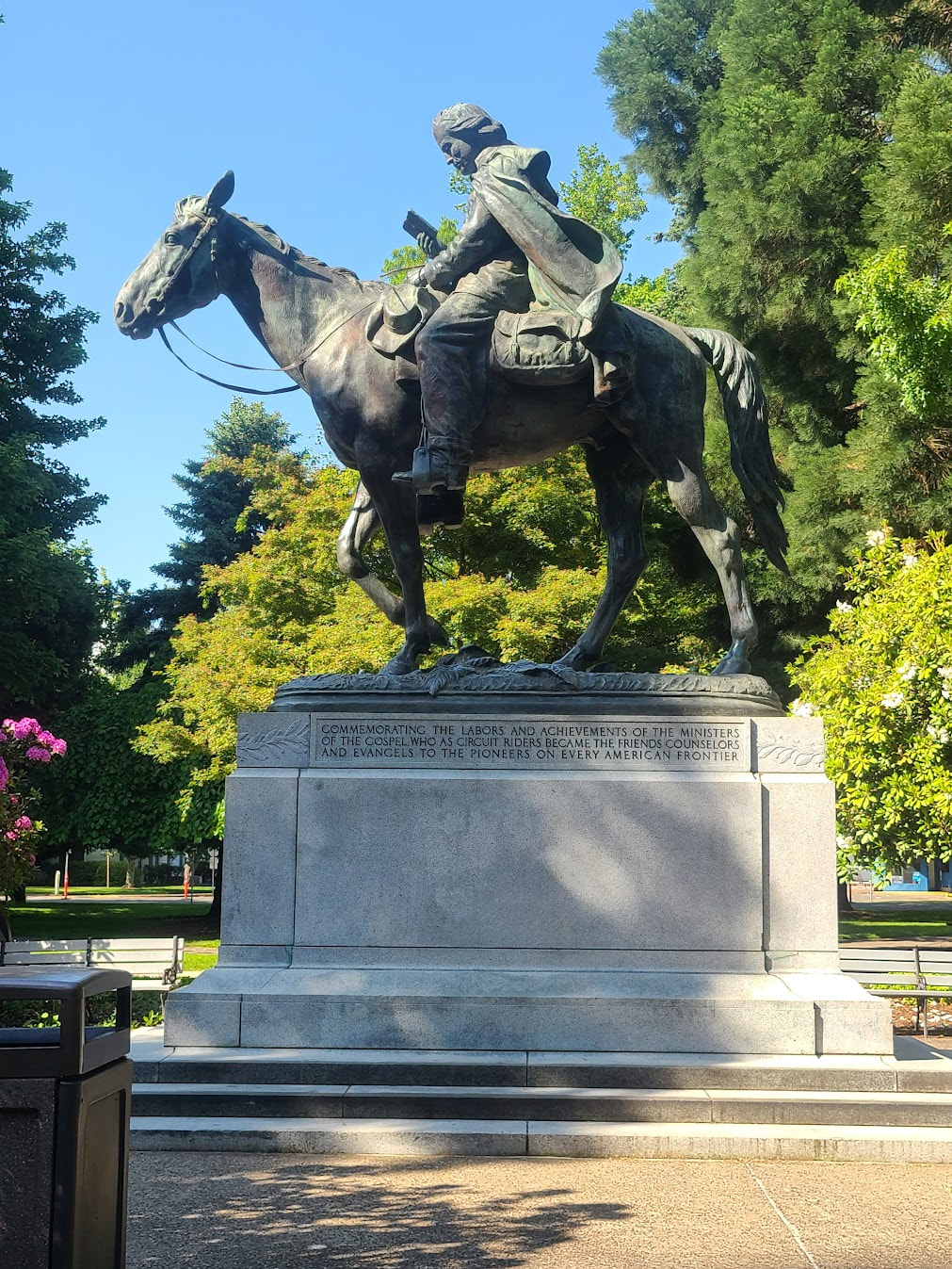
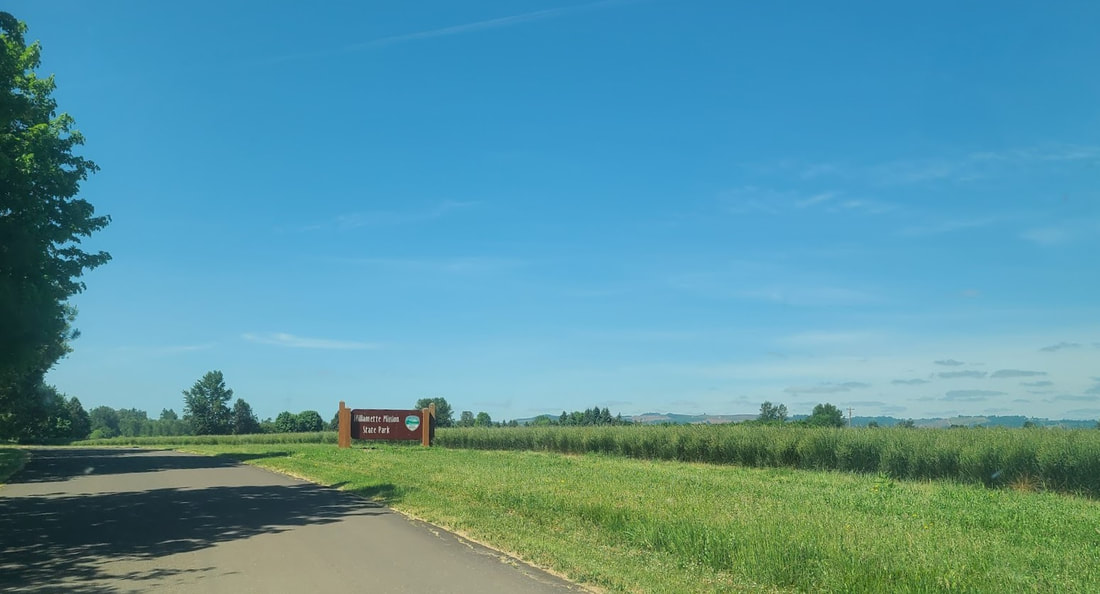
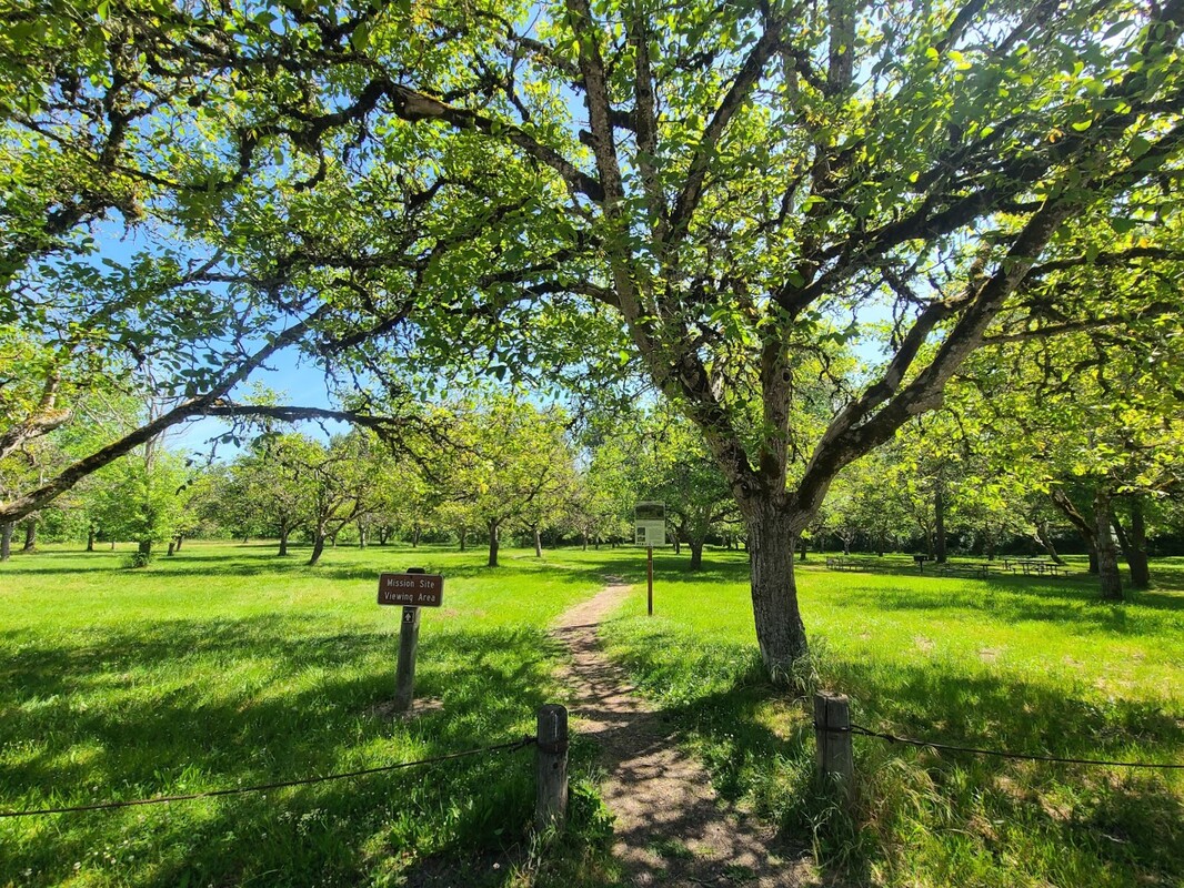
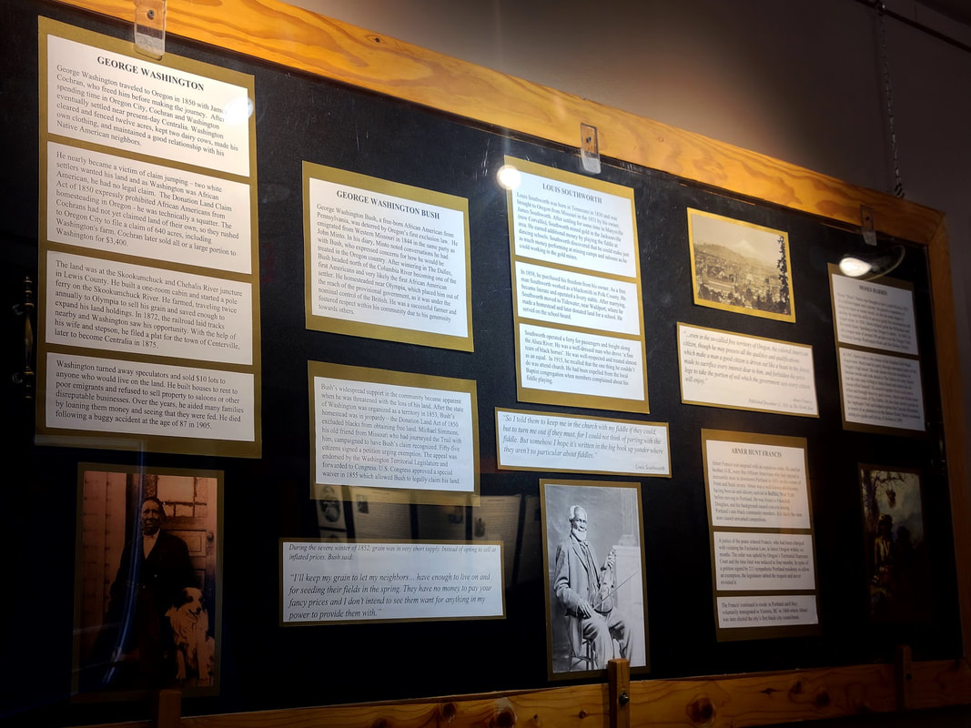
An extremely interesting historic interview of a local woman: “I was afraid to accept my liberty.” Amanda Gardner Johnson interviewed 1921 by The Oregon Daily Journal “I was born at Liberty, Clay County, Missouri, August 30, 1833. My father and mother were born at Louisville, Kentucky. No sir, I was never sold nor bartered for. I was given as a wedding present to my owner’s daughter. I belonged to Mrs. Nancy White[?]. She was married, after her husband’s death to Mr. Corum. I have known seven generations of the family. I knew (my) owner, Mrs. Corum, and her father. Mrs. Corum gave me to her daughter, Miss Lydia, when she married Anderson Deckard. My new owner was the third generation and I helped rear her children and grandchildren. That is five generations, and yesterday I held a baby in my arms that is the grandson of one of these grandchildren, so that makes seven generations I have known. I had five brothers and six sisters. Noene of them was solde like common Negroes. They were all given as wedding presents to relatives of the family when the houng folks got married. The thought of being ‘sold down South’ was always a cloud that shadowed the happiness of slaves. A man would drink and lose his money or he would be unlucky at cards and would have to sell some of his slaves. I have often attended auctions of slaves when I was a girl, back in Missouir. They are very much like auctions of any other stock, except that men that were buying the Negroes would ask them questions to see what they had done and were best fitted for. The would feel their muscles and look them over to see that they were sounde. Usually the slaves sold for $500 to $1500, depending on age and conditions. A strong young field hand would bring $1000 to $1200, while a handsome young Negro woman would often sell for $1200 to $1500 if she attracted the liking of some white man. Usually house servants commanded a better price than field hands. In 1853 my owners decided to come to Oregon. A merchant hearing that my master was to go to Oregon Territory where slaves could not be held, came to Mr. Deckard and said, ‘I will give you $1200 for Amanda. You can’t own her where you are going, so you might as well get what you can out of her.” I had been given to Miss Lydia, his wife, when I was seven, and I was 19 then. Mr. Deckard said, ‘Amanda isn’t for sale. She is going across the plains to the Willamette Valley with us. She has had the care of our four children. My wife and the children like her. In fact, she is the same as one of our family, so I guess I won’t sell her.’ Mr. Deckard asked me if I wanted to be given my freedom and stay where I had been raised, and where all my epole lived, but I was afraid to accept my liberty, much as I would have liked to stay there. The word of a Negro, even if a free Negro, was of no value in court. Any bad white man could claim that I had been stolen from him and could swear me into jail. Then, in place of keeping me in jail, he could buy my services for the time I was sentenced for, and by the time I had served my time for him he could bring up some other false charge and buy my services again, and do whatever he wanted to me, for Negroes were the same as cows and horses and were not supposed to have morals or souls. I was afraid to accept my liberty, so I came to Oregon with my owners. It took us six months, to a day, to travel by ox team from Liberty, Missouri, to Oregon City. We started from Clay County, March 13, 1853, and got to our destination Sept 13. When I think back nearly 70 years to our trip across the plains I can see herds of shaggy-shouldered buffaloes, slender-legged antelopes, Indians, sagebrush, graves by the roadside, dust and high water and the campfire of buffalo chips over which I cooked the meals. Lou Southworth, also a slave, crossed the same year I did. So did Benjamin Johnson, another slave, who later became my husband . . . We camped at Oregon City until October, while Mr. Deckard went on horseback down through Linn County looking for a donation land claim. He took one between Albany and Peoria. In those days, when the boats ran down the river, Peopria looked as if it would be a good-sized town. I went to work for a man named James Foster. He was a merchant, but later started the Magnolia Mills and made flour. When I left Missouri you could buy eggs for three to five cents a dozen, bacon at five to six cents a pound, butter at twelve to fifteen cents a pound, and corn for twenty cents a bushel, and you could hire men for fifty to seventy-five cents a day, so when I was paid $3.50 a week I decided I had come to the land of promise, a land that was flowing with milk and honey. On April 12, 1870, a little over 50 years ago, I married Ben Johnson. The Reverend T.J. Wilson, who now lives at Eugene, performed the ceremony. I was married at Mr. Foster’s house and they gave me a fine wedding. Yes, I never get over the feeling that my first duty is to my family. Whenever any of the Deckards are sick I always go to nurse them and take care of them, for you see, they are my people, and the only I’ve got. I am 88 years old, but I am strong and well. Most of our family have done themselves proud. No, I don’t suppose there are many other colored people in Oregon who have been slaves, but I have been free since I was 20, and that’s nearly 70 years ago.” The Moyer House--204 N Main St, Brownsville, OR 97327 Although this home is from a more settled, genteel era than the mid-1800 pioneers, it was built by those Oregon Trail pioneers. It's so fascinating, but I'll try to limit the photos here, and publish more in a future post. Salem OR--Oregon's state capital; about an hour south of Portland by freeway, depending on the traffic Early missionaries/settlers in the Willamette Valley came before the Oregon Trail was entirely "finished"; some got there by ship. I'm supposing it was from good reports of the Willamette Valley that it then became the major impetus for the Oregon Trail, at least before gold was discovered in California. For more about Salem & the wondrous Willamette Heritage Center campus, scroll down at the third link below. Willlamette Mission State Park—8 mi north of Salem OR
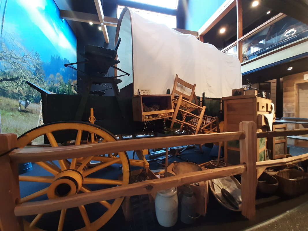
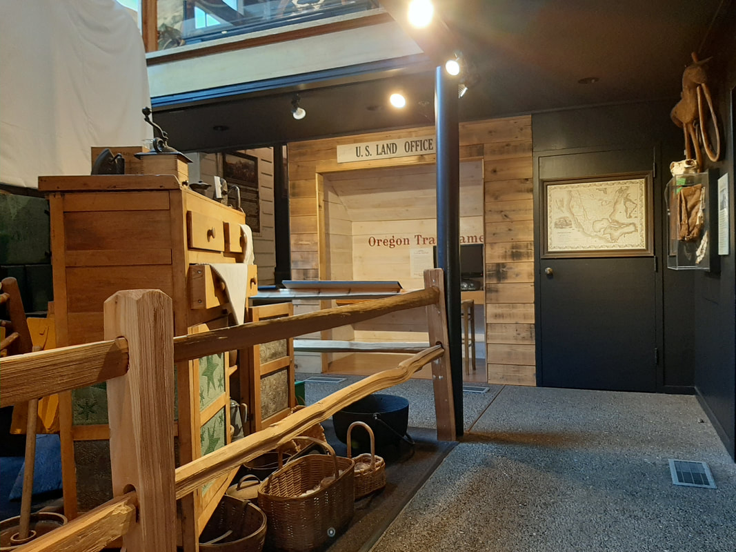
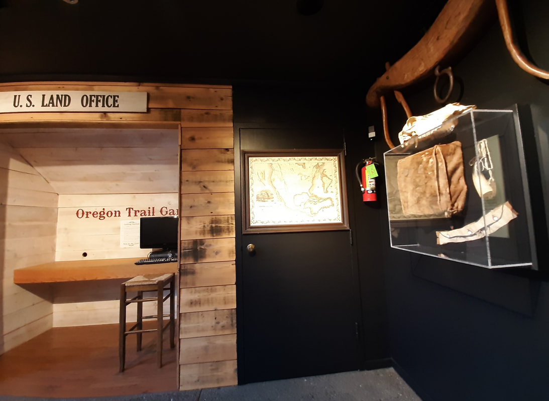
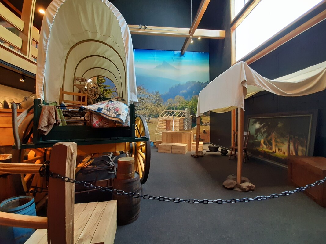
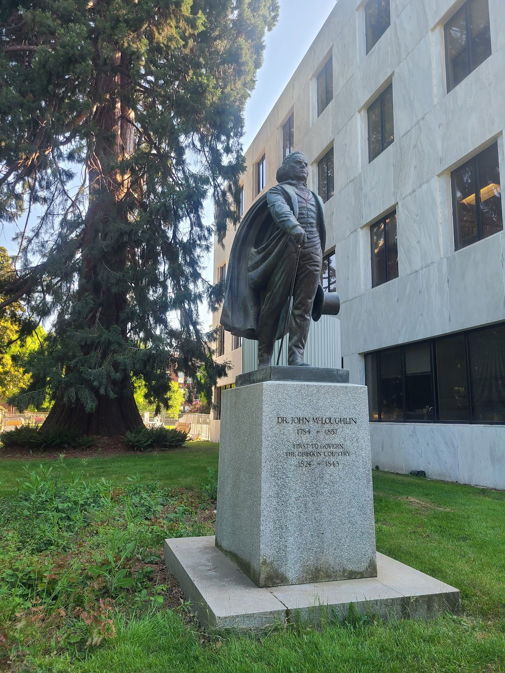
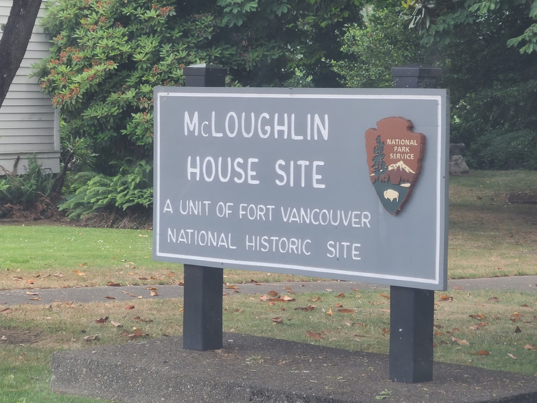
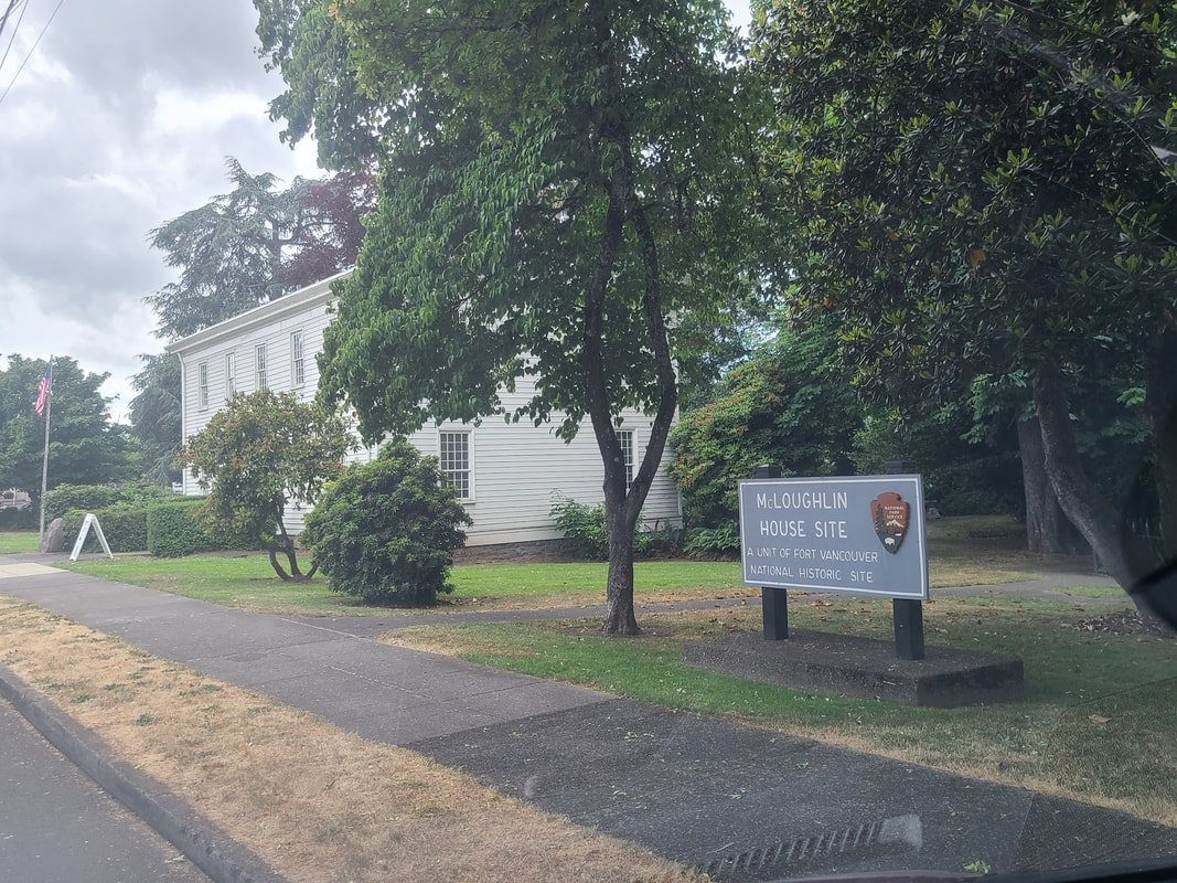
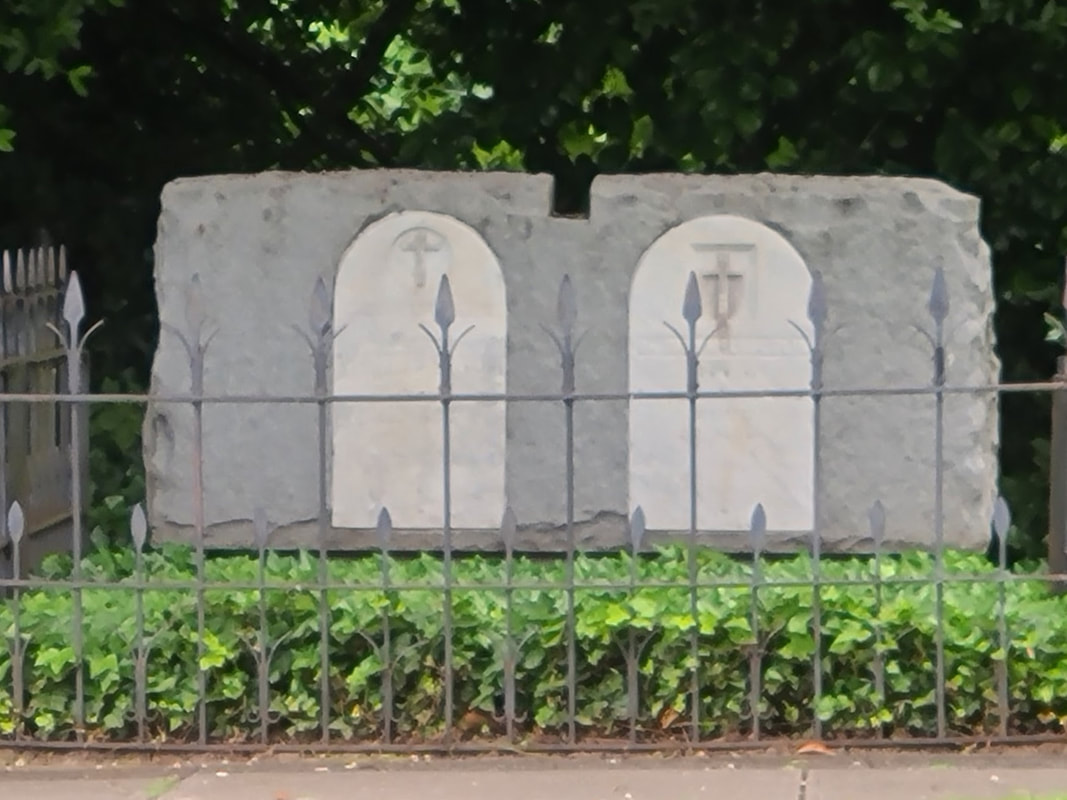
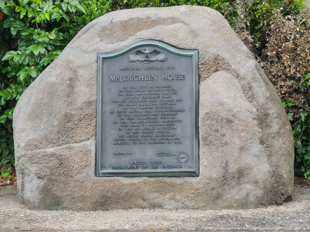
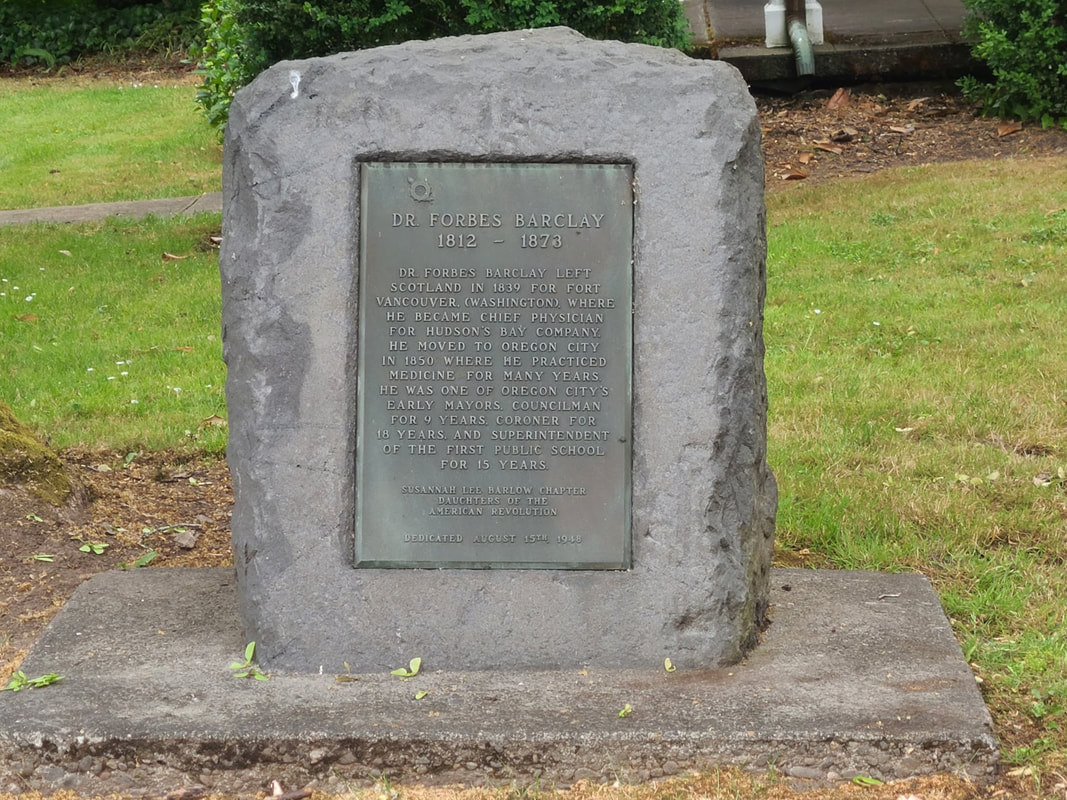
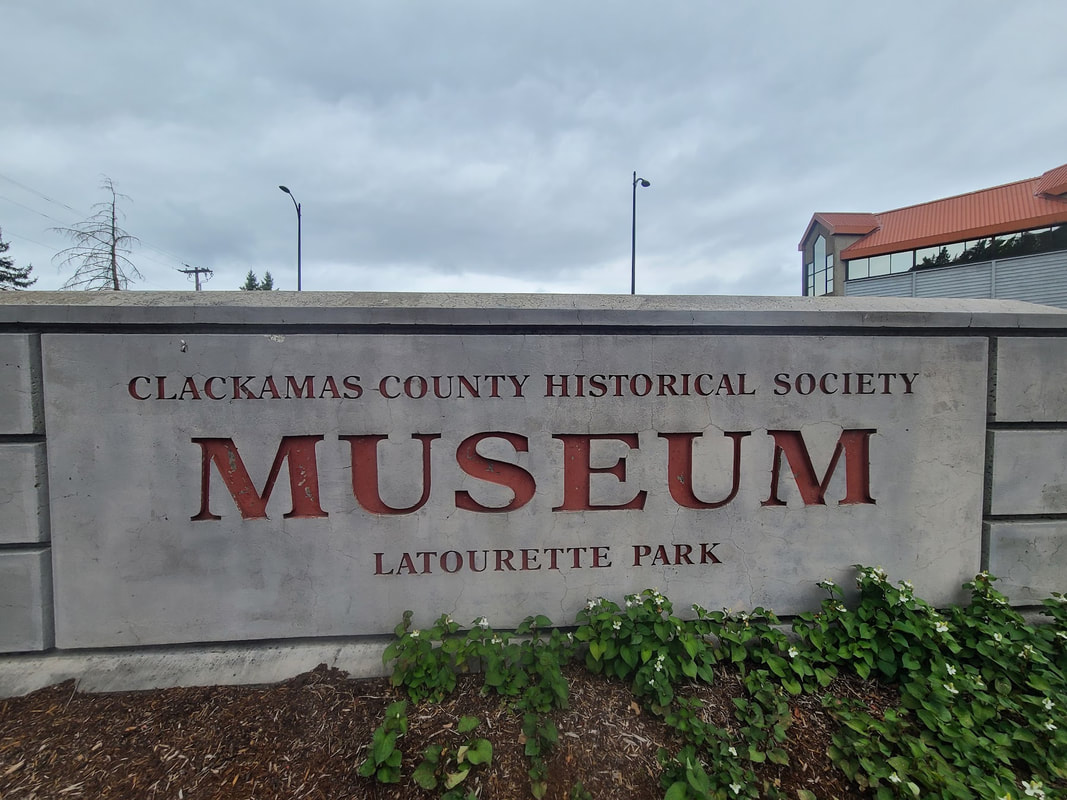
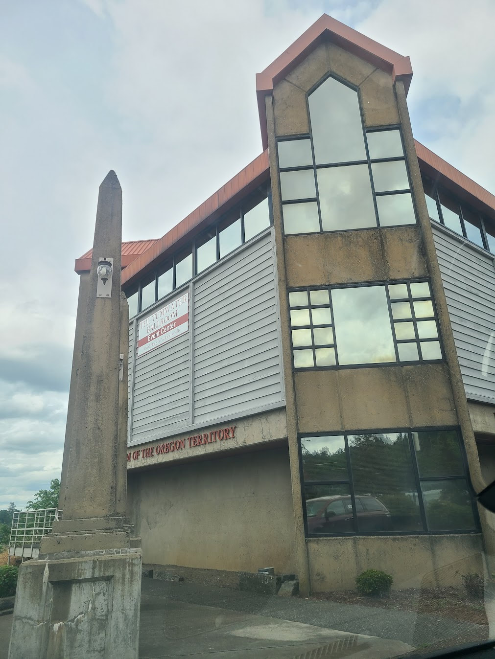
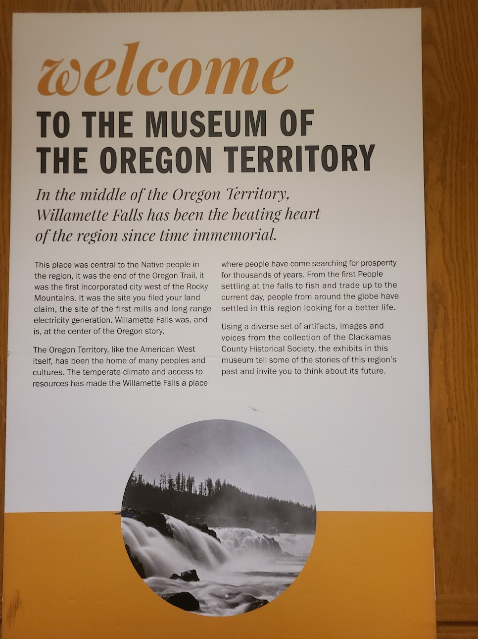
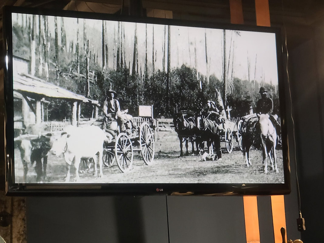
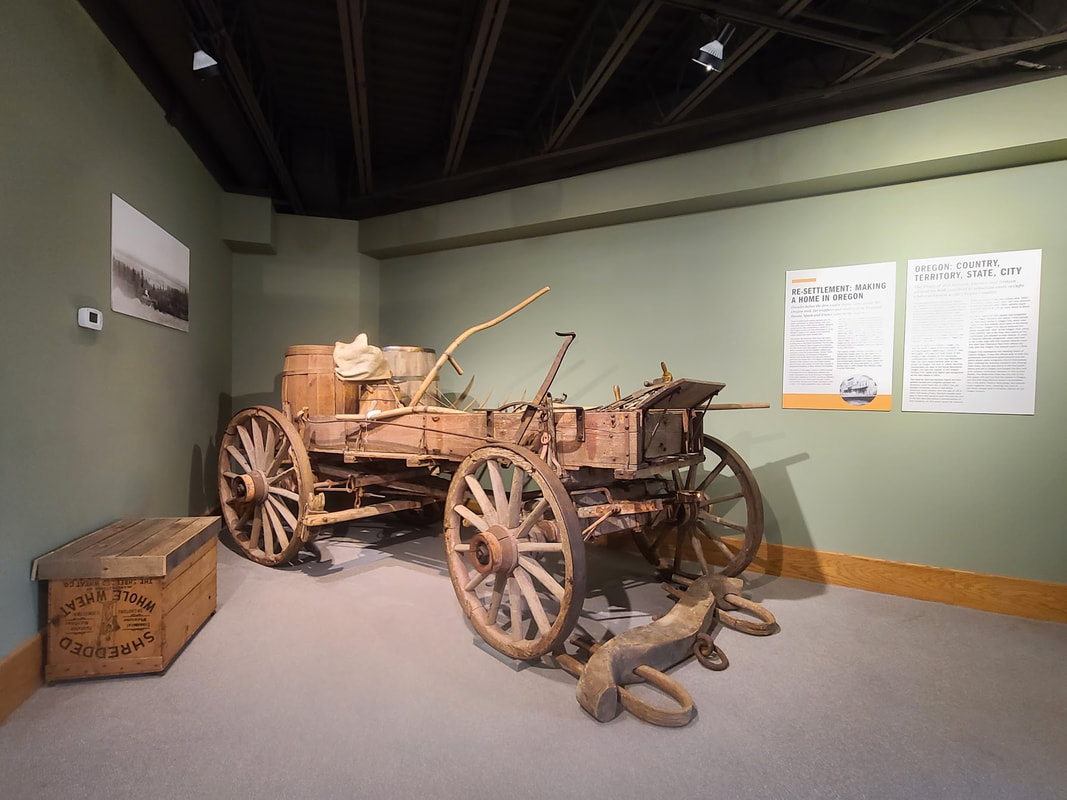
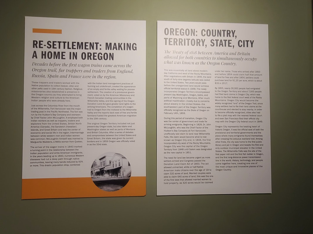
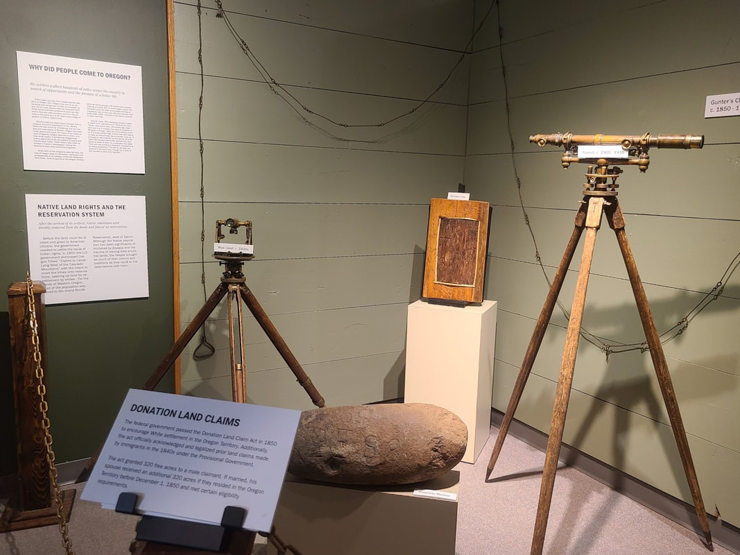
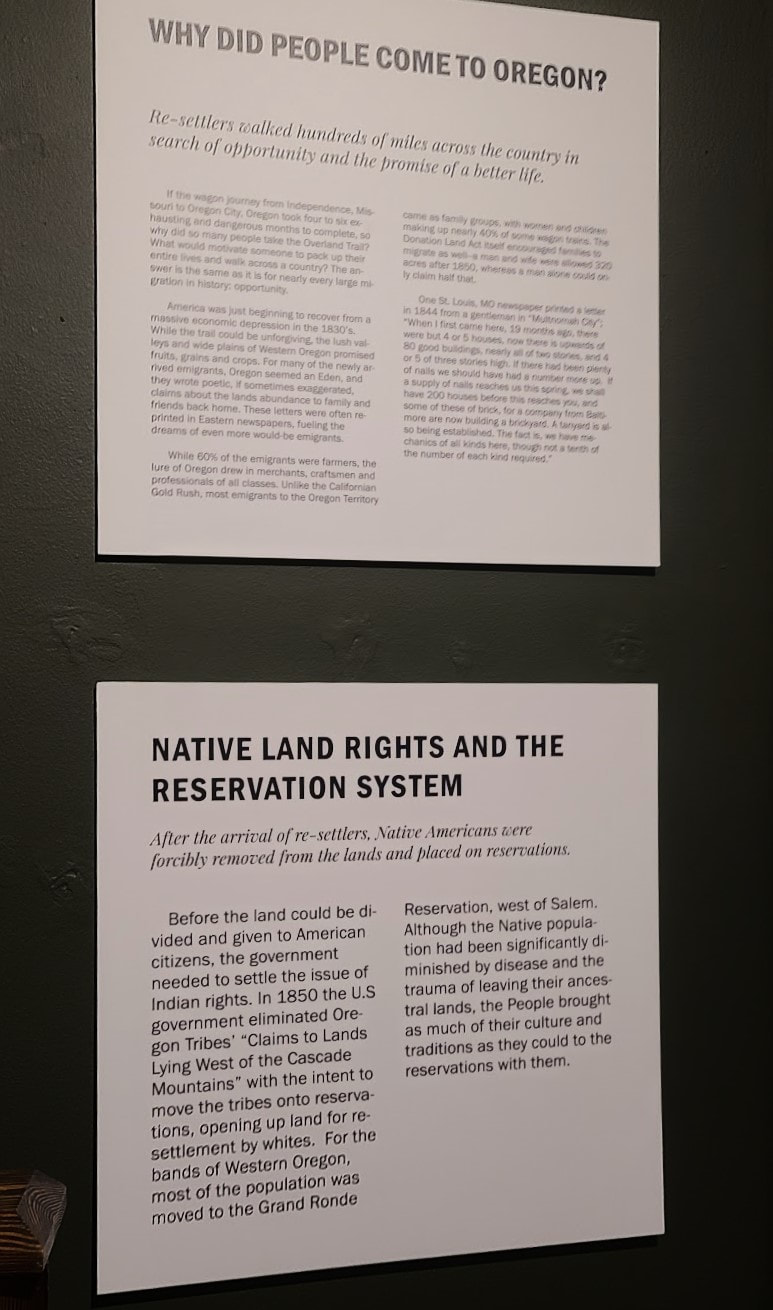
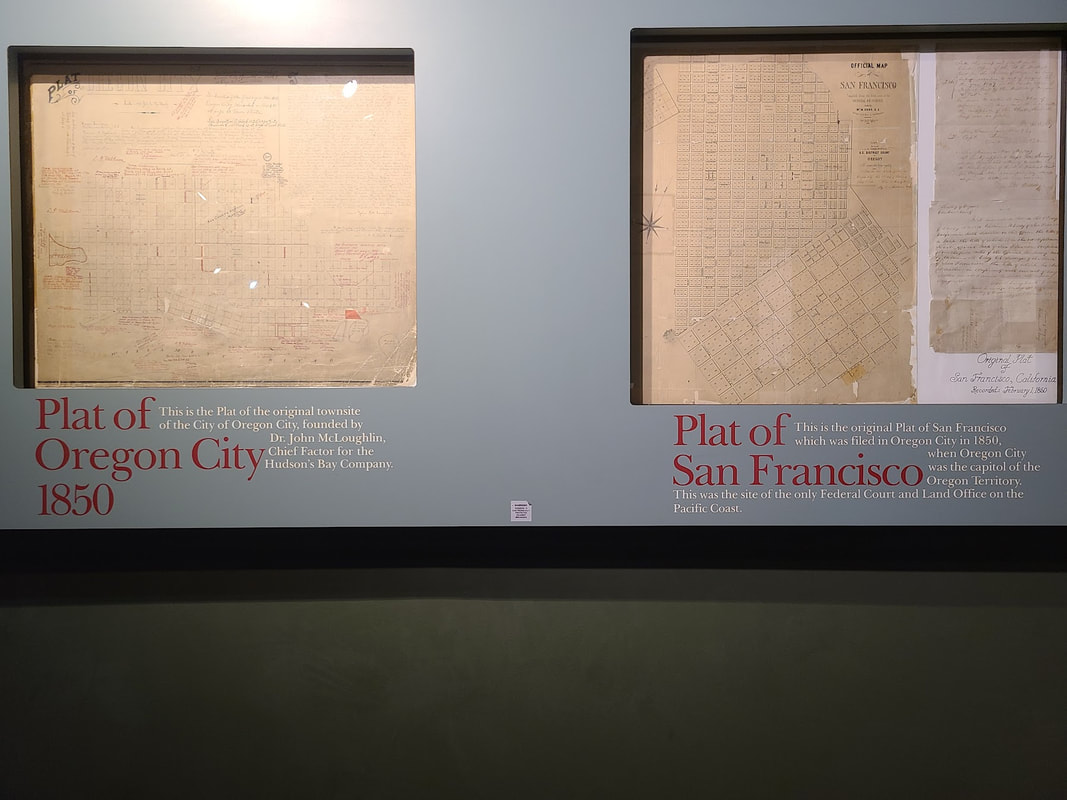
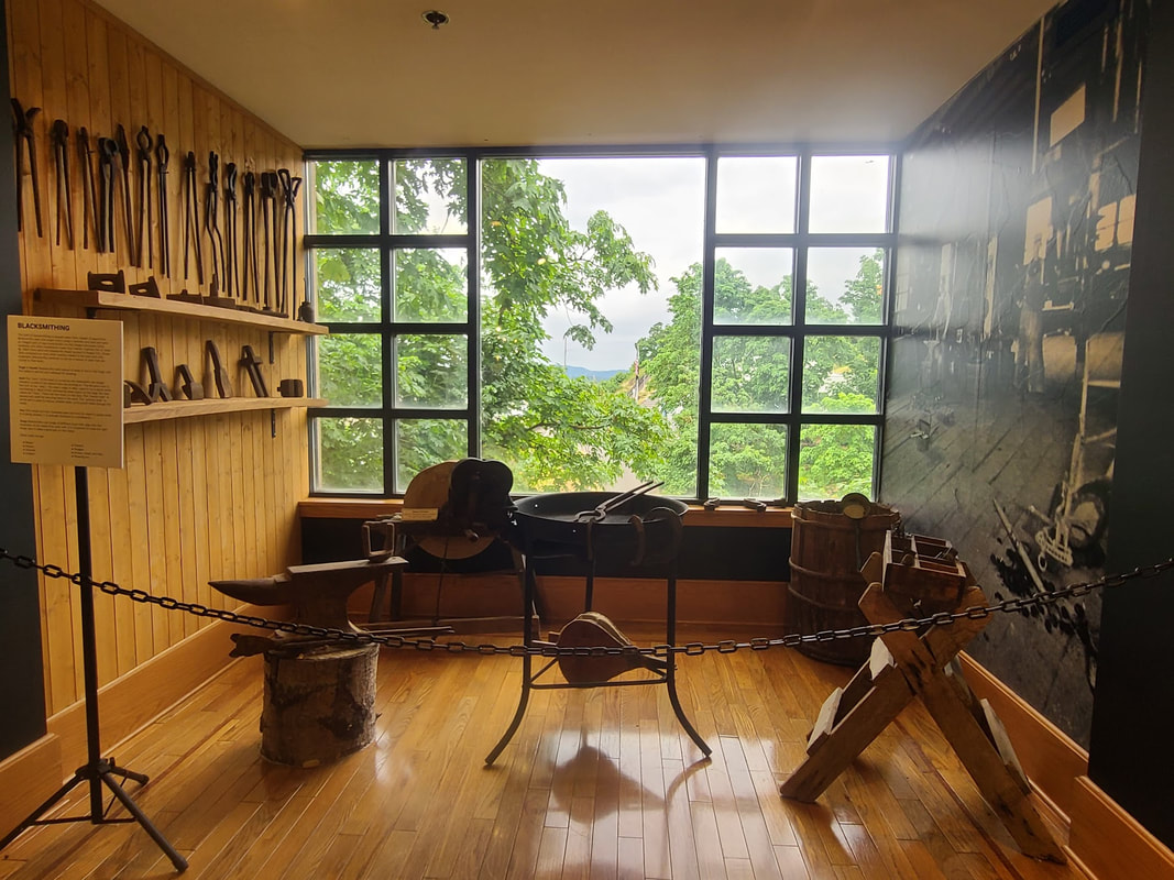
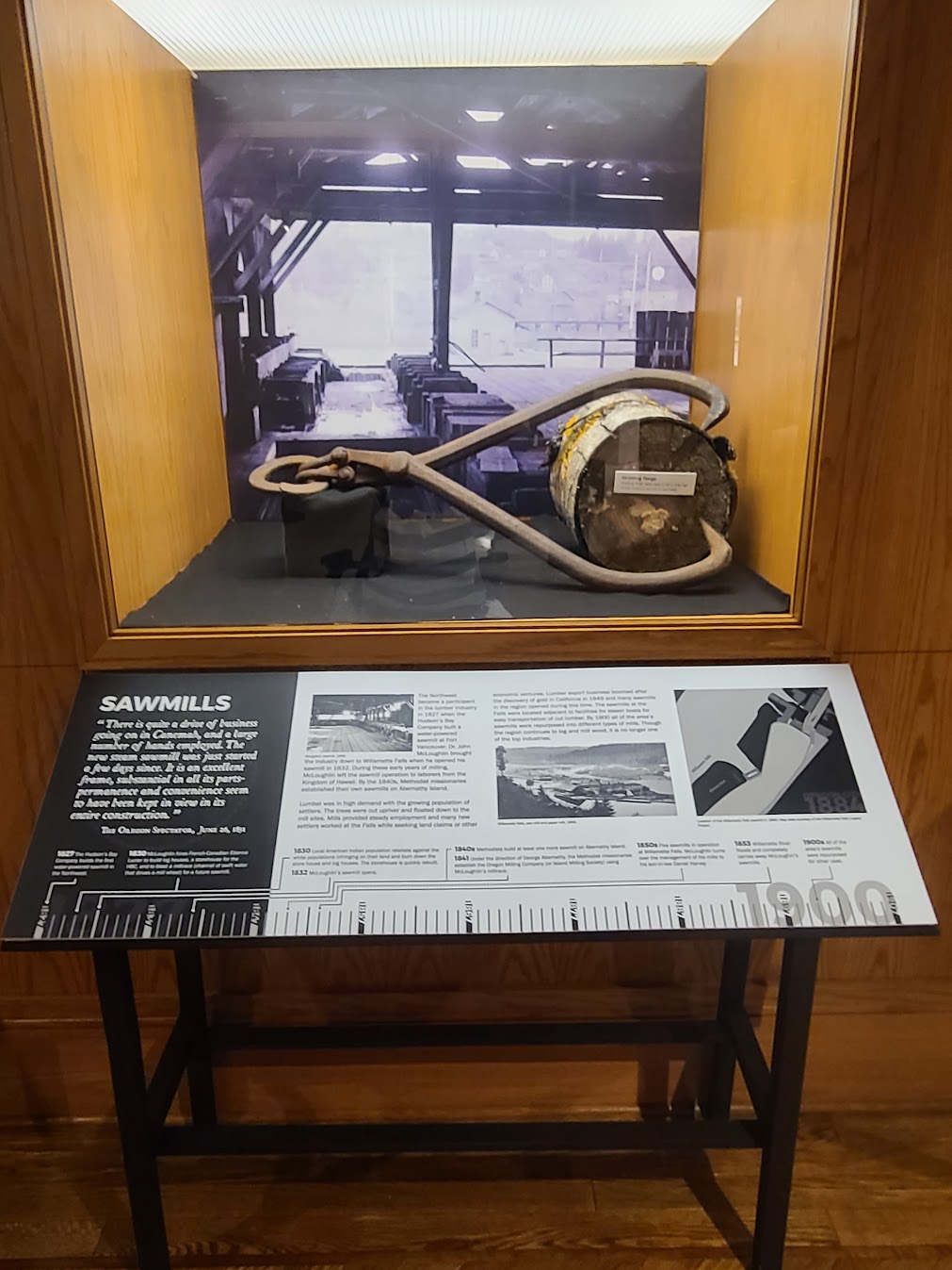
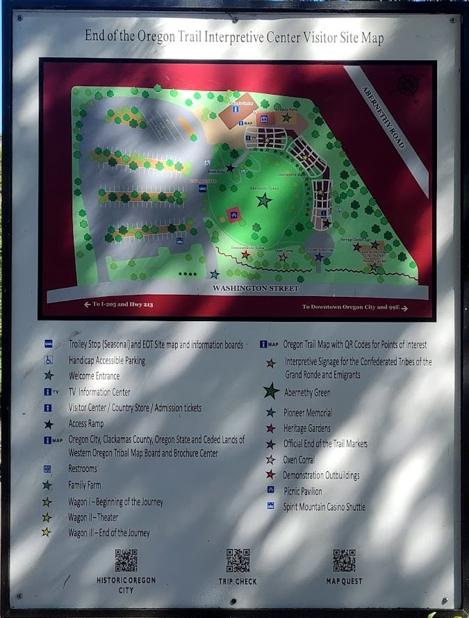
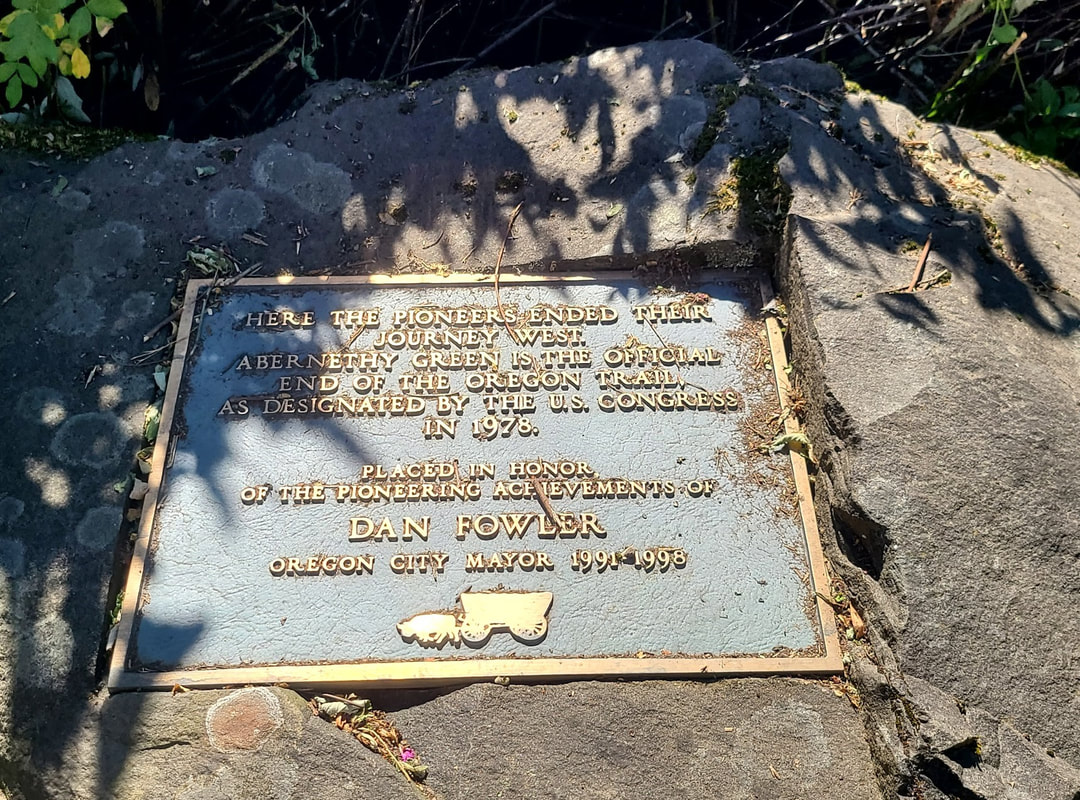
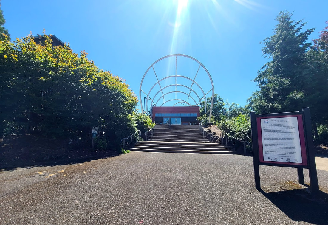
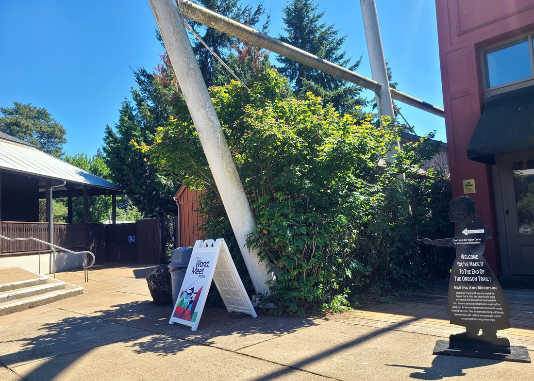
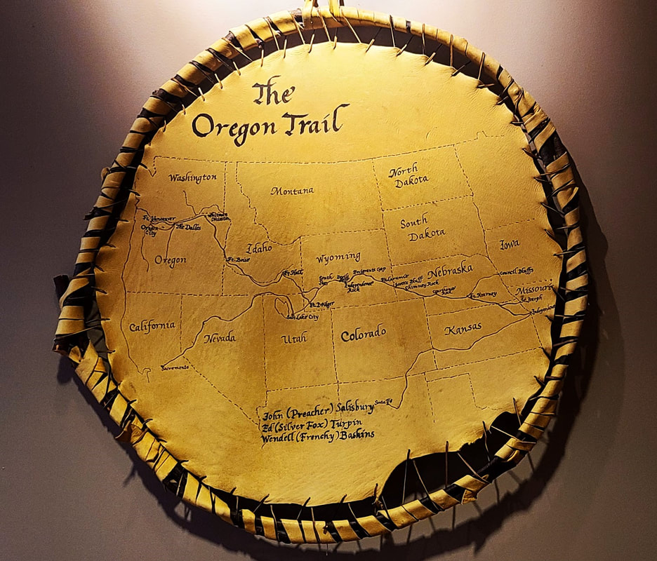
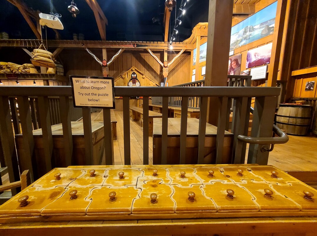
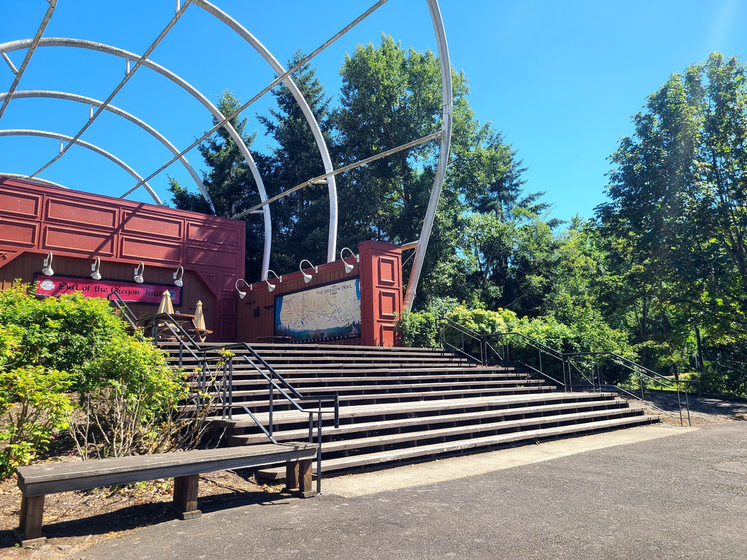
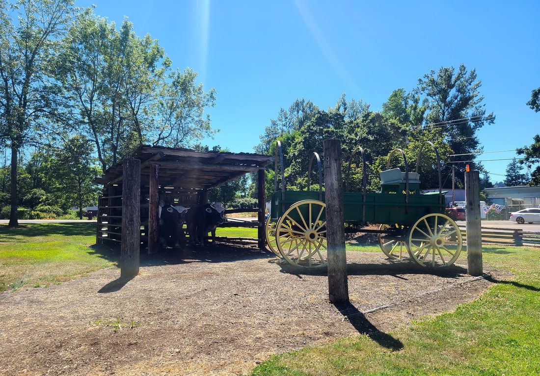
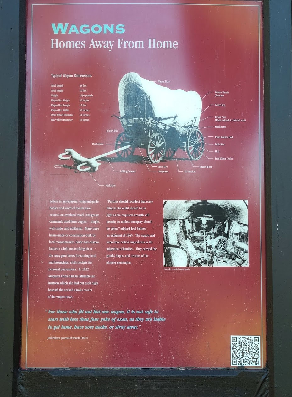
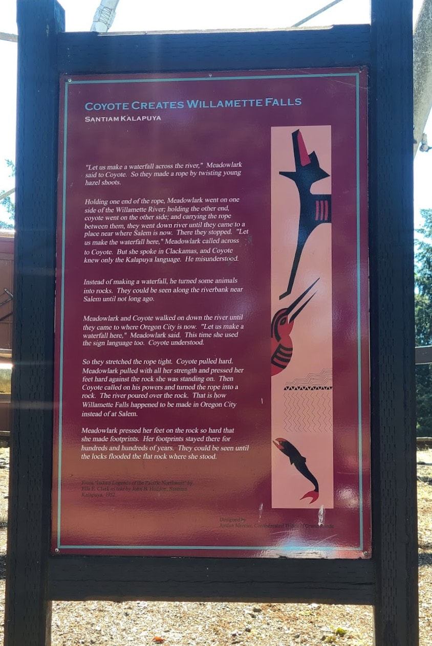
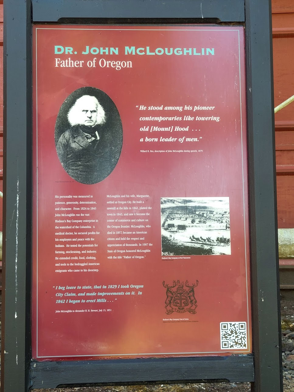
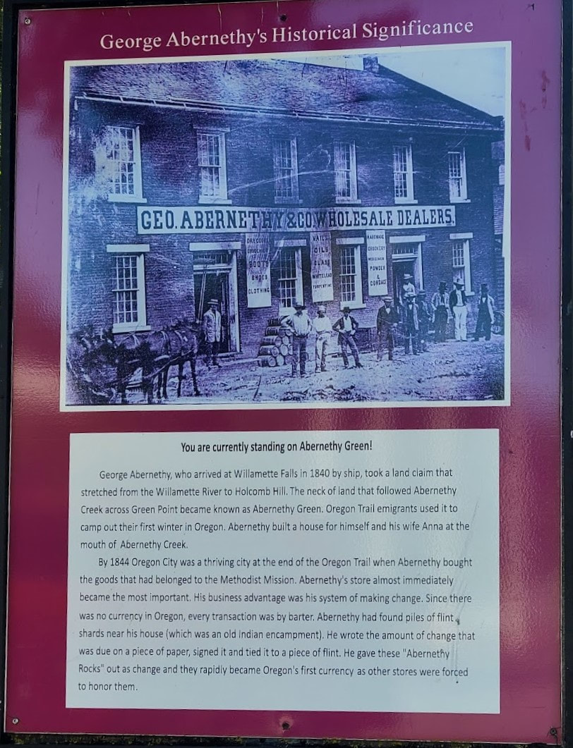
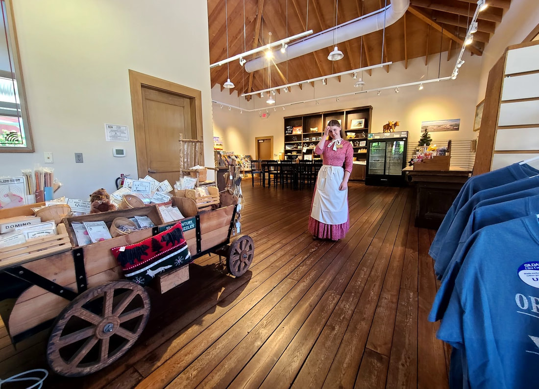
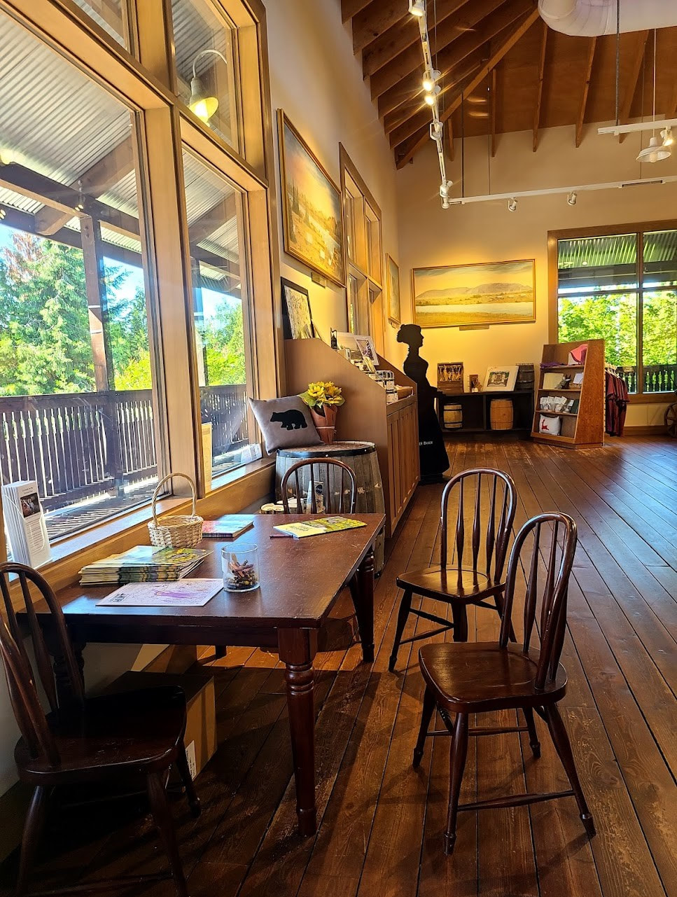
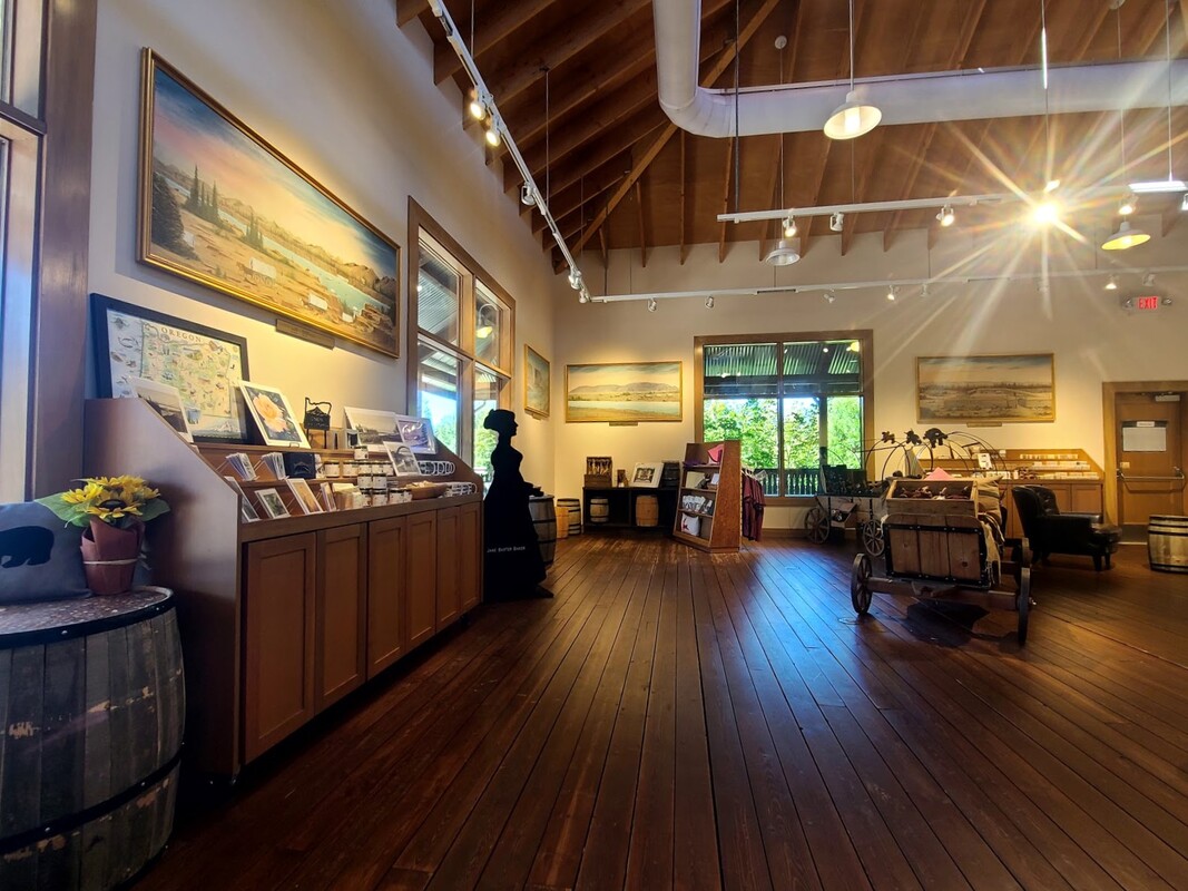
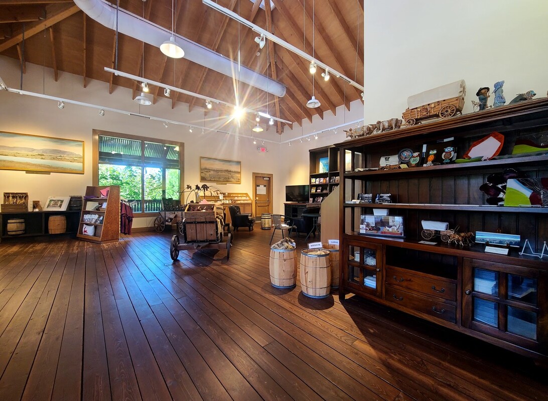
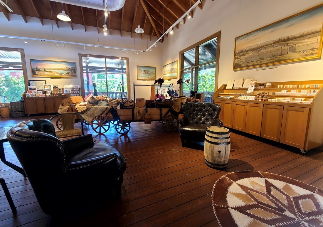
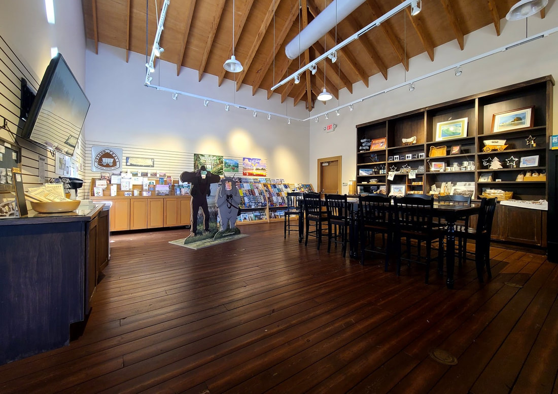
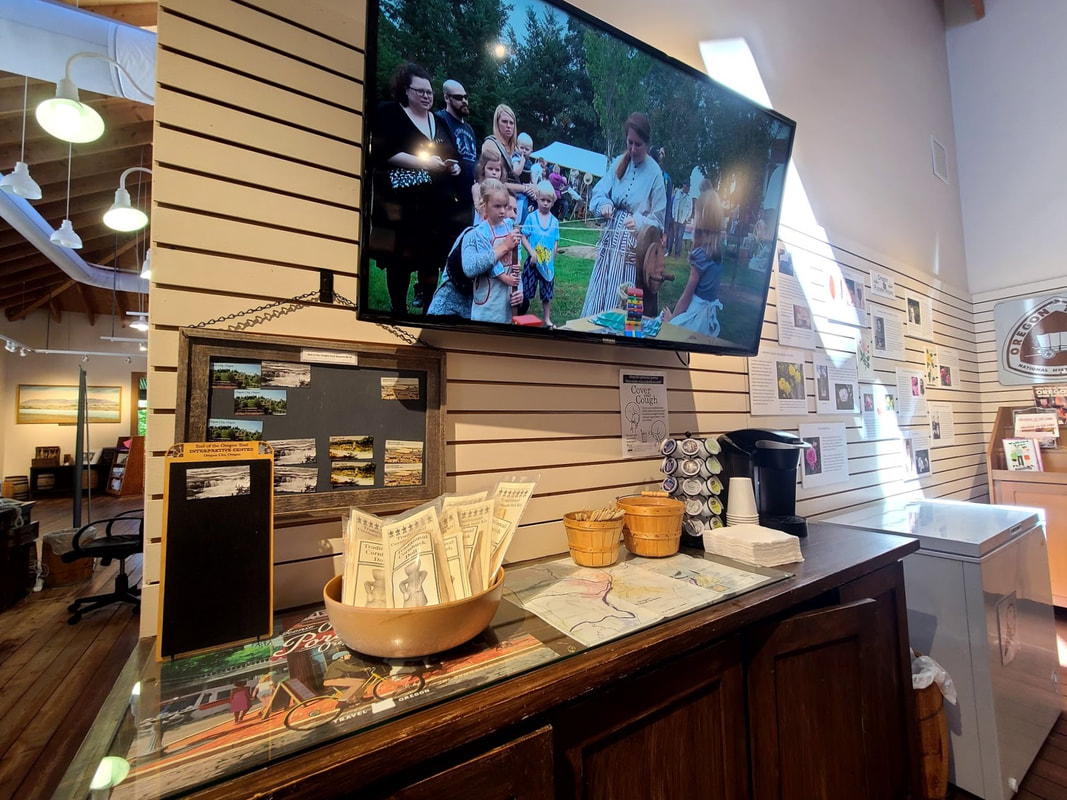
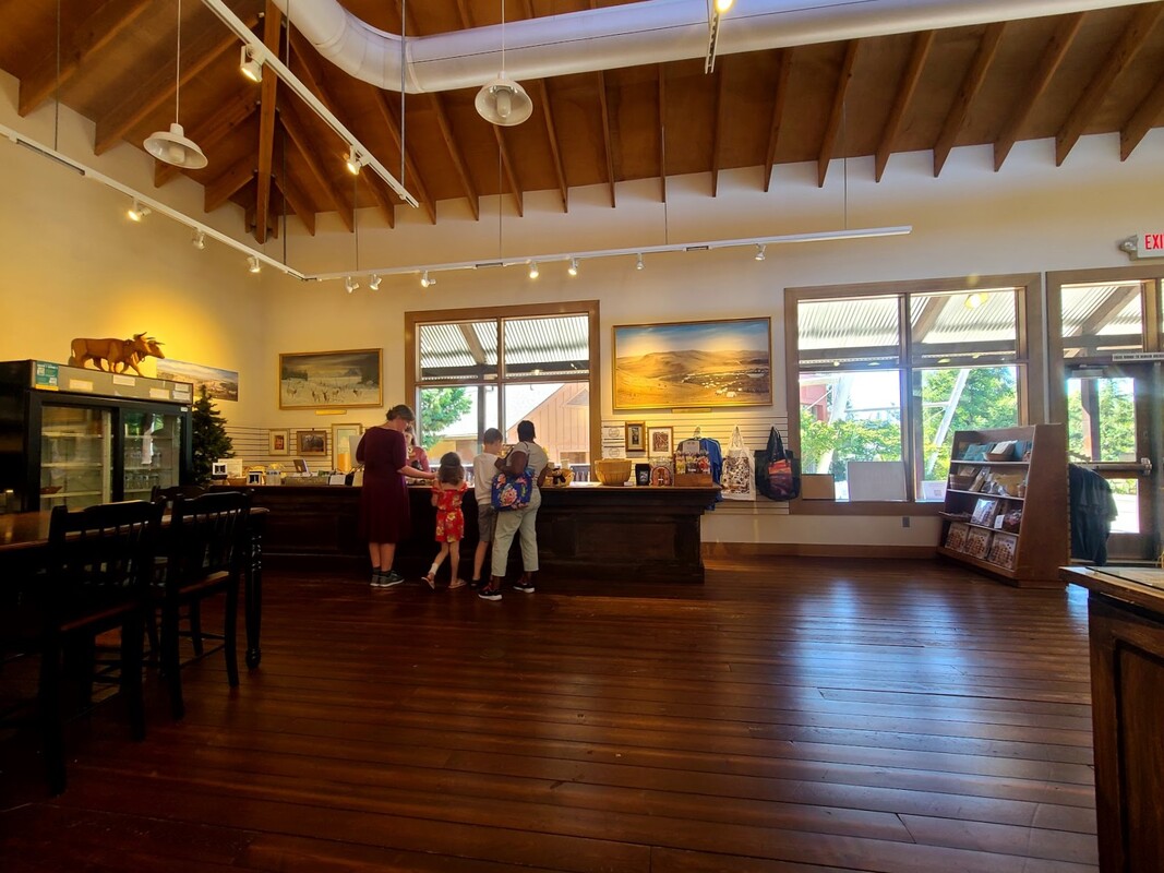
Oregon City McLoughlin House (administered by Ft Vancouver National Historic Site)--713 Center St, Oregon City OR Clackamas County Historical Society Museum aka Museum of the Oregon Territory--211 Tumwater Dr, Oregon City, OR 97045More about the Oregon Trail, McLoughlin, and the Museum of the Oregon Territory at End of the Oregon Trail Interpretive Center, Oregon City OR (metro Portland) For years I have wanted to get to this place, and at last I made it!
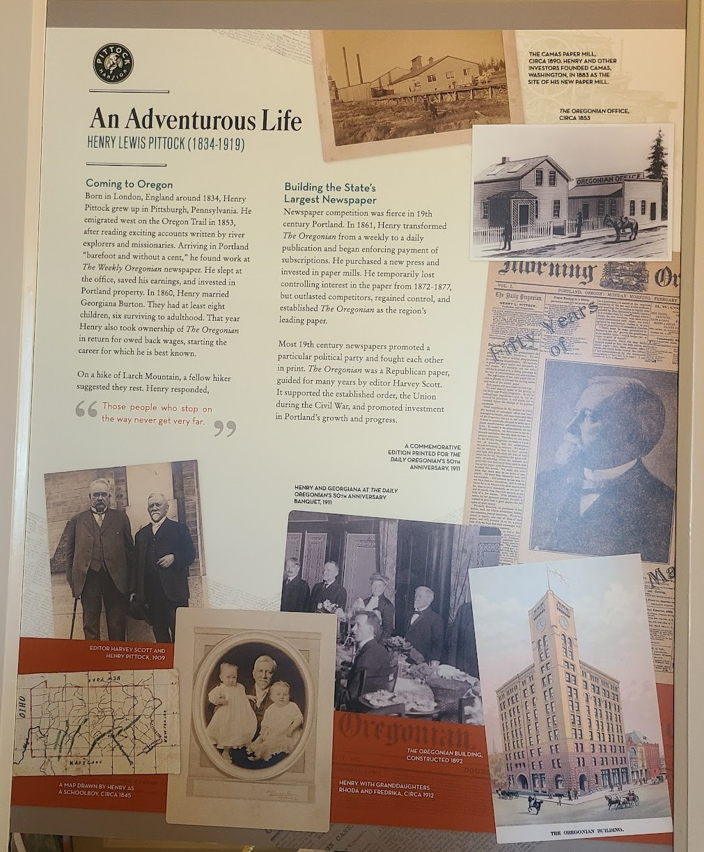
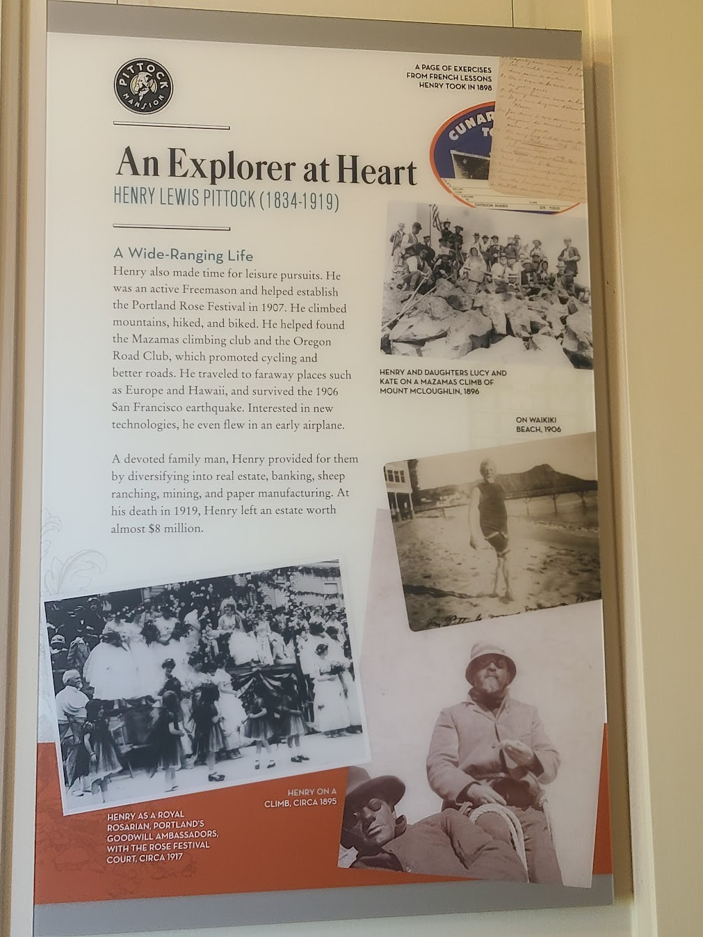
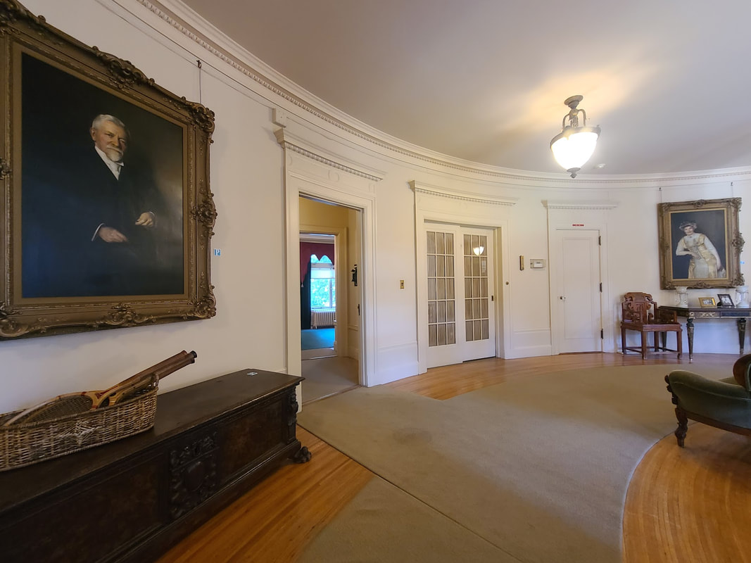
Pittock Mansion--3229 NW Pittock Dr, Portland, OR 97210 Although I had visited the fabulous Pittock Mansion a couple years ago at Christmas (a dazzling experience), it's worth going in summer as well, as there is so much to see outdoors (Wow! views) and in. And though the mansion wasn't built until 1914 (with cutting edge technology of the time), Pittock built it especially for his wife in their older years. He had emigrated to the Pacific Northwest on the Oregon Trail in 1853, and led an adventurous life. It's one opportunity to see what people did after traveling the Oregon Trail. To see it at Christmas, scroll down at the 2nd link below. I will yet post more pics of our summer visit of 2023. More and More about the Oregon Trail! Below are videos of traveling the Oregon Trail--a 15-day trip traveling along the Oregon Trail from it's beginning. More about that (eastern) end than the Oregon end, but that's the part I could not travel myself. He does a good job of showing where he's going on the map and tells/shows some interesting details. You might want to pause or watch again to take it all in. “In Search of the Oregon Trail” aired on PBS Apr 29, 1996 (imperfect copy linked below)
Landmarks or Stops on the Oregon Trail (and related articles) by USA Today National Historic Trails Interpretive Center—Capser WY Oregon Trail sites in Wyoming National Historic Oregon Trail Interpretive Center, Baker City OR
Grant’s Getaways: The Oregon Trail (Hell’s Canyon & the Baker City OR area)
1 Comment
|
Wheelchair WomanI've been in a wheelchair for 30+ years. It poses some challenges for traveling. Maybe others can benefit from my experiences. Archives
June 2024
Categories
All
|


 RSS Feed